Chin Hills
The Chin Hills are primarily inhabited by the Chin, a group of tribes of Mongol origin who share cultural and linguistic ties with the Kuki, Mizo, and Lakher…
What ethnic groups inhabit the Chin Hills and what are their cultural practices?
The Chin Hills are primarily inhabited by the Chin, a group of tribes of Mongol origin who share cultural and linguistic ties with the Kuki, Mizo, and Lakher peoples. They speak Tibeto-Burman languages.12
Cultural Practices
- Social Structure: Traditionally, Chin villages were self-contained units governed by councils of elders, headmen, or hereditary chiefs. They trace descent through the paternal line and practice exogamy, requiring marriage outside the paternal clan.1
- Economy and Agriculture: The economy is based on shifting agriculture, primarily cultivating rice, millet, and corn. They keep domestic animals, such as the mithan (a wild ox), for meat rather than labor or dairy.12
- Beliefs and Status: Traditional religion involves the veneration of numerous deities and spirits through offerings and sacrifices, though many have converted to Christianity. Social status is often achieved by hosting feasts, and hunting prowess is believed to grant high rank in the afterlife.1
What major rivers originate in or flow through the Chin Hills?
The Chin Hills are demarcated by two primary river systems that define the region’s drainage:
- Myittha River: This river serves as the eastern boundary of the Chin Hills. It is a significant tributary of the Chindwin River, which itself drains the western region of Myanmar.452
- Kaladan River: The headstreams of this river demarcate the western boundary of the Chin Hills.4
While these rivers are central to the region’s geography, the broader landscape of the Chin Hills is characterized by a complex network of deep, narrow gorges and forested ranges that influence local water flow.4
What are the main economic activities and natural resources found in the Chin Hills area?
The economy of the Chin Hills is primarily centered on agriculture, specifically shifting cultivation practiced on forested hillsides. Because the population is concentrated in these areas, farmers clear land for cultivation, typically abandoning plots after two or three years as the soil is exhausted and the area becomes overgrown with bamboo.2
Key agricultural products include:
- Jowar millet: The primary crop grown in the region.2
- Corn (maize): Cultivated extensively in the northern parts of the hills.2
- Rice: Grown in the southern regions on lower slopes that are terraced using felled timber.2
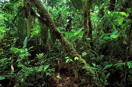
While the broader nation of Myanmar possesses significant natural resources—including petroleum, natural gas, coal, and various minerals—the provided information does not specify the extraction of these resources within the Chin Hills themselves. The region is characterized by its dense tropical forest, which transitions into oak, pine, and rhododendron at higher elevations.82
Are there any protected areas or national parks within the Chin Hills?
The provided information does not contain details regarding protected areas or national parks within the Chin Hills.
Sources
- Chin — Encyclopædia Britannica
- Chin Hills — Encyclopædia Britannica
- Tibet - The arts — Encyclopædia Britannica
- Chindwin River — Encyclopædia Britannica
- China - Drainage — Encyclopædia Britannica
- Myanmar - Drainage and soils — Encyclopædia Britannica
- Myanmar - Relief — Encyclopædia Britannica
- Myanmar - Resources and power — Encyclopædia Britannica
- Tibet - Agriculture and forestry — Encyclopædia Britannica
- Manipur - Agriculture, forestry, and fishing — Encyclopædia Britannica
Published on · 2 min read