Chung-yang Range
The Chung-yang Range (also known as the Central Range) is a prominent mountain group located in eastern Taiwan. It trends along the island's north-south…
What is the geographical location and extent of the Chung-yang Range in Taiwan?
The Chung-yang Range (also known as the Central Range) is a prominent mountain group located in eastern Taiwan. It trends along the island’s north-south axis, effectively traversing its entire length.12
The range covers a significant portion of the island’s interior, extending approximately 170 miles (270 km) in length and reaching up to 50 miles (80 km) in width. Geographically, it is characterized by its rugged relief, featuring dozens of peaks that rise above 9,850 feet (3,000 meters). The highest point in the range—and in all of Taiwan—is Mount Yu, which reaches an elevation of 13,114 feet (3,997 meters).12
To the east, the range is terminated abruptly by the T’ai-tung rift valley, while to the west, it slopes more gradually toward the island’s fertile coastal plains. Due to its steep and mountainous terrain, the region remains sparsely populated compared to the western plains.12
What role does the Chung-yang Range play in Taiwan’s water resources and river systems?
The Chung-yang Range serves as the primary watershed for Taiwan, as most of the island’s rivers originate on its mountain slopes. Because the range traverses the length of the island, it dictates the flow patterns of these waterways: rivers flowing eastward are characterized by steeper gradients and faster currents, while those flowing westward transition into wider, shallower riverbeds as they reach the coastal plains.1
The range is essential to the island’s hydrology, giving rise to major rivers such as the Cho-shui, which is the longest on the island, the Kao-p’ing, which possesses the largest drainage basin, and the Ta-chia and Hsin-Wu-lü rivers. The region receives abundant rainfall, often exceeding 150 inches (3,800 mm) annually, which feeds these systems.31
Managing these water resources is a significant challenge due to the high silt content carried by the rivers and the difficulty of maintaining stable channels. Additionally, the mountainous terrain supports critical infrastructure, such as hydroelectric plants, including those located near Jih-yüeh Lake.13
How has the Chung-yang Range impacted human settlement and economic activities in Taiwan?
The Chung-yang Range has profoundly shaped human geography in Taiwan by creating a stark divide between the island’s interior and its coastal regions. Because mountains cover approximately two-thirds of the island, the rugged, high-altitude terrain of the range is sparsely settled, primarily home to scattered groups of aborigines.14
In contrast, the western side of the island features a more gradual slope leading to fertile alluvial plains. This geography has concentrated the vast majority of Taiwan’s population and farmland in the west, where the flat terrain supports extensive agricultural activities. While the range itself is not a primary center for large-scale agriculture, its slopes provide abundant rainfall and serve as the source for major rivers that irrigate the western plains, historically enabling the productive farming that attracted early migrants.142
Economically, the range’s influence is also seen in infrastructure; for instance, the structural depressions within the mountain system, such as the area near Jih-yüeh Lake, have been utilized for major hydroelectric power generation.1
How does the Chung-yang Range affect Taiwan’s ecology and biodiversity?
The Chung-yang Range serves as a critical driver of Taiwan’s ecological diversity, primarily due to its significant elevation range and abundant rainfall, which often exceeds 150 inches (3,800 mm) annually.1
This vertical variation creates distinct climatic zones that support a wide array of vegetation:
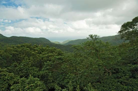
- Lower Elevations: The landscape is dominated by forests of broad-leaved trees.1
- Mid-Elevations: As altitude increases, these give way to mixed forests.1
- High Elevations: Above 6,000–8,000 feet (1,800–2,400 meters), the environment transitions into coniferous forests.1
By providing these varied habitats across its 170-mile length and numerous peaks exceeding 9,850 feet, the range acts as a vital sanctuary for the island’s flora and fauna. The rugged, sparsely settled nature of the terrain further helps preserve these ecosystems from human encroachment, allowing the mountain group to function as a central pillar of Taiwan’s natural biodiversity.1
Sources
- Chung-yang Range — Encyclopædia Britannica
- Taiwan - Relief — Encyclopædia Britannica
- Taiwan - Drainage and soils — Encyclopædia Britannica
- Taiwan - Agriculture, forestry, and fishing — Encyclopædia Britannica
Published on · 3 min read