Chūgoku Range
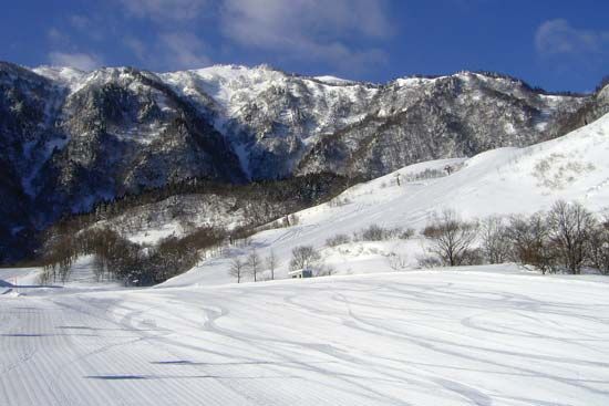
The Chūgoku Range in western Honshu, Japan, is characterized by relatively modest elevations, with only a few peaks exceeding 3,300 feet (1,000 meters).
What are some of the notable peaks or mountains within the Chūgoku Range?
The Chūgoku Range in western Honshu, Japan, is characterized by relatively modest elevations, with only a few peaks exceeding 3,300 feet (1,000 meters).1
Notable peaks and mountain areas within the range include:
- Mount Dai: Located in Tottori prefecture, this lava-dome volcano is a prominent feature, rising to an elevation of 5,673 feet (1,729 meters).1
- Kammuri Mountains: Situated to the west of the Gōno River gorge, this mountain block is sometimes considered an independent unit and reaches an elevation of 4,393 feet (1,339 meters).1
The range serves as a major divide between the Sea of Japan and the Inland Sea, consisting of the Backbone Range, the Kibi Plateau, and the Iwami Plateau.1
What are the main geographical features of the Chūgoku Range?
The Chūgoku Range is a significant mountain system in western Honshu, Japan, defined by three primary landforms:
- Backbone Range: This central feature acts as a sharp divide between the Sea of Japan and the Inland Sea. It is largely continuous, broken only by the Gōno River gorge. While most peaks are under 3,300 feet, the Kammuri block to the west reaches 4,393 feet.1
- Kibi Plateau: Located south of the Backbone Range, this area features eroded hilly surfaces at elevations between 660 and 1,970 feet. It is separated from the main range by a series of intermontane basins, such as those of Tsuyama, Niimi, and Miyoshi.1
- Iwami Plateau: Situated north of the Backbone Range, this plateau is more dissected than the Kibi. It includes the Akiyoshi Plateau, known for its karst topography, and features volcanic activity, including the lava-dome Mount Dai.1
Are there any cultural or historical sites associated with the Chūgoku Range?
The Chūgoku Range is historically significant for its role in regional connectivity and cultural heritage. A key historical feature is the Gōno River gorge, which has been bordered by an important highway since ancient times, serving as a vital corridor through the mountains.1
Additionally, the region is home to the Iwami Ginzan Silver Mine and Its Cultural Landscape, which is recognized as a UNESCO World Heritage site. Located within the prefecture of Shimane, this site reflects the historical importance of mining and its associated cultural landscape within the Chūgoku region. The area also features the Akiyoshi Plateau, where unique karst topography has shaped the local environment and land use over time.13
How does the Chūgoku Range influence the climate and weather patterns in the region?
The provided search results do not contain information regarding how the Chūgoku Range influences climate or weather patterns in the region. While the articles detail the range’s physical landforms, geological composition, and historical significance, they do not address its specific meteorological impact.
Sorry, the Britannica knowledge base does not contain this information.
Sources
- Chūgoku Range — Encyclopædia Britannica
- Japanese Alps — Encyclopædia Britannica
- list of World Heritage sites - Japan — Encyclopædia Britannica
- Japan - The major physiographic regions — Encyclopædia Britannica
Published on · 2 min read