Cobourg Peninsula
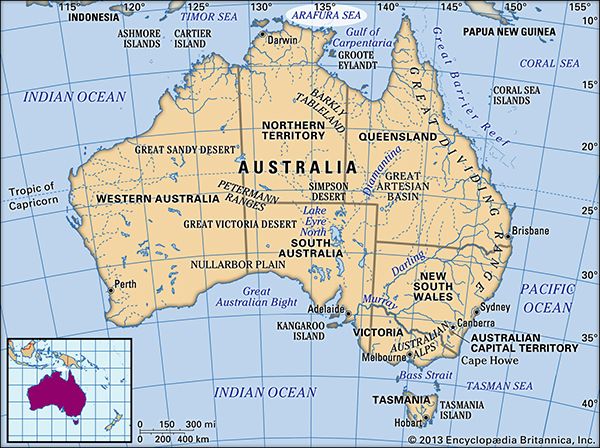
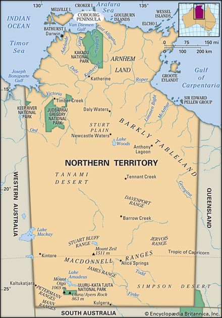
The Cobourg Peninsula is located at the northwestern extremity of Arnhem Land in the Northern Territory of Australia.
Where is the Cobourg Peninsula located in the Northern Territory of Australia?
The Cobourg Peninsula is located at the northwestern extremity of Arnhem Land in the Northern Territory of Australia.1
This narrow neck of land extends approximately 60 miles (100 km) toward Cape Don on the Dundas Strait, which separates the peninsula from Melville Island in the Timor Sea in the Timor Sea. The peninsula, which is primarily a low, undulating plateau, encloses the Van Diemen Gulf to its north and east. Its northern coastline is characterized by deep inlets, most notably Port Essington, which opens into the Arafura Sea1. Today, the area is protected as the Garig Gunak Barlu National Park, managed through a partnership between the traditional Aboriginal owners and the Northern Territory government.12
What are the unique geographical features of the Cobourg Peninsula?
The Cobourg Peninsula is defined by several distinct geographical characteristics:
- Topography: The region is primarily a low, undulating plateau that extends as a narrow neck of land for approximately 60 miles (100 km) toward Cape Don.1
- Coastal Features: Its northern coastline is notably deeply indented by various inlets. The largest of these is Port Essington, which measures roughly 19 by 7 miles (31 by 11 km).1
- Surrounding Waters: The peninsula is situated between major bodies of water, separating the Timor Sea from the Arafura Sea. It also serves to enclose the Van Diemen Gulf to its north and east, while the Dundas Strait separates it from Melville Island.1
What historical significance does the Cobourg Peninsula hold in Australian history?
The Cobourg Peninsula holds historical significance primarily as the site of early British attempts to establish a presence on Australia’s northern coast. In 1824, the region became the location for Britain’s third effort to settle the area, which culminated in the establishment of the settlement of Victoria at Port Essington. This settlement operated from 1838 until its eventual failure and abandonment in 1849.2
The peninsula was first surveyed in 1818 by Captain Phillip Parker King of the Royal Navy, who named the peninsula after Prince Leopold of Saxe-Coburg, the uncle of Queen Victoria. Today, the historical legacy of these colonial efforts is preserved through relics found within the Cobourg Marine Park. Furthermore, the area is recognized for its enduring connection to its traditional Aboriginal owners, who now manage the land jointly with the Northern Territory government as the Garig Gunak Barlu National Park.21
How is the Cobourg Peninsula managed for conservation and sustainable tourism?
The Cobourg Peninsula is managed as the Garig Gunak Barlu National Park. This area is administered through a joint management model, which involves a partnership between the traditional Aboriginal owners and the Northern Territory government.1
This collaborative approach ensures that conservation efforts and tourism activities are conducted in a manner that respects the cultural heritage and land rights of the traditional owners while preserving the peninsula’s unique environment.1
Sources
- Cobourg Peninsula — Encyclopædia Britannica
- Port Essington — Encyclopædia Britannica
Published on · 2 min read