Arafura Sea
The Arafura Sea is a shallow body of water located in the western Pacific Ocean. It is situated between the northern coast of Australia and the southern…
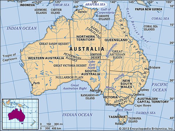
Where is the Arafura Sea located, and what countries border it?
The Arafura Sea is a shallow body of water located in the western Pacific Ocean. It is situated between the northern coast of Australia and the southern coast of New Guinea.12
To the west, the sea merges with the Timor Sea, while the Torres Strait connects it to the Coral Sea in the east. Much of the sea sits atop the Arafura Shelf, which is part of the larger Sahul Shelf.1
How does the Arafura Sea connect to other bodies of water in the Pacific region?
The Arafura Sea serves as a significant maritime link in the western Pacific Ocean, connecting to several surrounding bodies of water through various passages and boundaries:
- West and Northwest: The sea merges directly with the Timor Sea to the west, which acts as a transition point toward the Indian Ocean. To the northwest, it connects to the Banda and Ceram seas.13
- East: The Torres Strait serves as the primary connection between the Arafura Sea and the Coral Sea.14
- Deep-Sea Connections: While the surface waters connect these seas, the region is also linked by a chain of deep-sea depressions. The Aru Trough, located near the Aru Islands, is part of a system that extends westward into the Java Trench within the Indian Ocean.1
What historical significance does the Arafura Sea hold in terms of exploration and trade routes?
The Arafura Sea has long served as a significant maritime corridor, though its historical importance is defined more by the movement of regional traders and explorers than by major colonial settlement.
Early Trade and Exploration
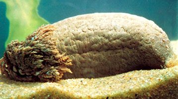
The region’s waters were traversed by various seafaring groups long before formal European mapping. Indigenous Arnhem Land legends describe the “Baijini,” mysterious mariners who arrived from the northwest to harvest sea cucumbers. Historians suggest these may have been Chinese, Arab, or Portuguese traders active in the Malay Archipelago during the 15th and 16th centuries. By the 18th century, Makassarese sailors from Celebes were regularly fishing off the northern Australian coast, establishing a consistent, if informal, trade presence.15
European Navigation
European interest in the Arafura Sea was primarily driven by the search for new trade routes and landmasses. In the 17th century, Dutch explorers, including Willem Jansz and Abel Tasman, charted parts of the northern Australian coast and the Gulf of Carpentaria. However, finding little of commercial interest, they did not pursue colonization. By the 19th century, the focus shifted to safety and mapping; naval surveyors like Matthew Flinders and Phillip Parker King worked to chart the dangerous, shoal-filled waters of the Arafura Sea and the Torres Strait to secure routes for British commerce.512
What is the average depth and size of the Arafura Sea?
The Arafura Sea is a shallow body of water covering an area of approximately 250,000 square miles (650,000 square km).1
Regarding its depth, the sea is generally shallow, with typical depths ranging from 165 to 260 feet (50 to 80 metres). However, the topography varies significantly across the region:1
- Western Edge: The sea deepens toward its western boundary, where coral reefs have developed at depths reaching nearly 2,000 feet (610 metres).1
- Aru Trough: Located near the Aru Islands, this deep, curving trench reaches a maximum depth of 12,000 feet (3,660 metres).1
The majority of the sea is underlain by the Arafura Shelf, which is part of the broader Sahul Shelf.17
Sources
- Arafura Sea — Encyclopædia Britannica
- Arafura Sea — Merriam-Webster
- Torres Strait — Encyclopædia Britannica
- Timor Sea — Encyclopædia Britannica
- Colonization of Australia - Early exploration — Encyclopædia Britannica
- Northern Territory - Prehistory and European exploration — Encyclopædia Britannica
- Sahul Shelf — Encyclopædia Britannica
- Banda Sea — Encyclopædia Britannica
Published on · 3 min read