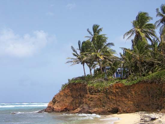
Coco River
The Coco River rises in southern Honduras near the town of San Marcos de Colón and flows eastward, eventually forming the international boundary between…
Are there any notable cities or settlements along the Coco River, and how do they utilize the river?
The Coco River rises in southern Honduras near the town of San Marcos de Colón and flows eastward, eventually forming the international boundary between Honduras and Nicaragua along its middle and lower course. While the river is not of great economic significance, it serves as a vital resource for local activities in the region.1
Regarding its utilization, the river is primarily used for:
- Transportation: Although the river spans 485 miles, only the lower 140 miles are navigable, allowing for the passage of medium-sized vessels.12
- Resource Extraction: The river supports some placer gold mining along its course.1
- Timber Industry: It is used to float timber harvested from the densely forested Caribbean lowlands.1
While the river flows through remote areas, it remains a key geographic feature of the region as it empties into the Caribbean Sea at Cape Gracias a Dios.1
Where is the Coco River located in Central America, and which countries does it border?
The Coco River is located in Central America, originating in southern Honduras near the town of San Marcos de Colón.1
The river flows eastward into Nicaragua and serves as the international boundary between Honduras and Nicaragua along its middle and lower course, a designation established following legal proceedings in 1961. It eventually empties into the Caribbean Sea at Cape Gracias a Dios.1
How does the Coco River compare to other major rivers in Central America in terms of size and importance?
The Coco River is a significant geographic feature in Central America, stretching 485 miles (780 km) across Honduras and Nicaragua. While it is longer than other regional waterways like the Lempa River—which spans approximately 200 miles (320 km)—the Coco River is not considered to be of great economic significance.13
In terms of utility, the Coco River is limited by its navigability, with only the lower 140 miles (225 km) accessible to medium-sized vessels. Its primary uses include small-scale placer gold mining and the transport of timber from the Caribbean lowlands.1
In contrast, other Central American rivers have been more extensively developed for national infrastructure. For example, the Lempa River is vital to El Salvador’s energy sector, hosting major hydroelectric installations that supply power to much of the country, and its basin supports significant agricultural development. While the Coco River serves as a critical international boundary, it lacks the large-scale industrial or energy-related development seen in other regional river systems.431
What is the significance of the Coco River in terms of geography and international boundaries?
The Coco River holds significant geographic and political importance in Central America as a primary international boundary. Rising in southern Honduras and flowing eastward through northern Nicaragua, the river serves as the official border between the two nations along its middle and lower courses. This status was formally established in 1961 following extensive litigation regarding territorial claims in the region.1
Geographically, the river spans 485 miles (780 km) and concludes its journey by emptying into the Caribbean Sea at Cape Gracias a Dios. The cape itself is situated on an island within the river’s delta and marks a prominent protrusion of land between the Yucatán Peninsula and South America. Historically, the area surrounding the river and the cape was a point of contention, as both countries laid claim to the northern section of the Mosquito Coast until the boundary was settled in 1960.16
Sources
- Coco River — Encyclopædia Britannica
- Nicaragua - Transportation and telecommunications — Encyclopædia Britannica
- South America - Rivers of South America — Encyclopædia Britannica
- El Salvador - Rivers and lakes — Encyclopædia Britannica
- Lempa River — Encyclopædia Britannica
- Cape Gracias a Dios — Encyclopædia Britannica
Published on · 3 min read