Cook Strait
Cook Strait is the body of water that separates the North and South islands of New Zealand. It connects the Tasman Sea to the Pacific Ocean, stretching about…
What is Cook Strait?
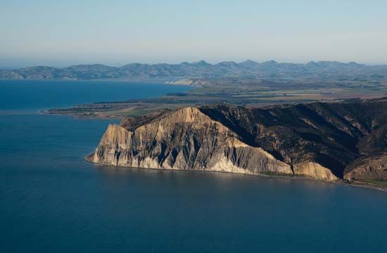
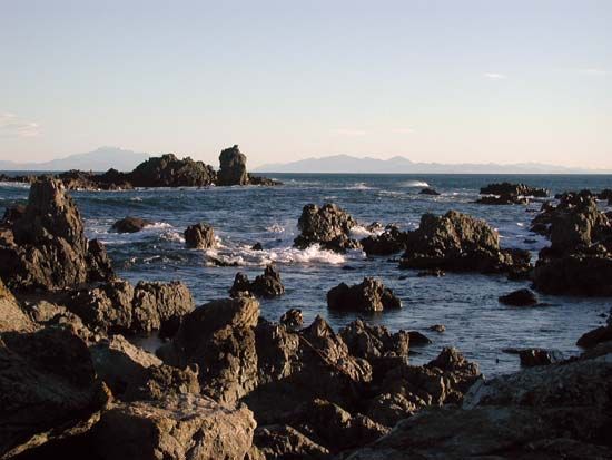
Cook Strait is the body of water that separates the North and South islands of New Zealand. It connects the Tasman Sea to the Pacific Ocean, stretching about 14 miles (23 km) at its narrowest point with an average depth of 420 feet (128 m).1
The region is characterized by steep cliffs and challenging maritime conditions, including fierce storms and treacherous currents that complicate navigation. Consequently, travel between Wellington and Blenheim is primarily conducted via ferry or air. The strait also serves as a critical corridor for infrastructure, with electric-power and communication cables running along its floor.1
While the Dutch navigator Abel Tasman first entered the area in 1642, he mistakenly identified it as a bay. It was not until 1770 that Captain James Cook confirmed it was a strait.1
Who was Captain James Cook?
James Cook (1728–1779) was a renowned British naval captain, navigator, and explorer who fundamentally transformed the world map through his precise cartography and scientific exploration.23
Major Expeditions
Cook led three major expeditions to the Pacific Ocean between 1768 and 1779:24
- First Voyage (1768–1771): Commissioned to observe the transit of Venus in Tahiti, Cook subsequently circumnavigated New Zealand and charted the eastern coast of Australia, claiming the region as New South Wales.536
- Second Voyage (1772–1775): Cook proved that a hypothetical southern continent did not exist in temperate latitudes, while charting numerous islands including Tonga, Easter Island, and New Caledonia.534
- Third Voyage (1776–1779): Focused on the North Pacific to search for a northwest passage, he discovered the Hawaiian Islands, where he was killed in 1779 during a conflict with local inhabitants.534
Legacy
Cook is celebrated for his exceptional seamanship and his commitment to the health of his crew; he famously prevented scurvy by enforcing strict dietary and hygiene standards. His work established the precedent of including scientists on naval voyages and provided geographical data so accurate that much of it remained in use for generations.34
What are the main geographical differences between New Zealand’s North and South Islands?
New Zealand’s North and South islands exhibit distinct geographical characteristics shaped by their complex geological history and tectonic activity.7
Topography and Relief
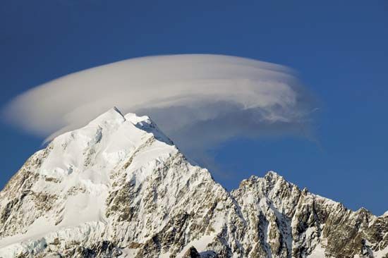
- South Island: The landscape is dominated by the Southern Alps/Kā Tiritiri o te Moana, a 300-mile-long chain of fold mountains that includes the country’s highest peak, Aoraki/Mount Cook. The island features rugged terrain, extensive glacier systems, and the expansive Canterbury Plains in the east, which contrast with the precipitous slopes of the Westland region.78
- North Island: The terrain is generally less precipitous and more undulating. It is defined by a central Volcanic Plateau and a mountain range that runs parallel to the east coast, reaching its highest point at Mount Ruapehu Mount Ruapehu.79
Climate and Environment
- Climate Patterns: While both islands experience temperate conditions, the South Island’s high mountain chains create a sharp climatic divide between the wet western slopes and the drier east. The North Island generally enjoys a more benign climate, with rainfall that is more evenly distributed throughout the year.7109
- Geological Activity: Both islands are part of the Ring of Fire, but the North Island is particularly noted for its ongoing volcanism, whereas the South Island is heavily influenced by movement along major faults, such as the Alpine Fault.7
How do ocean currents affect maritime navigation?
Ocean currents significantly influence maritime navigation by affecting a vessel’s intended path and speed. When navigators use dead reckoning—a method of estimating position based on a previously known point, course, and speed—they must account for the drift caused by water movement.1112
Because ocean currents can push a ship off its planned track, navigators historically and currently add an estimate for current or tidal drift to their calculations after determining their primary course. While these currents are often relatively slow and may cancel each other out over very long voyages, failing to account for them leads to cumulative errors in a vessel’s position.12
To maintain accuracy, navigators often perform “reinitialization,” where they restart their reckoning from a known position once it has been verified by a landmark or other navigational check. Understanding these patterns is essential for effective journey planning, including predicting arrival times and ensuring the vessel stays on its intended route.12
Sources
- Cook Strait — Encyclopædia Britannica
- James Cook — Encyclopædia Britannica
- Pacific Islands - The 18th century — Encyclopædia Britannica
- James Cook - Voyages and discoveries — Encyclopædia Britannica
- Colonization of Australia - Early exploration — Encyclopædia Britannica
- Pacific Ocean - European exploration — Encyclopædia Britannica
- New Zealand - Relief of New Zealand — Encyclopædia Britannica
- North Island — Encyclopædia Britannica
- New Zealand - Climate — Encyclopædia Britannica
- Southern Alps/Kā Tiritiri o te Moana — Encyclopædia Britannica
- ocean current - Distribution of ocean currents — Encyclopædia Britannica
- navigation - Development of marine navigation — Encyclopædia Britannica
- navigation - Correction for drift — Encyclopædia Britannica
- navigation - Direction finding — Encyclopædia Britannica
- hydrologic sciences - The circulation of the oceans — Encyclopædia Britannica
Published on · 3 min read