Galdhø Peak
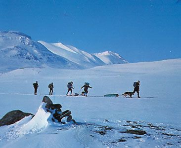
Galdhø Peak, more commonly known as Galdhøpiggen, is the highest mountain peak in Norway and the entire Scandinavian Peninsula. Located in the Jotunheim…
What is Galdhø Peak?
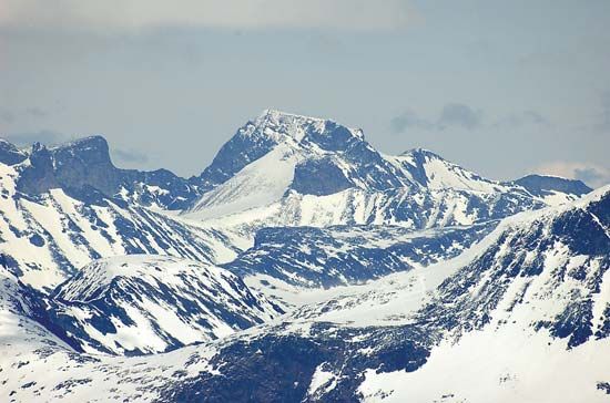
Galdhø Peak, more commonly known as Galdhøpiggen, is the highest mountain peak in Norway and the entire Scandinavian Peninsula. Located in the Jotunheim Mountains of south-central Norway, it reaches an elevation of 8,100 feet (2,469 metres).123
First climbed in 1850, the peak is a prominent feature of Jotunheimen National Park. It is surrounded by glaciers and serves as a popular destination for tourists and climbers during the summer season. The mountain is geologically linked to the ancient Caledonian volcanic rocks found in Scotland and stands near Glitter Mountain, which is the second-highest peak in the region.13
What is the significance of Jotunheimen National Park?
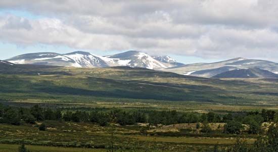
Jotunheimen National Park—derived from the name Jotunheimen, meaning “Giant’s Home”—is a region of profound geographical and cultural significance in south-central Norway. As the highest mountain range in the Scandinavian Peninsula, it contains the two loftiest peaks in the region: Galdhø Peak and Glitter Mountain.245
The area is significant for several reasons:
- Geological Importance: The mountains are geologically related to the ancient Caledonian volcanic rocks of Scotland and rise dramatically from a plateau approximately 3,000 feet above sea level.2
- Cultural Heritage: Mentioned in early Norse sagas, the landscape served as the setting for the opening of Henrik Ibsen’s famous drama, Peer Gynt.2
- Tourism and Economy: For over a century, the park has been a premier destination for hiking and mountaineering. Additionally, the lower slopes and plateaus remain vital for traditional summer pasturing of cattle and goats.2
How do glaciers shape the landscape of the Jotunheim Mountains?
Glaciers have been the primary architects of the dramatic landscape found in the Jotunheim Mountains. Through the powerful processes of erosion, plucking, and abrasion, these ice masses have transformed the region’s physique over millions of years.67
Glacial activity in the area has created several distinct landforms:
- U-Shaped Valleys: Glaciers inherited original V-shaped stream valleys and reshaped them by removing debris and eroding the bedrock along the base and lower sidewalls, resulting in the characteristic parabolic or U-shaped profiles seen today.6
- Cirques and Tarns: The heads of many glacial valleys are occupied by cirques—amphitheatre-shaped hollows carved into the mountainside. These basins often contain tarns, which are lakes formed in the over-deepened bedrock.6
- Arêtes and Horns: As glaciers eroded parallel valleys, they narrowed the divides between them into sharp, knife-edge ridges known as arêtes. Where multiple cirques met, they carved out jagged, peak-like horns, such as those found among the range’s highest summits.6
Today, the influence of ice remains visible, notably with Glitter Mountain still supporting a permanent glacial icecap.2
What are some other famous mountain ranges in Scandinavia?
Beyond the Jotunheim Mountains, the Scandinavian Peninsula features several other significant mountain ranges and highland areas:
- Kölen Mountains: Also known as the Scandinavian Mountains, this extensive range runs along the border between Norway and Sweden. It is characterized by numerous glaciers and includes Sweden’s highest peaks, such as Mount Kebne and Mount Sarek, the latter located within the renowned Sarek National Park.8
- Lang Mountains: This complex of ranges in south-central Norway acts as a major barrier, dividing the eastern and western regions of the country. It encompasses several notable features, including the Hardanger Plateau, which is Europe’s largest mountain plateau.42
- Dovre Mountains: Situated in west-central Norway, this range lies to the north and east of the Lang Mountains and serves as another prominent mountainous area within the Scandinavian landscape.4
These ranges are part of the ancient Caledonian orogenic belt, a geological system that has been significantly shaped by repeated periods of glaciation.2
Sources
- Galdhø Peak — Encyclopædia Britannica
- Jotunheim Mountains — Encyclopædia Britannica
- Galdhøpiggen — Merriam-Webster
- Lang Mountains — Encyclopædia Britannica
- Glitter Mountain — Encyclopædia Britannica
- glacial landform - Cirques , tarns, U-shaped valleys, arêtes, and horns — Encyclopædia Britannica
- Europe - Pleistocene glaciation — Encyclopædia Britannica
- Scandinavian Peninsula — Encyclopædia Britannica
- Norway - Relief — Encyclopædia Britannica
- Sweden - Relief — Encyclopædia Britannica
Published on · 3 min read