Gasconade River
The Gasconade River is a waterway located in south-central Missouri, United States. It originates in the Ozark Mountains and flows in a northeasterly…
What is Gasconade River?
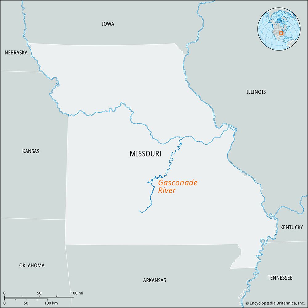
The Gasconade River is a waterway located in south-central Missouri, United States. It originates in the Ozark Mountains and flows in a northeasterly direction until it joins the Missouri River near the town of Hermann.12
The river spans approximately 250 to 265 miles in length and is well-regarded for its fishing opportunities. Additionally, the river features dams located near the communities of Richland and Vienna.12
What are the unique geological features of the Ozark Mountains?
The Ozark Mountains, also known as the Ozark Plateau, are a heavily forested highland region characterized by several distinct geological features.34
Topography and Structure
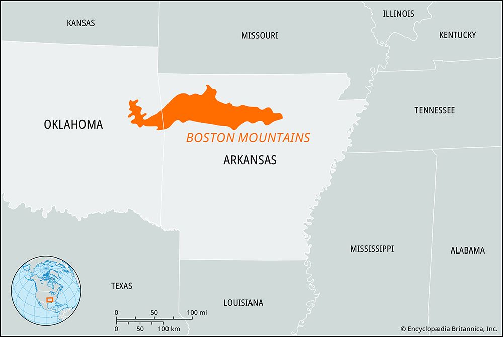
The region is an eroded tableland that generally ranges from 1,500 to 2,500 feet in elevation. It is defined by broad, flat-topped ridges and steep valleys. The southern edge, known as the Boston Mountains, is particularly rugged and contains the highest elevations in the range. To the north, the landscape transitions into the Springfield and Salem plateaus, which feature more gently rolling terrain.354
Karst Landscapes and Hydrology
A defining geological characteristic of the Ozarks is its karst terrain. This landscape is shaped by the dissolution of soluble bedrock, such as limestone and dolomite, which results in:6
- Underground Drainage: Much of the region’s water moves through subsurface conduits rather than surface streams.56
- Caves and Springs: The area is noted for its numerous limestone caves and large, majestic springs that serve as outlets for underground water systems.46
- Sinkholes: The surface is often marked by closed depressions where water drains into the subsurface.6
How do rivers like the Gasconade shape the surrounding landscape?
Rivers like the Gasconade River serve as primary agents of landscape evolution, molding the terrain through a continuous cycle of erosion and deposition.8
As these rivers flow through the Ozark Mountains, they act as powerful sculptors of the land:
- Valley Formation: Rivers create the very valleys they occupy. In the initial stages of development, they expend energy on vertical entrenchment, carving deep, narrow valleys into the bedrock. Over time, as the river smooths its profile, it shifts its energy toward lateral erosion, progressively broadening the valley floor.19
- Sediment Transport and Deposition: Rivers transport sediment-laden water, creating landforms such as floodplains. Through lateral accretion, rivers deposit sand and gravel on the inside of meander bends, forming point bars that shape the valley bottom.10
- Karst Interaction: In regions like the Ozarks, which feature soluble limestone and dolomite, rivers interact with karst systems. They may lose water to underground conduits, leading to the formation of dry valleys and complex, deranged drainage patterns where surface streams sink into the subsurface.11
What types of fish are commonly found in Missouri rivers?
Missouri’s diverse aquatic environments, including rivers like the Gasconade River, support a rich variety of life. While the state is home to more than 100 species of fish, the provided search results do not specify the exact names or types of fish commonly found in these rivers.114
The state’s river systems, particularly those winding through the Ozark Mountains, are well-regarded for their fishing opportunities, though specific species data is not detailed in the available records.114
Sources
- Gasconade River — Encyclopædia Britannica
- Gasconade — Merriam-Webster
- Ozark Plateau — Merriam-Webster
- Ozark Mountains — Encyclopædia Britannica
- Ouachita Mountains — Encyclopædia Britannica
- Arkansas - Relief, drainage, and soils — Encyclopædia Britannica
- cave — Encyclopædia Britannica
- river - Rivers as agents of landscape evolution — Encyclopædia Britannica
- river - Floodplain deposits, origins, and features — Encyclopædia Britannica
- cave - Fluviokarst — Encyclopædia Britannica
- river - Valley evolution — Encyclopædia Britannica
- Missouri - Relief — Encyclopædia Britannica
- river - Valleys and canyons — Encyclopædia Britannica
- Missouri - Plant and animal life — Encyclopædia Britannica
Published on · 2 min read