Glenmore
It is important to distinguish between two similarly named locations in Scotland: Glenmore and Glen More.
What is Glenmore?
It is important to distinguish between two similarly named locations in Scotland: Glenmore and Glen More.
Glenmore
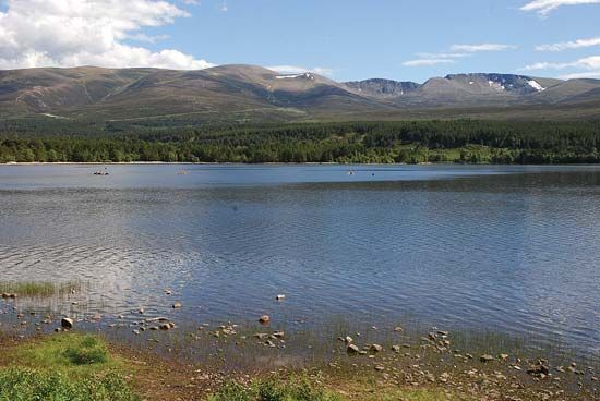
Glenmore is a national forest park located in the foothills of the Cairngorm Mountains within the Highland council area of Scotland. Established in 1948, this 12,000-acre park spans from the town of Aviemore to the summit of Cairn Gorm. It is a popular destination for outdoor recreation, offering sailing on Loch Morlich, climbing, walking, and the best skiing in Britain.1
Glen More
Glen More (often spelled as two words) refers to a significant valley in northern Scotland. This valley stretches approximately 50 miles, running southwest to northeast, and serves as the geographic connection between Loch Linnhe and the Moray Firth. The valley is also notable for containing the Caledonian Canal.2
What is the significance of the Caledonian Canal?
The Caledonian Canal is a 60-mile waterway in northern Scotland that runs southwest to northeast across the Glen Mor fault. Its primary significance lies in its engineering and historical role as a strategic link between the North Sea and the North Atlantic Ocean.
Key aspects of its significance include:
- Engineering Achievement: Surveyed by James Watt and constructed under the direction of Thomas Telford, the project connected a chain of freshwater lakes, including Lochs Ness, Oich, Lochy, and Eil.34
- Historical Economic Role: Upon its opening in 1822, the canal was of great economic importance, providing a vital transit route for shipping across the Scottish Highlands.3
- Modern Usage: While it was once a major commercial artery, the canal is now too small for modern oceangoing vessels. Today, it serves primarily as a scenic route for fishing and pleasure craft.3
What wildlife can be found in the Cairngorm Mountains?
The Cairngorm Mountains, which form part of the Grampian Mountains, are home to a diverse array of wildlife protected within the Cairngorms National Nature Reserve.56
Flora
The region features unique plant life adapted to its varied elevations. While lower areas contain remnants of original pine forests, such as those in the Spey valley, the higher slopes and plateaus support specialized alpine and Arctic species, including:
- Saxifrages
- Creeping azalea
- Dwarf willows5
Fauna
The mountains and their surrounding glens support a variety of mammals and birds:
- Mammals: Herds of red deer are commonly found on higher ground, while roe deer inhabit the woodlands. Other mammals include foxes, badgers, pine martens, otters, and both mountain and brown hares. The Scottish wildcat is also present, though it remains critically endangered.5
- Birds: The area is a significant habitat for birds of prey, including golden eagles, buzzards, peregrine falcons, and kestrels. Notable game birds include the red grouse and the ptarmigan, the latter of which is specifically found at higher elevations. Additionally, the large capercaillie has been reintroduced into the region’s pine woodlands.5
How was the landscape of the Scottish Highlands formed?
The landscape of the Scottish Highlands was shaped by a complex history of tectonic activity and intense glacial erosion.
Tectonic Origins
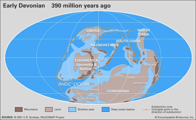
The foundation of the Highlands was established during the Caledonian orogenic belt formation, which occurred between 542 and 416 million years ago. This mountain-building event resulted from the collision of continental blocks following the closure of the Iapetus Ocean. Subsequent uplift and erosion during the Devonian Period led to the deposition of sandstones and conglomerates across the region. Approximately 50 million years ago, during the Eocene Epoch, an eastward tilting of the Highlands created the primary watershed that defines the modern drainage patterns.896
Glacial Sculpting
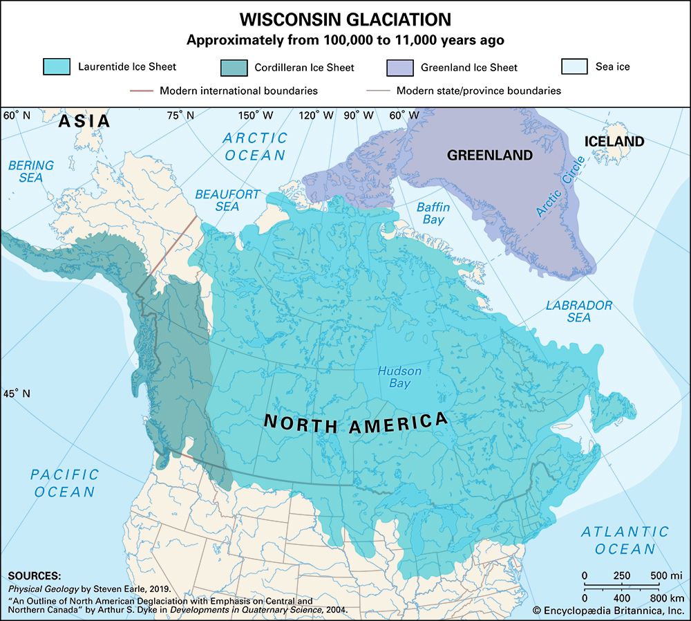
The rugged, dramatic relief seen today is largely the result of severe glaciation during the Pleistocene Epoch. Glaciers carved deep glens (valleys) into the ancient plateau, creating the characteristic U-shaped valleys and rock basins that now hold numerous lochs. In the northwest, this process scoured the Lewisian Complex bedrock, leaving behind a hummocky landscape of thin soil and small lakes.1011
Sources
- Glenmore — Encyclopædia Britannica
- Glen More — Merriam-Webster
- Caledonian Canal — Encyclopædia Britannica
- Caledonian Canal — Merriam-Webster
- Scotland - Plant and animal life — Encyclopædia Britannica
- Cairngorm Mountains — Encyclopædia Britannica
- Monadhliath Mountains — Encyclopædia Britannica
- Scotland - Relief of Scotland — Encyclopædia Britannica
- Grampian Mountains — Encyclopædia Britannica
- Caledonian orogenic belt — Encyclopædia Britannica
- Scotland - Ancient times — Encyclopædia Britannica
- Europe - Caledonian orogenic belt — Encyclopædia Britannica
- Scotland - Drainage — Encyclopædia Britannica
- Pleistocene Epoch - Glaciation — Encyclopædia Britannica
Published on · 3 min read