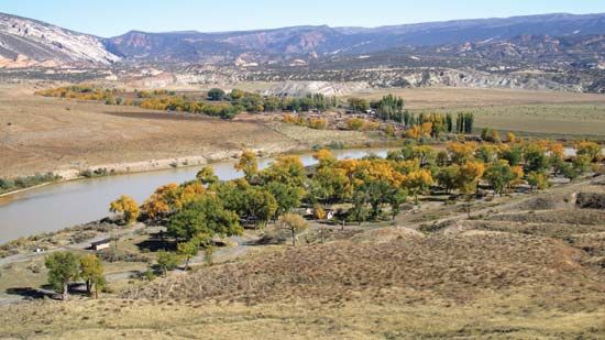
Great Scarcies River
The Great Scarcies River significantly shapes the local environment, particularly in its lower reaches within Sierra Leone. This region is characterized by…
How does the Great Scarcies River impact the local environment and ecosystems?
The Great Scarcies River significantly shapes the local environment, particularly in its lower reaches within Sierra Leone. This region is characterized by extensive mangrove swamp ecosystems, which have been historically altered by human activity.1
The river’s impact on the local landscape includes:
- Agricultural Transformation: Large portions of the mangrove swamps have been cleared to facilitate rice cultivation, a practice central to the local economy and the Temne people central to the local economy and the Temne people.1
- Economic Hubs: The river supports key agricultural infrastructure, including the West African Rice Research Station at Rokupr and government milling facilities at Mambolo, which rely on the river for the transport of swamp rice.1
- Coastal Resources: Near the river’s mouth at the Atlantic Ocean, the ecosystem supports vital local industries, specifically fishing and salt production.1
The river, which originates in the Fouta Djallon highlands, also experiences significant seasonal fluctuations in water levels, which are characteristic of the dense drainage patterns found throughout the region.2
What are the main geographical features of the Great Scarcies River?
The Great Scarcies River, also known as the Kolenté, is a significant waterway in western Africa with the following geographical characteristics:
- Origin and Course: The river rises in the Fouta Djallon highlands of western Guinea, approximately 25 miles (40 km) north of Kindia. It flows for a total of 160 miles (257 km) before reaching the Atlantic Ocean.1
- Border Definition: It serves as a natural boundary, marking 63 miles (101 km) of the border between Guinea and Sierra Leone.12
- Lower Reaches: Upon entering Sierra Leone, the river flows through a densely populated region characterized by mangrove swamps. This area has been extensively modified for rice cultivation.1
- Navigability and Infrastructure: The river is navigable up to Kambia, which is located 30 miles (48 km) upstream. Seasonal water levels fluctuate significantly, a common trait among the rivers in this region.12
Are there any significant historical or cultural events related to the Great Scarcies River?
The Great Scarcies River has been a focal point for regional development and infrastructure, particularly regarding its role in the agricultural economy of Sierra Leone.
Key historical and developmental milestones include:
- Agricultural Development: The river basin has long been central to the culture and economy of the Temne people, who have historically cleared mangrove swamps to establish rice cultivation systems.1
- Research and Industry: The establishment of the West African Rice Research Station at Rokupr and the construction of a government rice mill at Mambolo highlight the river’s historical importance as a hub for regional food security and agricultural research.1
- Infrastructure Modernization: A significant geopolitical and developmental event occurred in the mid-1970s when the People’s Republic of China financed the construction of bridges over the Great Scarcies and Little Scarcies rivers. These bridges replaced traditional ferry crossings at Kambia and Mange, significantly improving transportation and connectivity in the region.1
What are the main tributaries of the Great Scarcies River?
The provided search results do not contain information regarding the specific tributaries of the Great Scarcies River. While the documents detail the river’s course, its role in regional drainage, and its economic significance, they do not list or describe its tributary system.
Sources
- Great Scarcies River — Encyclopædia Britannica
- Sierra Leone - Drainage — Encyclopædia Britannica
Published on · 2 min read