Guaporé River
The Guaporé River serves as a significant component of the Amazon River system by acting as the largest affluent of the Mamoré River. The Mamoré, in turn, is…
How does the Guaporé River contribute to the Amazon River system?
The Guaporé River serves as a significant component of the Amazon River system by acting as the largest affluent of the Mamoré River. The Mamoré, in turn, is a major tributary of the Madeira River, which is the second-largest affluent of the Amazon.12
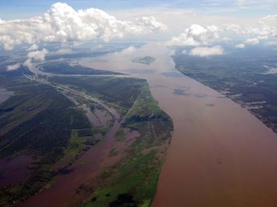
By flowing through the Mato Grosso Plateau and forming the border between Brazil and Bolivia, the Guaporé contributes to the drainage of this region into the broader Amazon basin. Unlike the silt-laden waters of the Mamoré, the Guaporé is characterized by its unusually clear water, a distinction that remains visible for several miles after the two rivers converge. Through this connection to the Mamoré and subsequently the Madeira, the Guaporé helps provide access to the forests of the Bolivian Oriente, ultimately feeding into the Amazon’s massive discharge.12
What are some of the major cities or settlements located on the banks of the Guaporé River?
The banks of the Guaporé River are primarily characterized by small, scattered settlements of indigenous peoples and mestizos, reflecting the remote nature of the surrounding tropical rainforest.1
While there are few large urban centers directly on the river, notable locations associated with the region include:
- Mato Grosso city: Located in the state of Mato Grosso, Brazil, the river flows past this settlement during its upper course.1
- Guajará-Mirim: Situated in Brazil near the confluence of the Guaporé and the Mamoré River, this town serves as a significant regional hub and was historically the southern terminus of the Madeira-Mamoré Railway.134
- Forte Príncipe da Beira: Constructed in the late 18th century near the confluence of the Guaporé and Mamoré rivers, this historic site remains a prominent landmark from the era of frontier conflicts between the Spanish and Portuguese.1
Are there any noteworthy geological features or formations along the course of the Guaporé River?
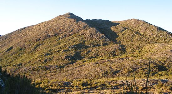
The Guaporé River originates in the Serra dos Parecis mountains, a significant geological feature located within the state of Mato Grosso, Brazil.1
As the river flows through its course, it traverses the western extension of the Brazilian Plateau, specifically moving through the Mato Grosso Plateau, which sits at an elevation of approximately 3,000 feet (900 meters). The western portion of the region through which the river flows is characterized primarily as a floodplain, which serves as one of the most significant tropical grazing lands in the world.5
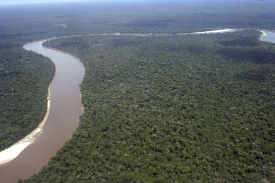
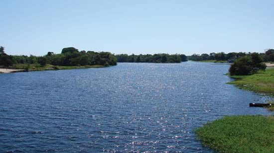
While the river is noted for its unusually clear water—a distinct feature compared to the silt-laden Mamoré River into which it flows—the surrounding landscape is dominated by tropical rainforest and expansive plains known as campos, which feature scrub growth and light forest.15
Where is the Guaporé River located, and what countries does it flow through?
The Guaporé River is located in west-central South America. It rises in the Serra dos Parecis mountains within the state of Mato Grosso, Brazil, and flows through a region of tropical rainforest.
As it continues its course, the river serves as the international border between Brazil and Bolivia before eventually emptying into the Mamoré River.1
Sources
- Guaporé River — Encyclopædia Britannica
- Amazon River - Physiography of the river course — Encyclopædia Britannica
- Rondônia — Encyclopædia Britannica
- Mamoré River — Encyclopædia Britannica
- Mato Grosso — Encyclopædia Britannica
- list of rivers - South America — Encyclopædia Britannica
Published on · 2 min read