Gulf of Tehuantepec
The Gulf of Tehuantepec is a large, wide-mouthed inlet of the Pacific Ocean located along the southern coast of the Isthmus of Tehuantepec in southeastern…
What is Gulf of Tehuantepec?
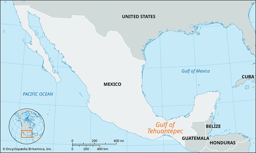
The Gulf of Tehuantepec is a large, wide-mouthed inlet of the Pacific Ocean located along the southern coast of the Isthmus of Tehuantepec in southeastern Mexico. It spans approximately 300 miles (500 km) from Puerto Angel in Oaxaca to Barra del Suchiate in Chiapas, measuring about 100 miles (160 km) across its mouth.1
The gulf’s coastline is characterized by numerous lagoons, such as Superior, Inferior, and Muerto, and it serves as the terminus for the Tehuantepec River. The primary port and settlement on the gulf is Salina Cruz, which functions as the southern end of a major trans-isthmus railroad. The region is also known for the “Tehuantepecer,” a violent north wind that brings cold air into the area.123
What is the Isthmus of Tehuantepec?
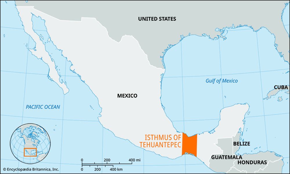
The Isthmus of Tehuantepec is a narrow strip of land in southern Mexico that separates the Gulf of Campeche (an arm of the Gulf of Mexico) to the north from the Gulf of Tehuantepec on the Pacific Ocean to the south.3
At its narrowest point, the isthmus measures 137 miles (220 km) across. The terrain is a broad, plateaulike ridge, with a northern region characterized by swamps and dense tropical forests, while the southern Pacific slopes are notably drier.3
Historically, the isthmus was evaluated as a potential site for an interoceanic canal, but the project was deemed too costly. Instead, a 192-mile (310-km) railroad was completed in 1907, linking the ports of Coatzacoalcos and Salina Cruz. Today, the region remains a significant transportation corridor and is the cultural heartland of the Tehuana people, known for their unique gold jewelry and matriarchal social structure.3
How do Tehuantepecer winds affect the local climate?
The Tehuantepecer is a violent north wind that significantly impacts the local climate by funneling cold air into the region surrounding the Gulf of Tehuantepec.1
While the Isthmus of Tehuantepec generally experiences a hot climate, these winds play a role in the regional atmospheric conditions. The presence of these cold, forceful winds contributes to the distinct environmental differences between the northern and southern sides of the isthmus; specifically, the Pacific slopes on the south are notably drier than the swampy, tropical northern side.2
Why was the Isthmus considered for an interoceanic canal?
The Isthmus of Tehuantepec was considered a favorable location for an interoceanic canal as early as the 16th century due to its potential as a strategic transportation route between the Atlantic and Pacific oceans.3
However, the proposal to construct a canal at this site was ultimately rejected because the project was deemed too costly. Instead of a canal, the region was developed as a land-based transit corridor; a 192-mile (310-km) railroad was completed in 1907, connecting the port of Coatzacoalcos on the Gulf of Campeche to Salina Cruz on the Gulf of Tehuantepec.3
Sources
- Gulf of Tehuantepec — Encyclopædia Britannica
- Tehuantepecer — Merriam-Webster
- Isthmus of Tehuantepec — Encyclopædia Britannica
- canals and inland waterways - The Panama Canal — Encyclopædia Britannica
- Panama Canal - History — Encyclopædia Britannica
- Panama Canal - American intervention — Encyclopædia Britannica
Published on · 2 min read