Haardt Mountains
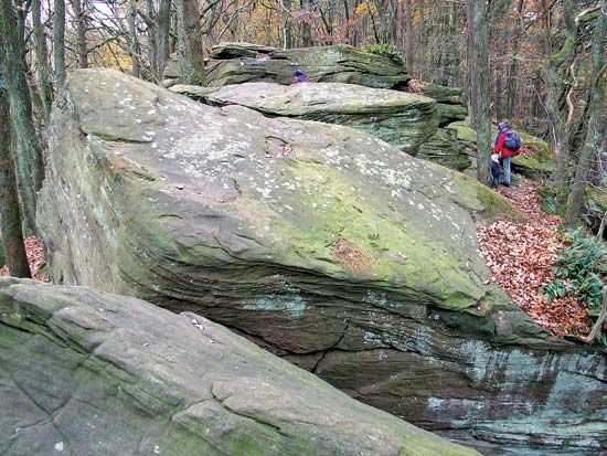
The Haardt Mountains are a mountain range located in the state of Rheinland-Pfalz in southwestern Germany.
What is Haardt Mountains?
The Haardt Mountains are a mountain range located in the state of Rheinland-Pfalz in southwestern Germany.1
Forming the eastern section of the Pfälzer Forest Mountains, the range is situated west of the Rhine River basin and stretches from the French border to a location approximately 20 miles south of Mainz. Geologically, they serve as a northern continuation of the Vosges Mountains. The range features densely forested slopes that reach a maximum elevation of 2,208 feet (673 meters) at Mount Kalmit.1
The region is well-known for its orchards and vineyards, making it a significant hub for tourism and winemaking, with major cities including Neustadt an der Weinstrasse and Bad Dürkheim.1
How are the Haardt Mountains related to the Vosges Mountains?
The Haardt Mountains are geologically defined as the northern continuation of the Vosges Mountains, which are located to the south.1
While the Haardt range forms the eastern portion of the Pfälzer Forest Mountains in southwestern Germany, it shares a common geological origin with the Vosges, effectively extending that mountain system northward from the French border toward the region south of Mainz.1
What makes the Palatinate Forest region famous for winemaking?
The Palatinate Forest region, particularly the area surrounding the Haardt Mountains, is a renowned center for viticulture due to its favorable geography and climate.
The region’s fame for winemaking is driven by several key factors:
- Geographic Advantage: The Haardt Mountains provide a sheltered, picturesque setting on their eastern slopes, where the landscape transitions into the Rhine River valley. This area benefits from fertile soils and a climate conducive to specialized agriculture.12
- The German Wine Highway: The region is home to the Deutsche Weinstrasse (German Wine Highway), a famous route that tours small, historic towns known for their terraced vineyards and wine production.3
- Institutional Support: Cities like Neustadt an der Weinstrasse serve as hubs for the German wine trade. These locations often host significant cultural events, such as the annual Deutsche Weinlesefest (Wine Festival), and house specialized training and research institutes dedicated to viticulture and horticulture.2
What are the main geographical features of the Rhine River basin?
The Rhine River basin is characterized by a diverse range of geographical features as it flows from the Alps to the North Sea. Its physiography can be divided into several distinct sections:
Alpine and High Rhine
The river originates in the Swiss Alps from two headstreams, the Vorderrhein and the Hinterrhein. It flows through a flat-floored section into Lake Constance before becoming the “High Rhine,” which features rapids and the Rhine Falls.4
The Broad Valley
Below Basel, the river enters a broad, flat-floored valley approximately 20 miles wide. This section is framed by ancient massifs, including the Vosges Mountains and Black Forest to the east and west, and the Haardt Mountains and Odenwald uplands.4
The Middle Rhine Gorge
The middle reach is famous for its spectacular, deep, and winding gorge. Here, the river cuts between the steep, slate-covered slopes of the Hunsrück and Taunus mountains. This area is noted for its terraced vineyards and numerous historic castles.45
Lower Plains and Delta
Downstream from Bonn, the valley opens into a broad plain. The final section in the Netherlands forms a complex delta where the river branches into wide channels, such as the Lek and Waal, before reaching the sea.4
Sources
- Haardt Mountains — Encyclopædia Britannica
- Rhineland-Palatinate - Geography — Encyclopædia Britannica
- Neustadt an der Weinstrasse — Encyclopædia Britannica
- Rhine River - Physiography — Encyclopædia Britannica
- Rhine River — Encyclopædia Britannica
Published on · 2 min read