Huon Gulf
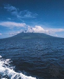
The Huon Gulf is a large inlet of the Solomon Sea located in the southwestern Pacific, indenting the coast of Papua New Guinea.
What is Huon Gulf?
The Huon Gulf is a large inlet of the Solomon Sea located in the southwestern Pacific, indenting the coast of Papua New Guinea.12
Stretching 100 miles (160 km) from Cape Cretin to Cape Ward Hunt, the gulf extends 65 miles (105 km) inland. It is geographically defined by the Huon Peninsula and the Rawlinson Range to the north, and the Kuper and Bowutu Mountains to the southwest. The Markham River flows into the gulf from the west, and the primary port towns situated along its shoreline include Lae, Salamaua, and Morobe. The entire 170-mile shoreline of the inlet was charted between 1873 and 1874 by the British navigator Captain John Moresby.13
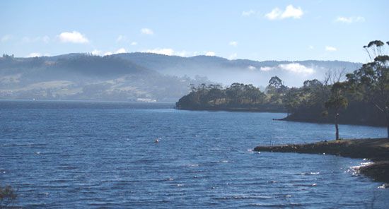
It is important to distinguish this feature from the Huon River, which is located in Tasmania, Australia.4
What is the significance of the Markham River to the Huon Gulf?
The Markham River serves as a vital geographical and economic link to the Huon Gulf. Flowing southeast through the Central Depression, the river terminates at the gulf just 3 miles (5 km) south of Lae, the region’s primary port city.51
The significance of the river to the gulf area includes:
- Economic Connectivity: The Markham Valley provides essential transport corridors. Two major roads ascend the valley from Lae, connecting the port on the Huon Gulf to the Bulolo Valley and the central highlands, facilitating the movement of goods such as timber, coffee, and agricultural produce for export.56
- Agricultural Development: The lower reaches of the river valley contain significant level agricultural land. This area has been developed for cattle farming and peanut cultivation, supporting the regional economy that relies on the nearby port facilities of the Huon Gulf.5
- Regional Hub: The proximity of the river mouth to Lae has made the area a central marketing and commercial hub for the surrounding region, bridging inland production with maritime trade.6
How did the Huon Gulf play a role in the Pacific theater of World War II?
The Huon Gulf was a critical theater of operations in the Pacific during World War II, serving as a focal point for Allied efforts to neutralize Japanese positions in New Guinea and isolate the major enemy stronghold at Rabaul.14
Key developments in the Huon Gulf region included:
- Strategic Denial: In March 1943, during the Battle of the Bismarck Sea, Allied aircraft decimated a Japanese convoy attempting to reinforce the Lae-Salamaua area. This victory effectively ended major Japanese attempts to reinforce New Guinea from Rabaul.4
- Allied Offensive: By mid-1943, Allied forces began a coordinated push toward the gulf’s port towns. On September 4, 1943, Australian forces launched amphibious landings near Lae, while U.S. paratroops dropped at Nadzab in the Markham River valley to secure an inland foothold.14
- Capture of Key Positions: The Allied campaign successfully captured Salamaua on September 12, 1943, and Lae on September 16, 1943. Shortly thereafter, Allied forces secured Finschhafen on the Huon Peninsula, further consolidating control over the region.14
These successes allowed the Allies to clear the Markham and Ramu river valleys and secure the Vitiaz and Dampier straits, effectively isolating Japanese forces and paving the way for further advances toward western New Guinea and the Philippines.74
What are some unique geographical features of the Huon Peninsula?
The Huon Peninsula in northeastern Papua New Guinea is defined by several distinct geographical features:
- Rugged Topography: The peninsula is characterized by high-altitude terrain, with elevations reaching over 13,000 feet (4,000 meters). This landscape is dominated by the Saruwaged and Rawlinson ranges, as well as the Cromwell Mountains.4
- Dense Environment: The region experiences heavy rainfall, ranging from 180 to 190 inches (4,600 to 4,800 mm) annually, which supports dense forest cover across the promontory.4
- Strategic Boundaries: Spanning 55 miles (89 km) in width, the peninsula is bounded by significant maritime and riverine features: the Vitiaz Strait of the Bismarck Sea to the north, the Solomon Sea to the east, the Huon Gulf to the south, and the Markham River to the west.4
- Archaeological Significance: Near Bobongara on the east coast, the area contains evidence of human habitation dating back approximately 40,000 years, marking it as one of the earliest sites of settlement in Oceania.4
Sources
- Huon Gulf — Encyclopædia Britannica
- Huon Gulf — Merriam-Webster
- Huon River — Encyclopædia Britannica
- Huon Peninsula — Encyclopædia Britannica
- Markham River — Encyclopædia Britannica
- Lae — Encyclopædia Britannica
- World War II - The Southwest and South Pacific, June–October 1943 — Encyclopædia Britannica
- World War II - Western New Guinea — Encyclopædia Britannica
- Pacific War - The Aleutians, Rabaul, and the Gilberts — Encyclopædia Britannica
Published on · 3 min read