Johore Strait
The Johore Strait is a northern arm of the Singapore Strait that stretches approximately 30 miles (50 km) in length and ranges from 0.75 to 3 miles in width.…
What is Johore Strait?
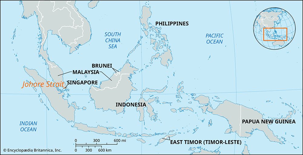
The Johore Strait is a northern arm of the Singapore Strait that stretches approximately 30 miles (50 km) in length and ranges from 0.75 to 3 miles in width. It serves as the body of water separating the Republic of Singapore from the Johor region at the southern tip of the Malay Peninsula.1
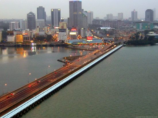
A rail and road causeway connects Johor Baharu, Malaysia, with Woodlands, Singapore, across the strait1. Historically, the area was the site of significant military conflict in February 1942 during the Japanese campaign to capture Singapore. The eastern portion of the strait includes the islands of Ubin and Tekong Besar and provides deepwater access to the Changi naval base.1
What was the significance of the Johor Strait during World War II?
During World War II, the Johor Strait served as the final natural defensive barrier protecting Singapore from the Japanese advance across the Malay Peninsula.13
By late January 1942, Japanese forces had successfully overrun the peninsula, positioning themselves directly opposite Singapore Island. The strait became the focal point of the conflict on February 8, 1942, when Japanese troops launched their assault by crossing the water to invade the island. This tactical maneuver effectively bypassed the British defenses, leading to the collapse of the colonial stronghold. Following this breach, the British command was forced to surrender the island and city just one week later, on February 15, 1942. Singapore remained under Japanese occupation until September 1945.3
How does the causeway impact trade between Malaysia and Singapore?
The causeway spanning the Johore Strait serves as a vital physical link between Singapore and Peninsular Malaysia, facilitating essential trade and transportation connections. By providing a direct rail and road route between Johor Baharu, Malaysia, and Woodlands, Singapore, the causeway enables the movement of goods and people across the strait, which otherwise separates the two regions.14
While the causeway is a critical infrastructure component for regional connectivity, it functions alongside Singapore’s broader logistics network. As one of the world’s busiest ports, Singapore relies heavily on its maritime terminals and the Port of Singapore Authority to manage the vast majority of its shipping tonnage and containerized cargo. The causeway complements these maritime operations by providing a land-based corridor for cross-border transit, supporting the integrated economic relationship between the two nations.4
Why is the Johor Strait important for Singapore’s water supply?
The Johor Strait itself is not the primary source of Singapore’s water; rather, the importance of the region lies in its proximity to the Teberau River in the Malaysian state of Johor.
Singapore relies on the Teberau River for a portion of its water supply, making the neighboring state of Johor a critical part of Singapore’s hinterland for essential resources. While the strait serves as a vital geographic and infrastructure link between the two nations via the causeway, the actual water security relationship is defined by these cross-border river agreements.12
Sources
- Johore Strait — Encyclopædia Britannica
- Johor — Encyclopædia Britannica
- history of Singapore - World War II and the end of colonialism — Encyclopædia Britannica
- Singapore - Transportation — Encyclopædia Britannica
Published on · 2 min read