Finisterre Range
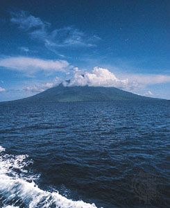
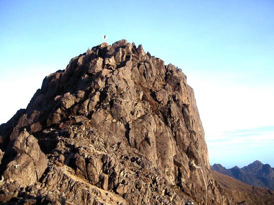
The Finisterre Range is a mountain range located at the base of the Huon Peninsula in northeastern Papua New Guinea.
What is Finisterre Range?
The Finisterre Range is a mountain range located at the base of the Huon Peninsula in northeastern Papua New Guinea.1
Situated in the southwestern Pacific Ocean, the range forms part of the northern boundary of the great Central Depression. Its highest point is an unnamed peak reaching an elevation of 13,533 feet (4,125 metres). The range is also significant for its hydrology, as tributaries originating there feed the Markham and Ramu rivers, which flow in opposite directions through the surrounding depression.1
What is the geography of the Huon Peninsula?
The Huon Peninsula is a prominent feature extending from northeastern Papua New Guinea into the southwestern Pacific Ocean. Measuring approximately 55 miles (89 km) wide, it is bounded by the Bismarck Sea to the north, the Solomon Sea to the east, the Huon Gulf to the south, and the Markham River to the west.3
The terrain is rugged and mountainous, rising to elevations exceeding 13,000 feet (4,000 metres) within the Saruwaged and Rawlinson ranges and the Cromwell Mountains. The region is characterized by dense forests, supported by an annual rainfall of 180–190 inches (4,600–4,800 mm). At the base of the peninsula lies the Finisterre Range, which contributes to the local hydrology by feeding tributaries into the Markham and Ramu rivers. Major settlements include the town of Lae in the southwest and Finschhafen in the east.31
How do the Markham and Ramu rivers shape the region?
The Markham and Ramu rivers are central to the geography of the great Central Depression in Papua New Guinea. These two rivers flow in opposite directions through the depression, effectively defining the drainage patterns of the region.5
The Ramu River
The Ramu River flows northwest through the Central Depression, collecting water from numerous streams that drain the Finisterre Range and the Bismarck and Adelbert ranges. Its course is characterized by swampy terrain and frequent channel changes, eventually emptying into the Bismarck Sea. Beyond its physical shaping of the landscape, the river is vital for infrastructure; the Yonki hydroelectric project on its upper course provides essential electricity to much of the surrounding highlands.35
The Markham River
The Markham River serves as a significant western boundary for the Huon Peninsula. Like the Ramu, it is fed by tributaries originating in the nearby mountain ranges, playing a key role in the hydrological network that sustains the region’s dense forests and rugged terrain.15
What are some other major mountain ranges in Papua New Guinea?
Papua New Guinea features a complex and rugged mountainous landscape shaped by tectonic activity. Beyond the ranges found on the Huon Peninsula, several other significant mountain systems define the country’s relief:
- Bismarck Range: Located in the northeastern segment of the central highlands, this range contains the country’s highest peak, Mount Wilhelm, which reaches 14,793 feet (4,509 metres). It serves as a vital watershed, acting as the source for the Ramu River and tributaries of the Sepik and Purari rivers.67
- The Highlands: This central mountainous zone extends across the island of New Guinea from west to southeast. It is characterized by elevations exceeding 13,000 feet (4,000 metres) and features fertile, enclosed upland basins formed by past volcanic activity and impeded drainage.7
- Maoke Mountains: While the westernmost segment of the central highlands lies primarily in the Indonesian province of Papua, these mountains are part of the same continuous geological system. This range includes the Sudirman and Jayawijaya ranges, containing Jaya Peak, the highest point on the island at 16,024 feet (4,884 metres).8
Sources
- Finisterre Range — Encyclopædia Britannica
- list of mountain ranges - Oceania (Pacific region) — Encyclopædia Britannica
- Huon Peninsula — Encyclopædia Britannica
- Huon River — Encyclopædia Britannica
- Ramu River — Encyclopædia Britannica
- Bismarck Range — Encyclopædia Britannica
- Maoke Mountains — Encyclopædia Britannica
- Papua New Guinea - Relief — Encyclopædia Britannica
- Papua New Guinea - Climate of Papua New Guinea — Encyclopædia Britannica
Published on · 3 min read