Jutland
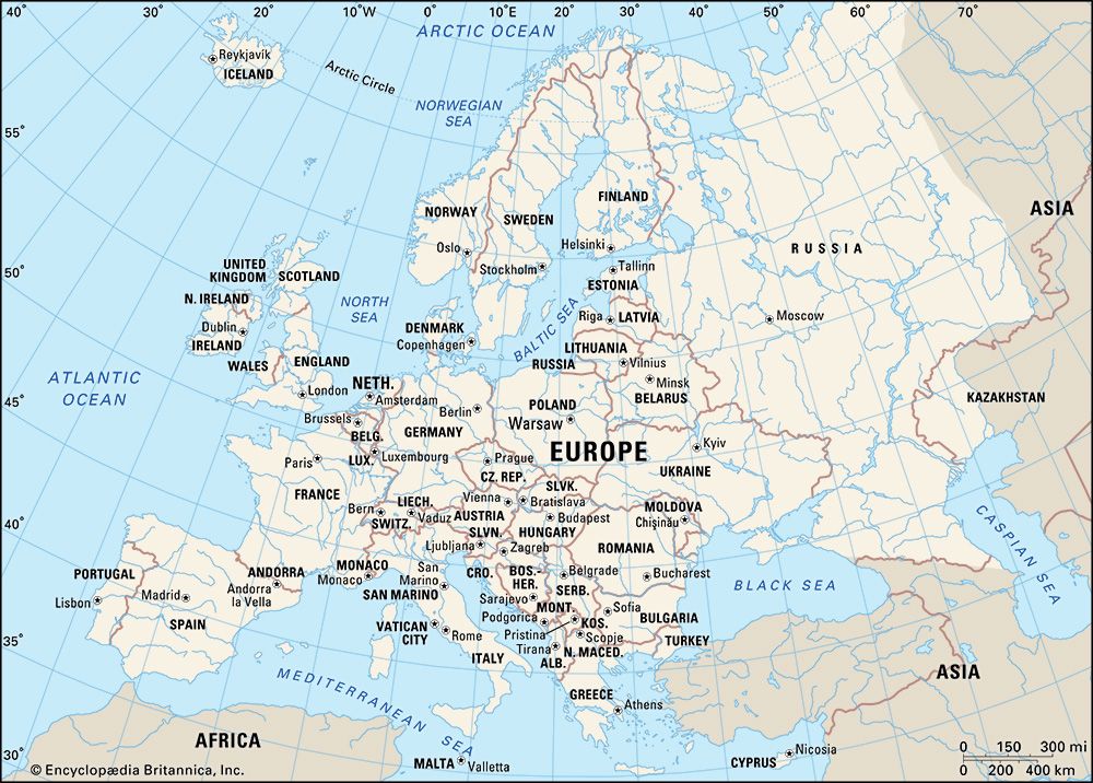
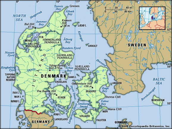
Jutland is a peninsula in northern Europe that projects into the North Sea. It forms the continental portion of Denmark and, in a broader geographical sense…
What is Jutland?
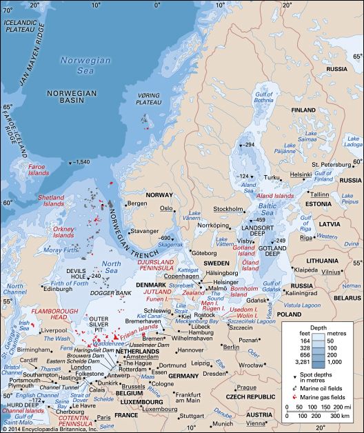
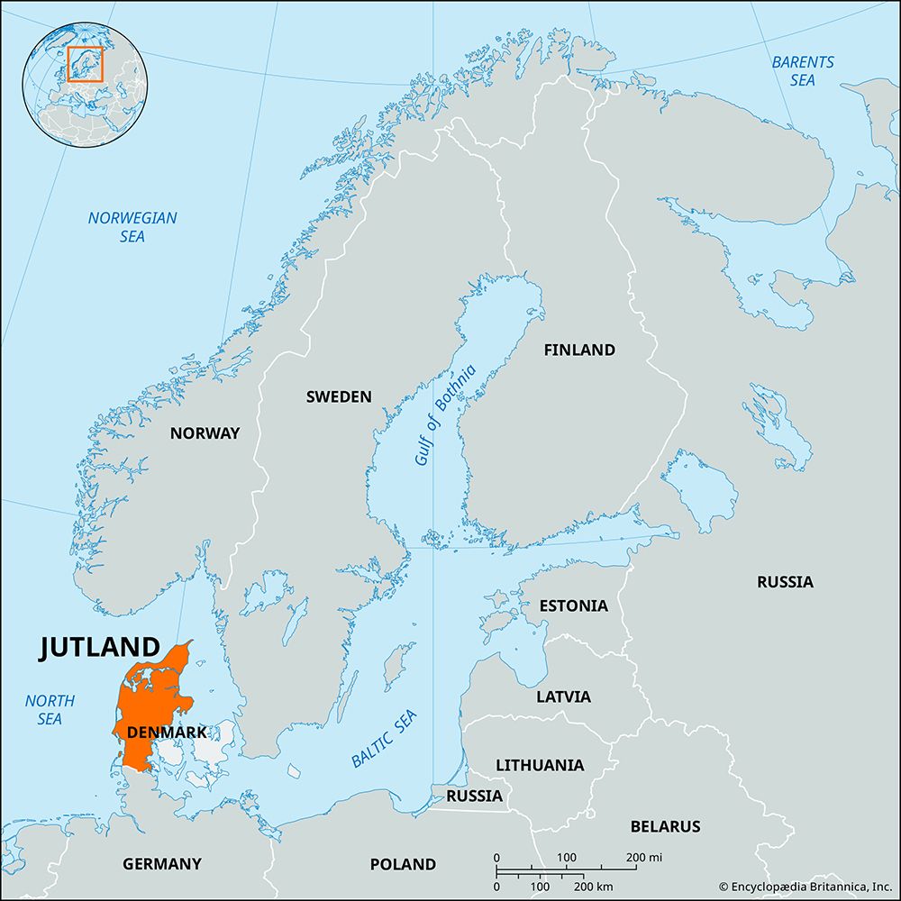
Jutland is a peninsula in northern Europe that projects into the North Sea. It forms the continental portion of Denmark and, in a broader geographical sense, includes the German state of Schleswig-Holstein.12
The peninsula is bounded to the west and north by the North Sea and the Skagerrak, and to the east by the Kattegat and the Little Belt. Historically known as the Cimbric Chersonese, it was later named for the Jutes, a Germanic people. Today, it accounts for more than two-thirds of Denmark’s total land area, with Århus serving as its major urban center.13
The name is also famously associated with the Battle of Jutland, the only major naval engagement between British and German fleets during World War I, which took place off the peninsula’s west coast.4
Who were the Jutes and how did they influence the region?
The Jutes were a Germanic people who, alongside the Angles and Saxons, migrated to Britain during the 5th century CE. While they lack a recorded history on the European continent, they are widely believed to have originated from the Scandinavian region, specifically the Jutland peninsula, which was later named in their honor.56
Their influence on the region was primarily felt through their settlement patterns in Britain. According to historical accounts from the Venerable Bede, the Jutes established themselves in Kent, the Isle of Wight, and parts of Hampshire. Archaeological and linguistic evidence supports this, noting distinct social structures and place-names in these areas that differentiate them from neighboring settlements. Those who remained in their ancestral homeland were eventually absorbed by the Danes.5
What was the significance of the Battle of Jutland in World War I?
The Battle of Jutland (May 31–June 1, 1916) was the largest naval engagement of World War I, serving as the only major confrontation between the main British and German battle fleets.29
The battle was initiated by German Admiral Reinhard Scheer, who sought to lure and destroy a portion of the British fleet. However, British intelligence intercepted his plans, allowing the Grand Fleet under Admiral John Jellicoe to intercept the German High Seas Fleet off the coast of Jutland.29
While both sides claimed victory, the engagement was tactically inconclusive. The British suffered greater losses in ships and personnel, yet the battle’s strategic significance was profound: the British maintained their numerical superiority in the North Sea. Consequently, the German High Seas Fleet remained confined to its home ports for the remainder of the war, leaving British naval dominance effectively unchallenged.9
How does the geography of the Jutland Peninsula shape Danish culture?
The geography of the Jutland Peninsula has profoundly shaped Danish culture, particularly through its influence on settlement patterns, economic life, and social organization.
Agricultural Foundations and Communalism
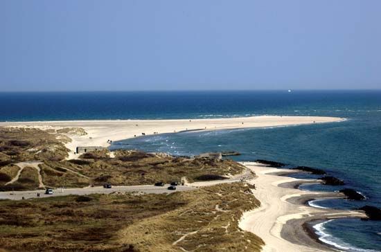
Historically, the landscape—shaped by the Weichsel glaciation—created a divide between the fertile loam plains of the east and the sandier, less productive soils of the west. This environment necessitated a high degree of cooperation. From the Middle Ages until the 18th century, Danish peasants operated under an open-field system, where they collectively managed fields and shared resources. This necessity for mutual reliance fostered a deep-seated communal spirit that remains a hallmark of Danish social values.110
Economic Adaptation
The peninsula’s varied terrain influenced how Danes utilized their land. While eastern regions supported cereal crops, western Jutland’s less fertile soil led to a focus on oats, rye, and potatoes. The presence of bogs, once a source of peat for fuel, was later transformed into grazing land. Furthermore, the peninsula’s extensive coastline and proximity to the North Sea encouraged the development of a robust fishing industry, which remains a vital part of the national economy.11112
Modern Settlement
Today, the geography continues to influence where people live. Major urban centers like Århus, Ålborg, and Esbjerg serve as hubs for the peninsula, while an excellent transportation network ensures that even rural areas remain integrated into the national life.10
Sources
- Jutland — Encyclopædia Britannica
- Battle of Jutland — Encyclopædia Britannica
- Denmark — Encyclopædia Britannica
- Jutland — Merriam-Webster
- Jute — Encyclopædia Britannica
- United Kingdom - The invaders and their early settlements — Encyclopædia Britannica
- Anglo-Saxon: Top Questions — Encyclopædia Britannica
- history of Denmark — Encyclopædia Britannica
- World War I - The Battle of Jutland — Encyclopædia Britannica
- Denmark - Agriculture and fishing — Encyclopædia Britannica
- Denmark - Settlement patterns — Encyclopædia Britannica
- Denmark - Relief — Encyclopædia Britannica
Published on · 3 min read