Kaduna River
The Kaduna River is characterized by significant seasonal fluctuations in its flow, which are directly influenced by the region's rainfall patterns. Due to…
How does the seasonal variation in rainfall affect the flow of the Kaduna River?
The Kaduna River is characterized by significant seasonal fluctuations in its flow, which are directly influenced by the region’s rainfall patterns. Due to these variations, the river is only navigable by light craft below Zungeru during the rainy season, specifically from July to October.1
The river’s discharge is closely tied to the timing of the rains, which also impacts the management of water infrastructure along its course. For instance, the Shiroro Dam, located at a gorge on the Kaduna River, is part of a project designed to manage these water resources. During periods of exceptionally heavy rainfall, such as in September 1999, the volume of water can become so great that dam operators are forced to release water to prevent structural overflow, which can lead to significant flooding in surrounding areas. These seasonal cycles are essential to the local economy, supporting fishing and agricultural activities like rice and sugarcane cultivation in the river’s floodplains.21
Are there any major cities or towns located along the banks of the Kaduna River?
Several significant towns and cities are located along the banks of the Kaduna River, which serves as a vital waterway in central Nigeria.
- Kaduna: As the capital of Kaduna state, this city is the largest urban center situated on the river. It has developed into a major industrial, commercial, and financial hub, with many of its industries—including textile mills and manufacturing plants—grouped along the river’s southern banks.15
- Zungeru: Located in Niger state, Zungeru is another prominent town on the river. It is historically significant as the former capital of the Northern Provinces and remains a key location featuring a rail bridge that crosses the Kaduna River.1
- Bida: While situated in the vicinity of the river, Bida is closely associated with the Kaduna’s lower floodplains, where it serves as a center for nearby agricultural projects, such as the Edozhigi and Badeggi natural irrigation schemes, which support rice and sugarcane production.1
Additionally, the river flows near various smaller settlements and is crossed by infrastructure like rail bridges at both Kaduna and Zungeru.1
How has the Kaduna River influenced the historical development of the region?
The Kaduna River has played a pivotal role in the historical and economic development of central Nigeria. Historically, the river’s floodplains have been essential for local populations, with the Gbari (Gwari) people utilizing the upper reaches for swamp rice cultivation, while the southern plains in Nupe territory became a hub for rice and sugarcane production.1
The river also influenced modern urban development. In 1913, Sir Frederick Lugard, the first British governor of Northern Nigeria, selected a site along the river for a new town due to its strategic location near the Lagos-Kano Railway. This town, Kaduna, replaced Zungeru as the capital of the Northern Provinces in 1917. Since the mid-20th century, the river has supported the city’s growth into a major industrial and financial center, with many industries—including textile mills and manufacturing—strategically grouped along its southern banks. Today, the river remains vital for regional agriculture, fishing, and transport, while large-scale infrastructure like the Shiroro Dam helps manage its seasonal flow for power and irrigation.51
Where is the Kaduna River located in Nigeria, and what are its major tributaries?
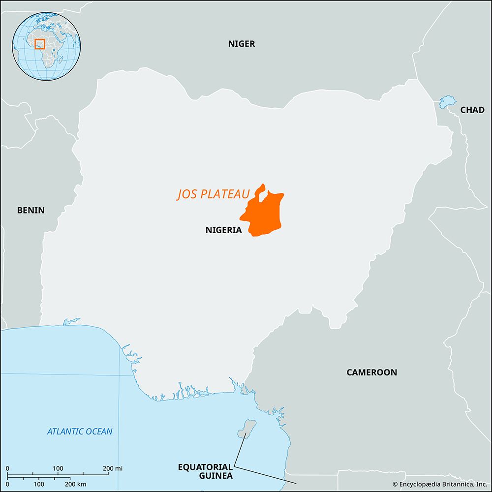
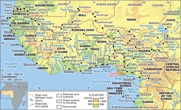
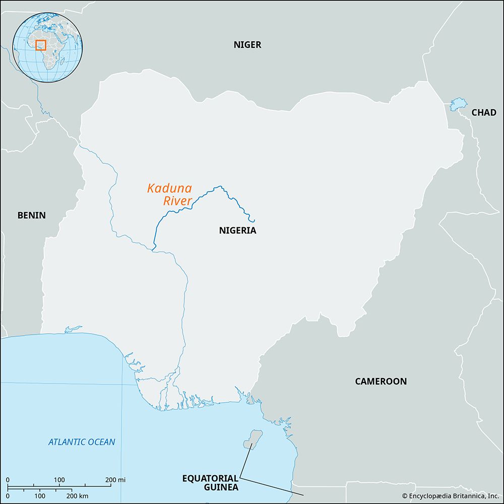
The Kaduna River is a major waterway located in central Nigeria. It rises on the Jos Plateau, specifically 18 miles (29 km) southwest of Jos near the town of Vom. From there, it flows in a northwesterly direction before turning southwesterly and southerly, eventually covering a 340-mile (550-kilometer) course until it joins the Niger River at Mureji.1
Regarding your inquiry about the river’s major tributaries, the provided search results do not contain information identifying specific tributaries of the Kaduna River. The available data focuses on the Kaduna River itself as a primary tributary of the Niger River and describes its course, economic significance, and the regions it traverses.16
Sources
- Kaduna River — Encyclopædia Britannica
- Niger River - Hydrology of Niger River — Encyclopædia Britannica
- Niger River - Climate — Encyclopædia Britannica
- Niger Dams Project — Encyclopædia Britannica
- Kaduna — Encyclopædia Britannica
- Kaduna — Encyclopædia Britannica
Published on · 3 min read