Laja River
The Laja River is a watercourse located in the state of Guanajuato in north-central Mexico. Spanning approximately 85 miles (135 km) in length, the river…
What is Laja River?
The Laja River is a watercourse located in the state of Guanajuato in north-central Mexico. Spanning approximately 85 miles (135 km) in length, the river originates in the Sierra Madre Occidental near San Felipe and flows through the central plateau, passing cities such as San Miguel de Allende, Comonfort, and Celaya.1
The Laja eventually joins the Apaseo River, which is a tributary of the Lerma River. Together with other major tributaries like the Turbio, the Laja helps form the Lerma River system, which is recognized as the largest river system in Mexico.12
What is the significance of the Lerma River system in Mexico?
The Lerma River system is highly significant as the largest river system in Mexico. Although the river itself is not navigable, it serves as a vital economic and infrastructural resource for the country.2
Key aspects of its significance include:
- Economic Utility: The waters of the Lerma are used extensively for hydroelectric power generation and to support irrigation for agriculture.2
- Urban Development: Many of Mexico’s large cities are situated along its banks, particularly within the basins of Toluca, Guanajuato, and Jalisco.2
- Hydrological Connectivity: The system includes major tributaries such as the Laja, Apaseo, and Turbio rivers. The Lerma flows into Lake Chapala—the country’s largest natural lake—and continues to the Pacific Ocean via its extension, the Río Grande de Santiago.23
How do rivers like the Laja support agriculture and irrigation?
Rivers like the Laja River support agriculture and irrigation primarily by serving as essential components of larger hydrological networks, such as the Lerma River system. In regions where water is a critical resource, these rivers provide the necessary supply for irrigation projects that enable farming in areas that might otherwise be unproductive.1
While the Laja itself is a key tributary, the broader Lerma system utilizes its waters extensively for both irrigation and hydroelectric power generation. Historically, irrigation has been practiced by conveying water from streams through canal systems to distribute it across croplands. Modern agricultural practices often involve pumping water from rivers or reservoirs into channels or using sprinkler systems to ensure crops receive sufficient moisture, particularly when rainfall is poorly distributed during the growing season.142
By providing a reliable water source, these river systems allow farmers to apply fertilizers effectively and utilize more productive crop varieties, which is essential for expanding agricultural output in both arid and fertile zones.4
What are the main geographical features of the Mesa Central region?
The Mesa Central, also known as the Mesa de Anáhuac, is a high plateau region in central Mexico that serves as the southern section of the Mexican Plateau.78
Its primary geographical features include:
- Elevation and Topography: The region lies at elevations between 6,000 and 7,500 feet (1,800 to 2,300 meters), with its southern end near Mexico City rising to 7,000–9,000 feet (2,100–2,700 meters). The landscape is characterized by a series of fairly level intermontane basins separated by eroded volcanic peaks.78
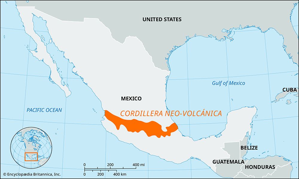
- Volcanic Influence: The region is defined by significant volcanic activity. The Cordillera Neo-Volcánica forms the southern backdrop of the mesa, featuring spectacular peaks such as Popocatépetl and Iztaccíhuatl.798
- Hydrology: Historically, the area contained vast lakes and marshes. While many were drained for settlement, significant remaining bodies of water include Lake Chapala, Lake Pátzcuaro, and Lake Cuitzeo.73
- Climate and Soil: The Mesa Central is wetter and more temperate than the northern Mesa del Norte. Its rich alluvial and volcanic soils support extensive agriculture, including crops like corn, beans, wheat, and sugarcane.78
Sources
- Laja River — Encyclopædia Britannica
- Lerma River — Encyclopædia Britannica
- Mexico - Drainage of Mexico — Encyclopædia Britannica
- Rio Grande - The economy — Encyclopædia Britannica
- Origins of agriculture - Irrigation — Encyclopædia Britannica
- Tigris-Euphrates river system - Agriculture and irrigation — Encyclopædia Britannica
- Mesa Central — Encyclopædia Britannica
- Sierra Madre - Geology — Encyclopædia Britannica
- Mexico - Physiographic regions — Encyclopædia Britannica
- Mexico - Climate — Encyclopædia Britannica
Published on · 3 min read