Biobío River
The Bío Bío River is a major river located in south-central Chile. Spanning approximately 240 miles (380 km), it originates in the Icalma and Galletué lakes…
What is Biobío River?
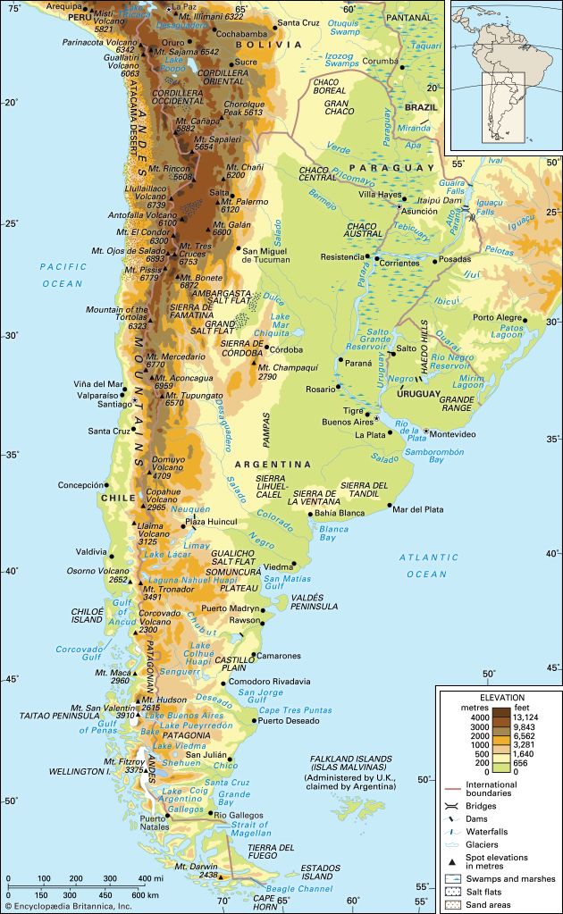
The Bío Bío River is a major river located in south-central Chile. Spanning approximately 240 miles (380 km), it originates in the Icalma and Galletué lakes within the Andes near the border with Argentina.12
The river flows northwestward, crossing the fertile Central Valley before cutting through the coastal mountain range to reach the Pacific Ocean near Concepción. Although it is one of the longest rivers in the country, it is navigable only by flat-bottomed boats. Geographically, the Bío Bío is often considered the southern boundary of middle Chile, a region that contains the majority of the nation’s population. It is also a vital water source for the surrounding Bío Bío region, where it is joined by its principal tributary, the Laja River.12
What is the significance of the Central Valley in Chile?
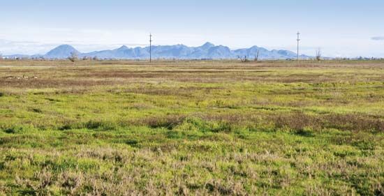
The Central Valley is a vital geological depression in central Chile, extending approximately 400 miles between the Andes and the coastal range. It serves as the nation’s agricultural heartland, containing 40 percent of all cultivated land and hosting the country’s primary wine-producing regions.3
The significance of the Central Valley includes:
- Demographic Hub: It is the home of the majority of the Chilean population. Santiago, the nation’s capital and cultural center, is located at its northern end, while other significant urban centers like Rancagua, Talca, and Chillán serve as hubs for the surrounding agricultural hinterlands.34
- Historical Foundation: The valley was the primary focus of Spanish colonization beginning in the mid-1500s, establishing the foundation for the country’s traditional settlement patterns and the development of large landed estates known as haciendas.34
- Economic Productivity: Benefiting from a Mediterranean climate and mineral-rich alluvial soils, the region is highly productive. Following 20th-century agrarian reform, the valley’s productivity was further emphasized to boost exports.34
Who were the Araucanian people and how did they resist colonization?
The term Araucanian historically refers to a group of Indigenous peoples in south-central Chile whom Spanish ethnographers divided into three populations: the Picunche in the north, the Mapuche in the central valleys, and the Huilliche in the south. Today, these groups generally identify as Mapuche, the most numerous Indigenous population in South America.567
While the Picunche and Huilliche were largely assimilated into colonial society, the Mapuche are renowned for their 350-year resistance against Spanish and later Chilean domination. Their successful defense was characterized by several strategic adaptations:57
- Military Reorganization: The Mapuche formed widespread political and military alliances that transcended their traditional village-level structure.57
- Tactical Innovation: Warriors adopted the use of horses in battle and learned to counter Spanish tactics, often under the leadership of effective strategists like Lautaro and Caupolicán.576
- Geographic Defense: Following intense conflicts, they maintained the Bío Bío River as a boundary for three centuries, effectively limiting colonial expansion into their southern forest homelands.56
How do earthquakes impact the geography of the Biobío region?
The Biobío region is situated in a highly active tectonic zone where the Nazca Plate subducts beneath the South American Plate. This ongoing geological process is the primary driver of the region’s seismic activity and its physical geography.28
The impact of earthquakes on the region’s geography includes:
- Orogeny and Uplift: The continuous subduction of the Nazca Plate is responsible for the formation and ongoing uplift of the Andes Mountains. This process has shaped the region’s varied landscape, which spans from the coastal mountain range and the Central Valley to the Andean cordillera.28
- Seismic Events: The region frequently experiences powerful earthquakes, such as the magnitude-8.8 Chile earthquake of 2010. These events can cause extensive damage to infrastructure and the natural environment.28
- Tsunami Risk: Large-scale seismic activity in this subduction zone has the potential to trigger [tsunamis], which significantly impact the coastal geography and settlements along the Pacific shoreline.8
Sources
- Biobío River — Encyclopædia Britannica
- Biobío — Encyclopædia Britannica
- Central Valley — Encyclopædia Britannica
- Chile - Settlement patterns — Encyclopædia Britannica
- Araucanian — Encyclopædia Britannica
- Mapuche — Encyclopædia Britannica
- Araucanian wars — Encyclopædia Britannica
- Nazca Plate — Encyclopædia Britannica
Published on · 3 min read