Kushk River
The Kushk River is a river located in Afghanistan and Turkmenistan. It is formed by the confluence of the Āq Robāṭ and Galleh Chaghar headstreams in…
What is Kushk River?
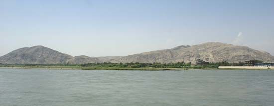
The Kushk River is a river located in Afghanistan and Turkmenistan. It is formed by the confluence of the Āq Robāṭ and Galleh Chaghar headstreams in northwestern Afghanistan. The river flows northwest, passing the town of Koshk-e Kohneh, before turning north to form a 10-mile (16-km) stretch of the border between the two countries. It eventually empties into the Morghāb River in Turkmenistan after a 172-mile (277-km) course.1
While the name “Kushk” may sound similar to the ancient Kingdom of Kush, that was a historical civilization in Nubia (modern-day Sudan), not a river. The Kushk River flows through a semiarid region and, despite being dry in some sections during the summer, provides essential irrigation for farmlands along its middle and lower courses.21
What is the significance of the Morghab River?
The Morghāb River is a vital waterway in Central Asia, flowing approximately 600 miles (970 km) from its source in the mountains of northwestern Afghanistan into the Karakum Desert of Turkmenistan.3
Its significance lies primarily in its role as a lifeline for agriculture and transportation in an otherwise arid region:
- Irrigation: The river is essential for farming, with dams at Dashköpri and Yolöten used to control and distribute water for irrigation along its course.3
- Tributary System: It serves as the terminal point for the Kushk River, which joins the Morghāb at Dashköpri, further contributing to the water supply of the region.31
- Infrastructure: A railroad branch follows the river’s path from Dashköpri to the city of Mary, where it connects to the Transcaspian Railway, facilitating regional connectivity.3
Ultimately, the river sustains human activity before disappearing into the sands of the Karakum Desert north of Mary.3
How do semiarid climates affect river systems?
Semiarid climates significantly alter river systems by creating environments where water availability is irregular, leading to the development of ephemeral streams and arroyos. Unlike perennial rivers in humid regions, these systems are characterized by the following dynamics:
- Flow Variability: Rivers in semiarid regions often lack consistent water sources. They may be fed by seasonal mountain runoff or irregular rainstorms, causing them to be dry for most of the year and subject to sudden, intense flash flooding.45
- Erosion and Deposition: Due to sparse vegetation cover and high sediment yields, these streams exhibit rapid rates of erosion and deposition. They often form flat-floored trenches known as arroyos, which are distinct from the V-shaped gullies found in humid climates.56
- Downstream Dissipation: As these streams flow downstream, they frequently become shallower. Much of the water is lost to evaporation or percolation into the dry streambed, often resulting in the stream dissipating entirely into terminal mudflows or salt marshes.456
- Channel Geometry: Ephemeral networks often develop complex, high-order channel systems. Because they lack the binding effect of continuous vegetation, they are prone to processes like piping and headcutting, which can create stepped channel profiles.56
What are some other major rivers in Afghanistan?
Beyond the Morghāb River, Afghanistan’s drainage system is defined by several major river basins that originate in the central highlands and typically terminate in inland lakes or deserts.9
- Helmand River: As the longest river in the country (approximately 715 miles), it is a critical lifeline for agriculture in southwestern Afghanistan. It flows into the Sīstān depression, a series of wetlands on the Afghan-Iranian border.910
- Amu Darya: Stretching 1,578 miles, this river forms a significant portion of Afghanistan’s northern border with Tajikistan and Uzbekistan. It is fed by major tributaries like the Qondūz and the Kowkcheh.9
- Kābul River: This is the primary river in eastern Afghanistan. Unlike most others in the country, it flows eastward into Pakistan to join the Indus River, eventually reaching the Arabian Sea.911
- Harīrūd: Dominating the northwestern drainage, this river flows through the fertile Herāt Valley before turning north to form part of the border with Iran and eventually disappearing into the Karakum Desert.9
Sources
- Kushk River — Encyclopædia Britannica
- Sudan - The kingdom of Kush — Encyclopædia Britannica
- Morghāb River — Encyclopædia Britannica
- Asia - Rivers — Encyclopædia Britannica
- arroyo — Encyclopædia Britannica
- Tigris-Euphrates river system: Top Questions — Encyclopædia Britannica
- Origins of agriculture - Irrigation — Encyclopædia Britannica
- river - Variation of stream regime — Encyclopædia Britannica
- Afghanistan - Drainage of Afghanistan — Encyclopædia Britannica
- Kabul River — Encyclopædia Britannica
- Helmand River — Encyclopædia Britannica
Published on · 3 min read