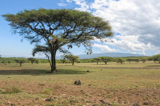
Lake Chilwa
Lake Chilwa is located in southeastern Malawi. It sits within a depression situated between the Shire Highlands to the west and the border of Mozambique to…
What is the geographical location and size of Lake Chilwa in Malawi?
Lake Chilwa is located in southeastern Malawi. It sits within a depression situated between the Shire Highlands to the west and the border of Mozambique to the east, extending north-northeast from the Mulanje Mountains.1
Regarding its size, the lake covers an area of approximately 1,000 square miles (2,600 square km). However, it is important to note that about half of this area consists of swamp and mixed savanna vegetation. The lake is relatively shallow, with a maximum depth of 10 feet (3 metres), and its water levels are known to fluctuate seasonally.1
How does Lake Chilwa compare to other lakes in Malawi in terms of size and importance?
In terms of size and importance, Lake Chilwa differs significantly from other major water bodies in Malawi, most notably Lake Malawi (also known as Lake Nyasa).
Size Comparison
- Lake Malawi: As the dominant feature of the country, it covers approximately 11,430 square miles (29,604 square km) and reaches depths of over 2,300 feet.12
- Lake Chilwa: It is much smaller, covering about 1,000 square miles (2,600 square km), with half of that area consisting of swamp and savanna vegetation. It is also very shallow, with a maximum depth of only 10 feet (3 metres).3
- Lake Malombe: Even smaller than Chilwa, it covers 162 square miles (420 square km).4
Importance and Characteristics
While Lake Malawi is the primary drainage system and a major source of fish for the country, Lake Chilwa serves as a distinct endoreic (in-flowing) drainage system. Economically, both lakes are vital for commercial fishing, though Lake Malawi accounts for approximately three-fourths of the country’s total catch. Lake Chilwa is also significant for its surrounding wetlands, which support rice and crop cultivation during the dry season.325
What is the cultural significance of Lake Chilwa to the people of Malawi?
Lake Chilwa holds significant economic and practical importance for the people of Malawi, primarily as a vital resource for sustenance and agriculture. While the provided records do not detail specific folklore or spiritual traditions associated with the lake, its cultural significance is deeply rooted in the livelihoods of the surrounding communities.
Economic and Agricultural Importance
- Fisheries: The lake is a crucial source of food and income, supporting both subsistence and commercial fishing. Local communities have organized natural resources committees to actively participate in the management of these fisheries and the enforcement of regulations to ensure the sustainability of their catch.17
- Cultivation: The lake’s margins are essential for agriculture. During the dry season, the fertile soil around the lake is used to cultivate rice, which serves as a key food crop for the region.12
- Habitat Management: The importance of the lake to the local population is reflected in international and local efforts to safeguard its environment. In the late 1990s, initiatives were established to improve crop production and protect the biodiversity of the wetland habitat, which remains central to the regional economy.1
What role does Lake Chilwa play in the local climate and weather patterns?
Lake Chilwa acts as an endoreic (in-flowing) drainage system for the surrounding highlands, including the Zomba and Mulanje Mountains. While the lake does not dictate regional weather patterns, its water levels are heavily influenced by the local climate.
The lake’s hydrology is characterized by a delicate balance between seasonal inflows from rivers like the Sombani and Phalombe and significant losses due to evaporation and seepage. Because the lake is shallow—with a maximum depth of only 10 feet (3 metres)—it is highly sensitive to these climatic factors, experiencing seasonal water level fluctuations of 2–3 feet (0.6–1 metre). In its lower reaches, the rivers feeding the lake often run dry as they cross lacustrine sands, a process driven by the high rates of evaporation in the basin. Historically, the lake was much deeper and larger, but it has shrunk over time as the regional climate and drainage patterns have shifted.1
Sources
- Lake Chilwa — Encyclopædia Britannica
- Malawi - Agriculture, forestry, and fishing — Encyclopædia Britannica
- Lake Nyasa — Encyclopædia Britannica
- Lake Malombe — Encyclopædia Britannica
- Malawi - Relief — Encyclopædia Britannica
- Malawi - Drainage and soils — Encyclopædia Britannica
- Malawi - Early history — Encyclopædia Britannica
- hydrologic sciences - Water and energy fluxes in lakes — Encyclopædia Britannica
Published on · 3 min read