LaSal Mountains
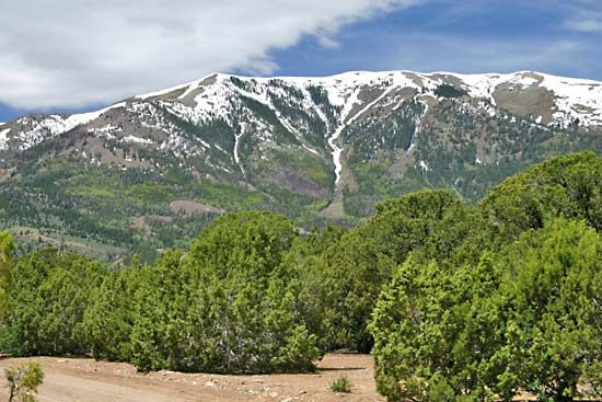
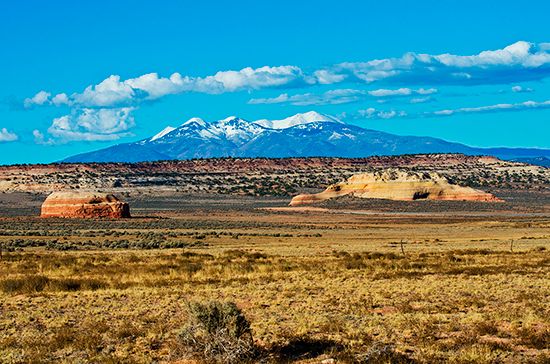
The La Sal Mountains (often spelled LaSal) are a laccolithic mountain range located in eastern Utah, U.S., spanning San Juan and Grand counties. As a…
What is LaSal Mountains?
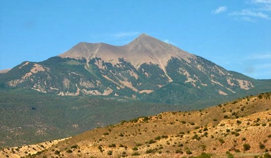
The La Sal Mountains (often spelled LaSal) are a laccolithic mountain range located in eastern Utah, U.S., spanning San Juan and Grand counties. As a volcanic segment of the Colorado Plateau, these mountains are formed by groups of laccoliths—domes created when magma is injected between layers of sedimentary rock.12
The range features Mount Peale, which reaches an elevation of 12,721 feet (3,877 metres) and serves as the highest point on the Colorado Plateau. Much of the region is protected within the Manti-La Sal National Forest, and the local economy is primarily supported by mining and lumbering. The mountains were named Sierra de la Sal (Spanish for “Salt Mountains”) by the Domínguez-Escalante expedition in 1776, referencing the abundant salt deposits found in the area.1
What is a laccolith and how does it form mountains?
A laccolith is a type of igneous intrusion that forms when magma is forced between existing layers of sedimentary rock. Unlike sills, which are sheetlike and parallel to the surrounding rock, a laccolith has a relatively flat floor and a domed, mushroom-shaped roof.324
These structures contribute to mountain building through a specific process:
- Injection: Magma rises from a deep source through a central, pipe-like conduit.32
- Bulging: As the magma is injected between sedimentary layers, it exerts pressure that forces the overlying rock strata to arch upward, creating a dome-like structure.32
- Massif Formation: A single mountain range or massif is often composed of a group of these individual laccoliths.2
Well-known examples of this geological process can be found in the Henry Mountains of Utah, where the mountains were first described and named. Because laccoliths are intrusive rocks, they solidify beneath the surface and are often only revealed as prominent landforms after the surrounding, softer sedimentary rock is removed by erosion.345
How did the La Sal Mountains get their name?
The La Sal Mountains received their name from the Domínguez-Escalante expedition, led by Spanish Franciscan missionary Silvestre Vélez de Escalante and his superior, Francisco Domínguez.16
During their 1776 exploration of the region, the expedition members named the range Sierra de la Sal—Spanish for “Salt Mountains”—to reference the abundant salt deposits they discovered in the area.1
What other mountain ranges are found on the Colorado Plateau?
The Colorado Plateau is primarily characterized by its high-elevation plateaus and deep canyons rather than the extensive folding and faulting found in the adjacent Rocky Mountains. However, several notable mountain groups exist within the region, formed by laccoliths—domed structures created when magma is injected between layers of sedimentary rock.2
The prominent mountain groups found on the Colorado Plateau include:
- La Sal Mountains: Located in southeastern Utah, these mountains are a classic example of a massif formed by a cluster of laccolithic intrusions.2
- Henry Mountains: Also situated in Utah, this range is geologically significant as the site where the concept of the laccolith was first described and named.2
- Abajo Mountains: Another group of mountains in the region that shares the same laccolithic origin.2
- Carrizo Mountains: Located in the southern portion of the plateau, these mountains are also composed of these distinct igneous intrusions.2
Sources
- LaSal Mountains — Encyclopædia Britannica
- Rocky Mountains - Physiography — Encyclopædia Britannica
- laccolith — Encyclopædia Britannica
- igneous rock - Intrusive igneous rocks — Encyclopædia Britannica
- intrusive rock — Encyclopædia Britannica
- Silvestre Vélez de Escalante — Encyclopædia Britannica
Published on · 2 min read