Colorado Plateau
The Colorado Plateau has been home to diverse Indigenous peoples who adapted their lifestyles to its arid, rugged landscape. Early residents included the…
What Native American tribes have historically inhabited the Colorado Plateau, and how have they interacted with the landscape?
The Colorado Plateau has been home to diverse Indigenous peoples who adapted their lifestyles to its arid, rugged landscape. Early residents included the Ancestral Pueblo, who developed sophisticated pueblo architecture and dry-farming techniques to cultivate corn, beans, and squash. They famously built cliff dwellings in canyon alcoves to utilize the warming effects of winter sun.123
Other groups, such as the Ute and Southern Paiute, historically relied on hunting and gathering across the plateaus and canyonlands. The Navajo (Diné) migrated to the region later, adopting farming practices from the Pueblo peoples while maintaining their own traditions, such as building hogans and creating intricate textiles and jewelry.4563
These tribes interacted with the landscape by:
- Water Management: Constructing stone channels and check dams to capture runoff from sporadic rains.3
- Agriculture: Utilizing floodplain farming and irrigation systems to support crops in desert environments.15
- Resource Utilization: Foraging for wild plant foods and small game, which remained essential even for agricultural groups.137
How was the Colorado Plateau formed geologically, and what are its main features?
The Colorado Plateau is a unique physiographic province characterized by its high elevation and remarkably flat-lying sedimentary rock layers, which have remained largely undeformed since the Precambrian time.89
Geologic Formation
Unlike many mountain ranges formed by intense folding or faulting, the Colorado Plateau rose to its current elevation primarily through the thermal expansion of the underlying lithosphere during the late Cenozoic Era. This broad, uniform uplift preserved the horizontal orientation of Paleozoic-era limestone and sandstone layers. While the region lacks the history of folding seen in the adjacent Rocky Mountains, it has been shaped by localized volcanic activity, including the formation of laccoliths—domed mountains created by magma intrusions—such as the La Sal and Henry mountains.8109
Main Features
- Canyonlands: The plateau is famously dissected by the Colorado River system, which has carved deep, dramatic gorges like the Grand Canyon8.9
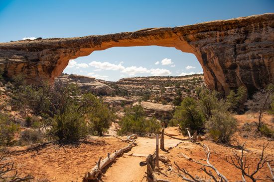
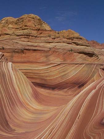
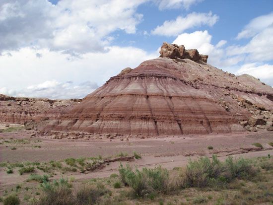
- Erosional Landforms: Differential erosion of alternating weak and resistant rock layers has created a distinct “cliff-and-bench” topography, resulting in iconic buttes, mesas, and natural arches.109
- Diverse Sections: The province includes varied landscapes ranging from the high-elevation plateaus of Utah to the volcanic-influenced Datil section in the southeast.10
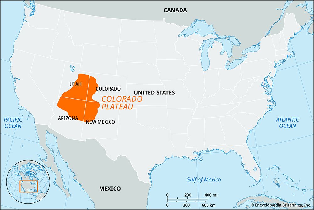
What is the geographic location and extent of the Colorado Plateau?
The Colorado Plateau is a vast physiographic province located in the southwestern United States. It encompasses approximately 130,000 square miles (337,000 square km) and spans four states:8
- Utah: The southeastern half.
- Colorado: Extreme western and southwestern regions.
- New Mexico: The northwestern portion.
- Arizona: The northern half.
The province is situated within the Colorado River basin and is geographically bounded by the Rocky Mountains to the north and east, the Great Basin to the west, and the Sonoran Desert to the south.813
The region is characterized by significant topographic diversity, with elevations ranging from 2,000 feet (600 meters) within the Grand Canyon to over 12,700 feet (3,870 meters) in the La Sal Mountains of Utah. It is divided into six distinct sections, including the High Plateaus of Utah, the Uinta Basin, the Canyon Lands, the Navajo section, the Grand Canyon section, and the volcanic-rich Datil section.8
What is the climate like on the Colorado Plateau, and how does it vary across the region?
The climate of the Colorado Plateau is defined by its rugged topography, which creates a complex pattern of local climates where conditions can vary significantly over short distances.14
General Climatic Conditions
Arid conditions prevail across much of the plateau. Because the region is characterized by high elevation and varied terrain, the climate is heavily influenced by a location’s altitude, its exposure to direct sunlight, and the orientation of valleys and mountain ranges relative to air circulation.14
Regional Variations
- Elevation and Temperature: There is a marked temperature gradient based on altitude. Lower plateaus and valley bottoms are significantly warmer, while higher elevations experience more extreme winter temperatures.14
- Precipitation: Precipitation levels are closely tied to elevation. While the lower regions remain arid, areas above 5,500 feet (1,700 meters) receive sufficient moisture to support thick forests. In these higher zones, annual precipitation can range from 20 to 50 inches (500 to 1,270 mm), whereas lower areas are much drier.14
- Seasonal Patterns: The region experiences wide daily temperature fluctuations, a common feature of high-altitude, arid environments.14
Sources
- Indigenous peoples of the American Southwest - Traditional culture patterns — Encyclopædia Britannica
- Navajo — Encyclopædia Britannica
- Mesa Verde National Park — Encyclopædia Britannica
- Native American - The Southwest — Encyclopædia Britannica
- Ute — Encyclopædia Britannica
- Paiute — Encyclopædia Britannica
- Colorado River - Early inhabitants — Encyclopædia Britannica
- Colorado Plateau — Encyclopædia Britannica
- plateau - Formative processes — Encyclopædia Britannica
- Rocky Mountains - Physiography — Encyclopædia Britannica
- Tertiary Period - Volcanism and orogenesis — Encyclopædia Britannica
- North America - 1.8 to 1.6 billion years ago — Encyclopædia Britannica
- Colorado Plateau — Merriam-Webster
- Colorado - Climate of Colorado — Encyclopædia Britannica
- Rocky Mountains - Climate — Encyclopædia Britannica
Published on · 4 min read