Liao River
The Liao River is historically significant primarily as a geographic anchor for the development of early civilizations and nomadic powers in northeastern…
What is the historical significance of the Liao River in Chinese civilization?
The Liao River is historically significant primarily as a geographic anchor for the development of early civilizations and nomadic powers in northeastern China, rather than as a major waterway for commerce.
In the 4th millennium BCE, the region centered in western Liaoning and eastern Inner Mongolia—the area drained by the Liao River system—was home to the Hongshan culture. This Neolithic society is notable for its sophisticated jade-working traditions, including the creation of amulets shaped like coiled dragons, which reveal cultural connections to other early coastal civilizations.123
Centuries later, the region became the heartland of the Liao dynasty (907–1125). Founded by the nomadic Khitan tribes, this state utilized a unique dual-administration system to govern both nomadic steppe populations and agricultural Chinese subjects. By controlling territories in southern Manchuria and regions south of the Great Wall, the Liao dynasty served as a critical center for the exchange of culture, administration, and military practices between Chinese and northern nomadic peoples, influencing subsequent dynasties like the Jin.45
What is the total length of the Liao River and how does it compare to other major rivers in China?
The Liao River is approximately 860 miles (1,390 km) long and possesses a drainage basin covering about 83,000 square miles (215,000 square km).2
When compared to China’s three principal rivers—the Huang He, the Yangtze, and the Xi River—the Liao River is significantly smaller in scale and importance as a waterway. While the three major rivers are vital arteries that flow generally from west to east across the country, the Liao River is primarily a regional feature of the Northeast (Manchurian) Plain. Unlike the major rivers, the Liao is not considered a significant waterway for commerce; its mouth is prone to silting, and it is navigable only by smaller craft. Furthermore, while the major rivers are central to China’s drainage systems, the Liao River system is characterized by a low gradient, seasonal flooding, and being icebound for approximately three months each year.28
How is the Liao River used for economic purposes, such as agriculture and industry?
The Liao River plays a limited role as a commercial waterway due to heavy siltation and seasonal freezing, but it is economically significant for the resources found within its basin and delta region.2
Industrial Significance
The Liao River basin is a vital hub for heavy industry in Liaoning province. The city of Panjin, located at the Liao River delta, has developed major industries specifically based on the region’s rich local resources, particularly oil. The Liao River oil field, which began development in the late 1960s, has grown to become one of the largest onshore petroleum producers in China. Furthermore, the river system supports the broader industrial network of the region, which includes coal mining, iron and steel production, and chemical manufacturing in nearby industrial centers like Shenyang and Anshan.910
Agricultural and Water Use
While the river is not a primary artery for shipping, its basin is a critical agricultural area. The Northeast (Manchurian) Plain, which the river system drains, is characterized by deep, flat, and fertile sediment. Although the river valley is prone to seasonal flooding, which has necessitated the use of dikes, the water is managed to support the regional economy.2
Where is the Liao River located in China, and what regions does it flow through?
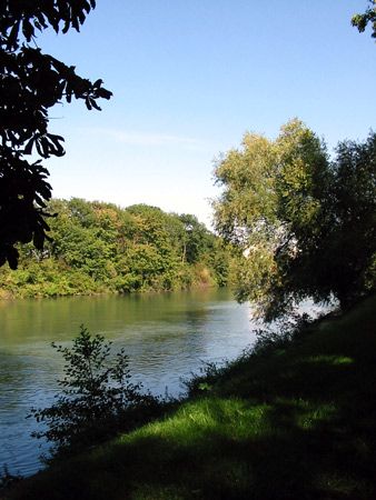
The Liao River is located in the southern part of the Northeast region of China, historically known as Manchuria. It flows primarily through Liaoning province and the Inner Mongolia Autonomous Region. Inner Mongolia Autonomous Region.2
The river system is composed of two main branches:
- East Liao: Drains the foothills of the eastern mountains of the Northeast.
- West Liao: Drains the arid uplands of southeastern Inner Mongolia via its tributaries, the Laoha, Yingjin, and Xinkai rivers.2
The river flows through the Northeast (Manchurian) Plain, a region characterized by deep, flat, and sediment-rich land. It eventually empties into the Gulf of Liaodong near the port of Yingkou. Along its course, it is joined by the Hun River, which drains the Liaodong Peninsula and the Changbai Mountains, passing through the city of Shenyang.23
Sources
- Hongshan culture — Encyclopædia Britannica
- Liao River — Encyclopædia Britannica
- Liao — Merriam-Webster
- history of China - 4th and 3rd millennia bce — Encyclopædia Britannica
- Liao dynasty — Encyclopædia Britannica
- China - 4th and 3rd millennia bce — Encyclopædia Britannica
- China - The Khitan — Encyclopædia Britannica
- China - Drainage — Encyclopædia Britannica
- Liaoning - Manufacturing — Encyclopædia Britannica
- Liaoning - Resources and power — Encyclopædia Britannica
- Hebei - Drainage and soils — Encyclopædia Britannica
- Liaoyang — Encyclopædia Britannica
Published on · 3 min read