Da Hinggan Range
The Da Hinggan Range ecosystem features distinct biological zones shaped by its north-to-south climatic gradient.
What types of flora and fauna are found in the Da Hinggan Range ecosystem?
The Da Hinggan Range ecosystem features distinct biological zones shaped by its north-to-south climatic gradient.
Flora
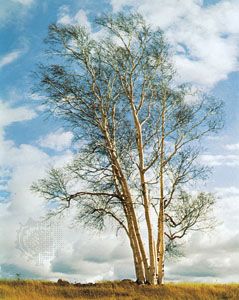
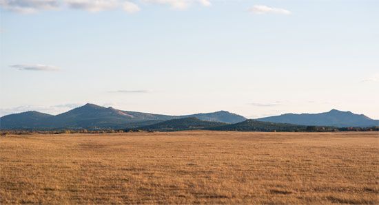
The northern section of the range is characterized by cold temperatures and permafrost, supporting dense forests of larch, birch, aspen, and pine. At the highest elevations, the vegetation transitions to shrub cover. As the climate becomes warmer and drier toward the central and southern sections, the coniferous forests gradually give way to broad-leaved forests and, eventually, patches of grassland interspersed with woodland. In the south, tall grasslands dominate the landscape, with forests restricted to higher elevations above 5,000 feet (1,500 metres).12
Fauna
The region is rich in wildlife, particularly in its forested areas. Common animal species include:
- Ungulates: Deer and elk.12
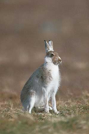
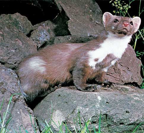
- Small mammals: Marten and hare.12
- Fur-bearing animals: The range supports a variety of other fur-bearing species.12
How was the Da Hinggan Range formed, and what are its main geological features?
The Da Hinggan Range was formed during the Jurassic Period, approximately 200 to 145 million years ago.1
Geological Features
The range is essentially a tilted fault block, characterized by a distinct asymmetrical structure:
- Fault Line: An ancient fault line defines its eastern edge, which faces the Northeast (Manchurian) Plain.1
- Topography: The mountains feature a sharp eastern face and a more gentle western slope that descends toward the Mongolian Plateau. While the eastern slopes are heavily dissected by river tributaries, the mountains generally exhibit rounded forms with flat peaks.1
- Composition: The range is composed largely of igneous rocks, formed through the solidification of magma, as well as metamorphic rocks.12
- Dimensions: The system is significantly broader in the north (about 190 miles) than in the south (about 60 miles), with an average elevation ranging from 3,950 to 4,250 feet and reaching a maximum height of 6,673 feet.1
What is the geographical location and extent of the Da Hinggan Range in China?
The Da Hinggan Range is a major mountain system situated in the northeastern section of the Inner Mongolia Autonomous Region in northeastern China.
The range spans approximately 750 miles (1,200 km) from north to south. Its geographical extent is defined by the following boundaries:
- North: The Amur River.
- South: The Xar Moron River.
- East: The flat lowlands of the Northeast (Manchurian) Plain.
- West: The high Mongolian Plateau.
The system is notably asymmetrical, with a sharp eastern face and a more gradual western slope. Its width varies significantly, measuring about 190 miles (306 km) in the north and narrowing to approximately 60 miles (97 km) in the south. Serving as a critical watershed, the range separates the river systems of the Northeast Plain—including the Liao, Sungari, and Nen rivers—from the headwaters of the Amur River and its tributaries to the northwest.1
What role did the Da Hinggan Range play in China’s history, particularly during times of conflict or migration?
The Da Hinggan Range has historically served as a significant geographical divide between the Northeast (Manchurian) Plain and the Mongolian Plateau. While the range acted as a natural barrier, the provided search results indicate that the region remained largely unexplored until the 20th century.
There is no specific historical record in the provided data detailing the range’s role in ancient conflicts or large-scale migrations. Instead, the documented history of the area focuses on its 20th-century development:
- Infrastructure: The region’s integration began in the early 20th century with the construction of the Chinese Eastern Railroad, which linked Qiqihar to Manzhouli.
- Resource Extraction: During the Japanese occupation of Manchuria (1931–1945), additional railways were constructed specifically to facilitate the extraction of lumber from the mountains.
- Demographics: The area has long been inhabited by peoples speaking Mongol and Manchu-Tungus languages, such as the Evenk and Orochon, who maintained traditional lifestyles in these remote highlands.
Sources
- Da Hinggan Range — Encyclopædia Britannica
- Xiao Hinggan Range — Encyclopædia Britannica
- Inner Mongolia - Plant and animal life — Encyclopædia Britannica
- Mongolian Plateau — Encyclopædia Britannica
Published on · 3 min read