Lingayen Gulf
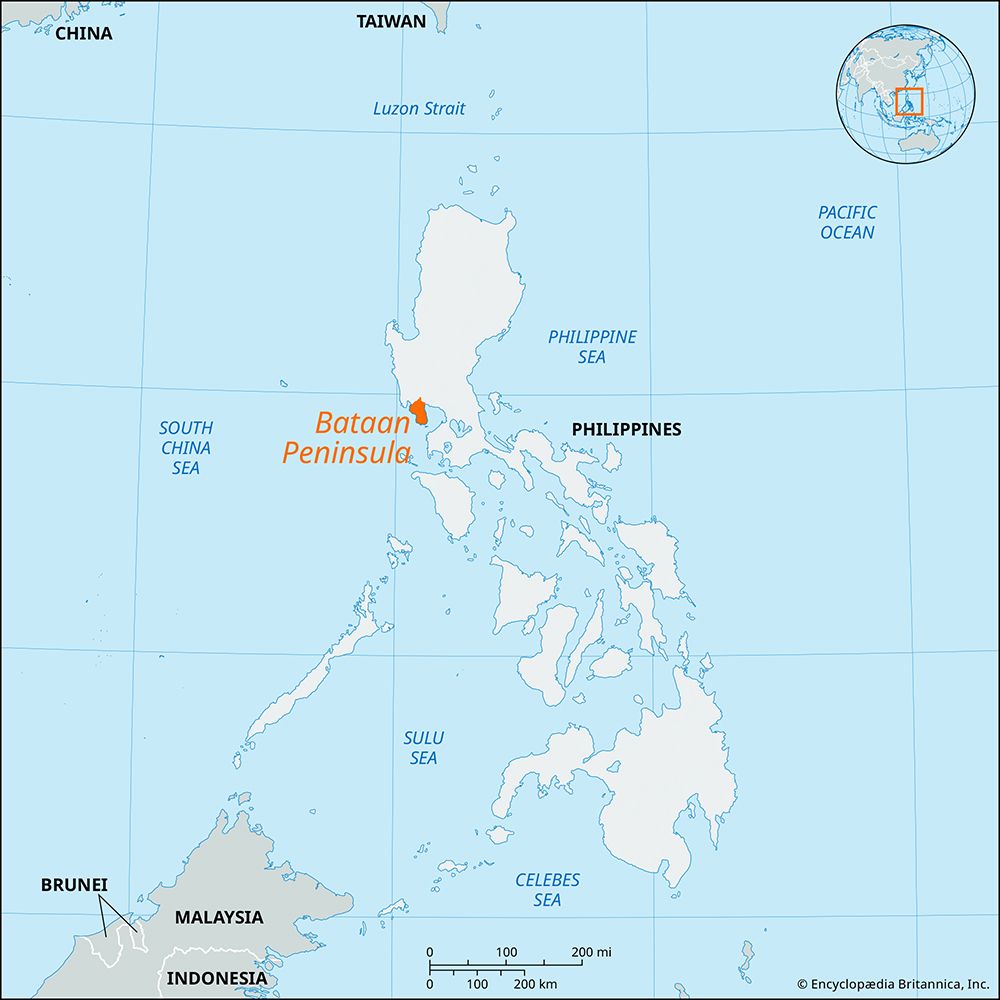
Lingayen Gulf is a large inlet of the South China Sea that indents the western coast of central Luzon in the Philippines for 36 miles (56 km). The gulf spans…
What is Lingayen Gulf?
Lingayen Gulf is a large inlet of the South China Sea that indents the western coast of central Luzon in the Philippines for 36 miles (56 km). The gulf spans 26 miles at its entrance, situated between Santiago Island to the west and San Fernando Point to the east.1
The area is home to several islands, including Santiago, Cabarruyan, and the Hundred Islands, which features the Manleluang Spring National Park. Dagupan, located on the southern shore, serves as the primary commercial center, while the provincial capital and port of Lingayen is situated at the Agno River Delta.1
Historically, the gulf was the site of a significant military operation during World War II. On January 9, 1945, American forces conducted an amphibious landing at Lingayen Gulf to begin the liberation of Luzon from Japanese occupation. This strategic move allowed U.S. forces to advance across the Central Plains toward Manila.2
What role did the Hundred Islands play in the region’s history or tourism?
The Hundred Islands are a prominent geographical feature located within the Lingayen Gulf off the coast of Luzon, Philippines.
While the provided information notes that the islands are the site of the Manleluang Spring National Park, the available records do not detail specific historical events or tourism developments associated with them beyond this designation.1
How did the geography of Luzon influence the military strategy during the invasion of the Philippines?
The geography of Luzon played a decisive role in shaping military strategy during the 1945 invasion of the Philippines.
Strategic Landings and Terrain
The U.S. invasion force targeted Lingayen Gulf on the west coast, a location that provided a strategic entry point to the Central Plains. Because the Japanese commander, Gen. Yamashita Tomoyuki, did not anticipate a landing at this site, Allied forces initially met little resistance. Once ashore, the flat terrain of the Central Plains facilitated the rapid movement of the XIV Corps toward Manila. the rapid movement of the XIV Corps toward Manila.3
Defensive Sectors
Recognizing the limitations of his forces, Yamashita utilized Luzon’s mountainous topography to implement a static defense strategy. He established three primary defensive strongholds in rugged terrain:
- Mountains west of Clark Field in the Central Plains.
- Mountainous terrain east of Manila.
- The strongest sector in the mountains of northwestern Luzon, centered on Baguio.43
Coastal and Bay Operations
Geography also dictated specialized amphibious operations. To prevent the Japanese from using the Bataan Peninsula as a defensive bastion, the XI Corps landed at Subic Bay to cut off access routes. Furthermore, the need to secure Manila Bay for Allied shipping led to targeted assaults on Corregidor Island and the southern tip of Bataan.43
What are some of the major industries that support the economy of cities like Dagupan today?
Dagupan serves as a vital commercial center and port for the surrounding region in western Luzon. Its economy is primarily supported by the following industries:
- Agriculture and Aquaculture: The region is recognized as one of the most productive agricultural areas in the Philippines. Major outputs include rice, corn, coconuts, sugarcane, tobacco, and various tropical fruits like mangoes. Additionally, the city is a significant producer of fish.51
- Salt Production: The area is known for the production of solar-evaporated salt.5
- Manufacturing and Commerce: As a chartered city and port, Dagupan hosts various manufacturing activities and functions as the principal commercial hub for the Lingayen Gulf region.56
The city’s economic reach is bolstered by its connectivity to Manila via an extensive road network and rail lines, which facilitate the transport of regional agricultural products to larger markets.51
Sources
- Lingayen Gulf — Encyclopædia Britannica
- World War II - The Philippines and Borneo, from September 1944 — Encyclopædia Britannica
- Pacific War - The Philippines — Encyclopædia Britannica
- Battle of Leyte Gulf - The landings on Leyte — Encyclopædia Britannica
- Dagupan — Encyclopædia Britannica
- Pangasinan — Encyclopædia Britannica
Published on · 3 min read