Lomonosov Ridge
The Lomonosov Ridge was discovered by Soviet scientists during expeditions conducted between 1948 and 1949, with the findings subsequently reported in 1954.
When was the Lomonosov Ridge first discovered and by whom?
The Lomonosov Ridge was discovered by Soviet scientists during expeditions conducted between 1948 and 1949, with the findings subsequently reported in 1954.1
Prior to this discovery, it was widely believed that the Arctic Ocean consisted of a single, large basin. The identification of this 1,100-mile-long submarine mountain range revealed the complex topography of the ocean floor, showing that the region is actually divided into two major basins. The ridge is named in honor of the Russian scientist, poet, and grammarian Mikhail Vasilyevich Lomonosov.12
What role does the Lomonosov Ridge play in Arctic Ocean circulation and climate?
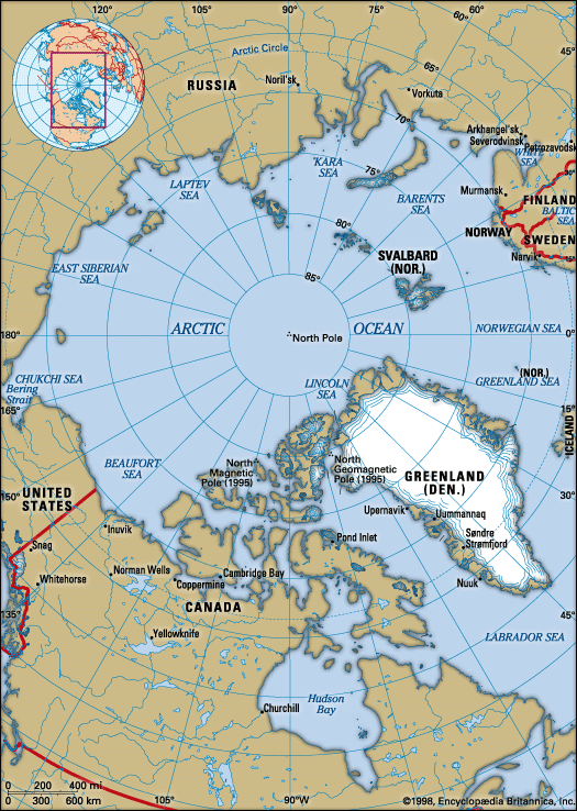
The Lomonosov Ridge serves as a critical topographic feature in the Arctic Ocean, fundamentally shaping the region’s oceanographic environment. By dividing the ocean into two major basins—the Eurasia Basin and the Amerasia Basin—the ridge acts as a physical barrier that influences water circulation, marine life, and ice movement.13
Regarding its role in circulation, the ridge facilitates the movement of deeper water masses. While the circulation of deeper Atlantic water is complex, it has been observed that this water enters the Amerasia Basin by fanning out and flowing over the crest of the Lomonosov Ridge.2
Furthermore, the Arctic Ocean’s overall circulation and its exchange with the Atlantic Ocean are of major significance to global thermohaline circulation. Changes in the export of fresh water and ice from the Arctic—processes influenced by the basin structure and topography—have the potential to impact global climate variability by affecting the convection processes that produce North Atlantic Deep Water3.
How does the Lomonosov Ridge affect marine life and ecosystems in the Arctic?
The Lomonosov Ridge plays a significant role in the Arctic Ocean by acting as a major physical barrier that influences the distribution of marine life and the movement of ice. By dividing the ocean into two distinct basins—the Eurasia Basin and the Amerasia Basin—the ridge creates separate environments that affect how water circulates and how nutrients and organisms are transported throughout the region.12
While the ridge is a prominent geological feature, its primary influence on ecosystems is indirect, stemming from its role in shaping the ocean’s complex topography and controlling the flow of water masses between the two basins. By restricting or directing these flows, the ridge helps define the environmental conditions that support the diverse biological communities found within the Arctic’s deep-sea basins.12
How deep is the Arctic Ocean around the Lomonosov Ridge?
The Lomonosov Ridge is a major submarine feature that rises significantly from the surrounding seafloor. The depth of the ridge’s crest varies, ranging from approximately 3,100 to 5,400 feet (945 to 1,645 meters), with its highest point reaching a depth of about 3,200 feet (975 meters).12
The ridge stands as a massive mountain range, rising 6,000 to 11,000 feet (1,800 to 3,400 meters) above the adjacent basin floors. The depths of the basins flanking the ridge are as follows:1
- Eurasia Basin side: The basin on the Atlantic side reaches depths greater than 13,000 feet (4,000 meters). Specifically, the Fram Basin, located between the Lomonosov Ridge and the Nansen-Gakkel Ridge, has a depth of 14,070 feet (4,290 meters).12
- Amerasia Basin side: The adjacent basin is approximately 11,000 feet (3,350 meters) deep. The Makarov Basin, situated between the Lomonosov Ridge and the Alpha Cordillera, has a floor depth of 13,200 feet (4,020 meters).12
Sources
- Lomonosov Ridge — Encyclopædia Britannica
- Arctic Ocean - Topography of the ocean floor — Encyclopædia Britannica
- Arctic Ocean - Oceanography — Encyclopædia Britannica
- Mid-Atlantic Ridge — Encyclopædia Britannica
Published on · 3 min read