Little Belt Mountains
The Little Belt Mountains are a segment of the northern Rocky Mountains located in central Montana, U.S. Extending 40 miles (64 km) from southeast of Great…
What is Little Belt Mountains?
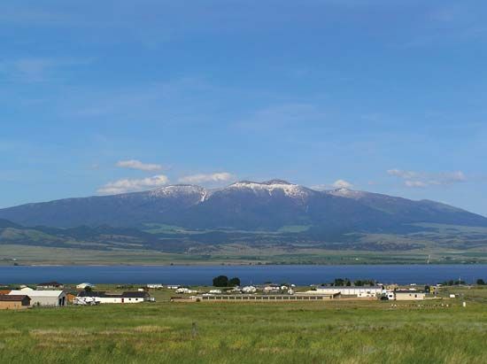
The Little Belt Mountains are a segment of the northern Rocky Mountains located in central Montana, U.S. Extending 40 miles (64 km) from southeast of Great Falls to the Musselshell River, the range is situated east of the Big Belt Mountains.1
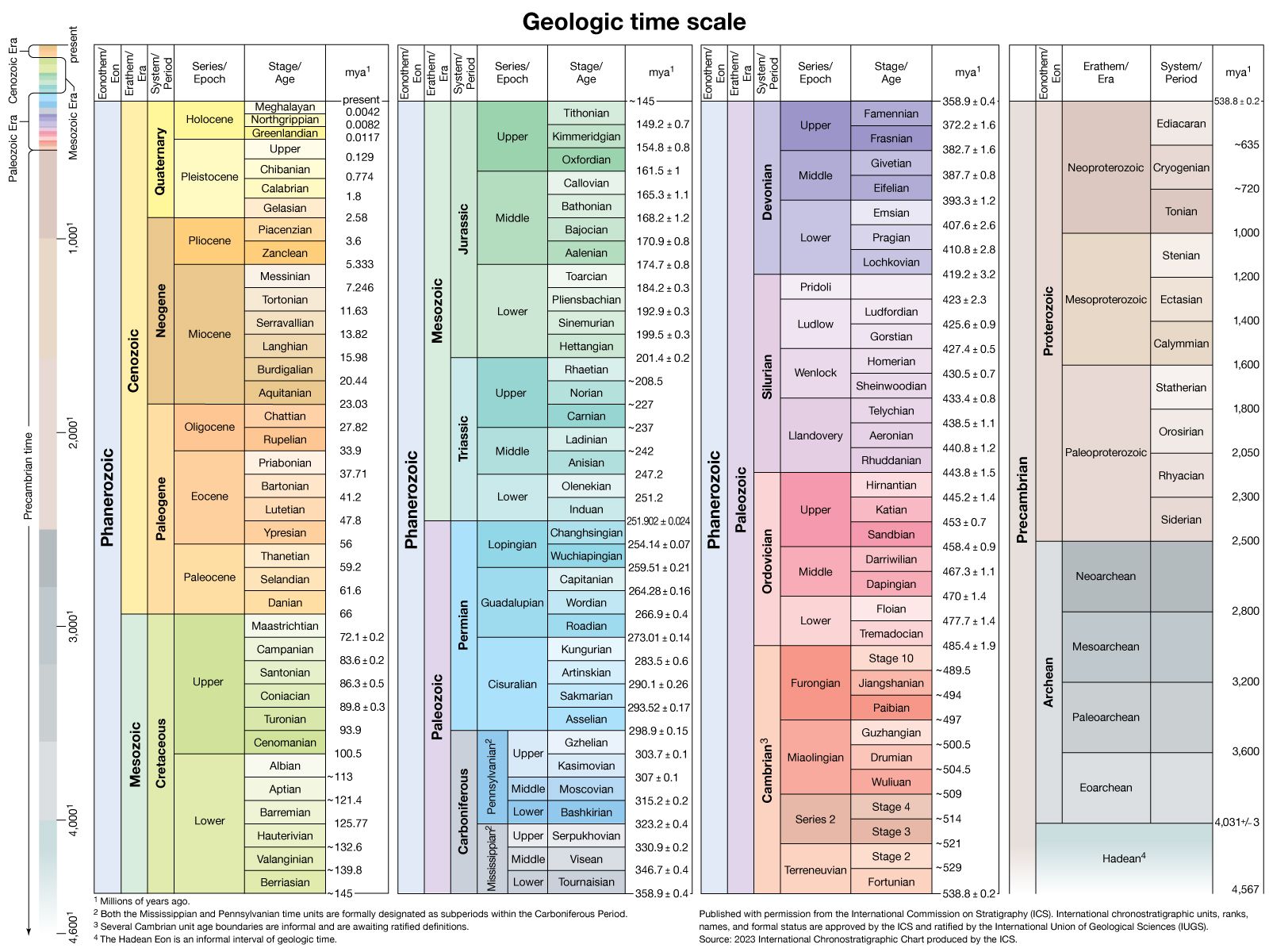
The landscape is defined by grassy meadows and lush timber forests, with Big Baldy Mountain serving as the highest point at 9,191 feet (2,801 metres). Geologically, the range was formed during the Laramide orogeny approximately 70 million years ago and contains exposures of Precambrian rocks associated with the Beltian Geosyncline.12
Today, the mountains are part of the Lewis and Clark National Forest and are recognized as a popular recreation area, as well as a site for mining deposits including gold, silver, lead, and zinc.1
What is the Laramide orogeny?
The Laramide orogeny was a series of mountain-building events that significantly shaped western North America during the Late Cretaceous and Paleogene periods, roughly spanning from 80 million to 35 million years ago. Rather than a single event, it is now understood as a polyphase process involving disparate pulses of deformation that varied in intensity and timing across the continent, from Mexico to Alaska.34
The orogeny is primarily associated with crustal shortening and uplift in the Rocky Mountains, particularly in the Central and Southern Rockies of Montana, Wyoming, Colorado, and New Mexico. These tectonic effects are attributed to changes in the angle of the subducting oceanic slab beneath the continental margin, which became significantly shallower. This shift caused arc magmatism to migrate hundreds of miles inland and triggered extensive vertical uplift and thrust faulting.34
How do the Little Belt Mountains differ from the Big Belt Mountains?
The Little Belt Mountains and the Big Belt Mountains are distinct segments of the northern Rocky Mountains in central Montana. Their primary differences lie in their geographic positioning and specific physical characteristics:
- Geographic Location: The Little Belt Mountains are situated to the east of the Big Belt Mountains. While the Little Belts extend 40 miles (64 km) from southeast of Great Falls toward the Musselshell River, the Big Belts occupy the area to their west.1
- Topography: The Little Belt Mountains are noted for their specific landscape of grassy meadows and lush timber forests, with Big Baldy Mountain reaching an elevation of 9,191 feet (2,801 metres).1
Both ranges share a common origin, having been formed during the Laramide orogeny approximately 70 million years ago, and both are recognized for their mineral wealth and recreational value within the Lewis and Clark National Forest.1
What are the geological features of the Beltian Geosyncline?
The Beltian Geosyncline (also known as the Belt Basin) was a linear trough in the Earth’s crust where massive quantities of Precambrian sediments were deposited.25
Geological Composition and Structure
The basin contains a thick sedimentary prism reaching depths of up to 19 km (12 miles) in some areas. These rocks, collectively known as the Belt Series, consist primarily of:56
- Sedimentary Rocks: Thick deposits of sandstones, shales, sandy shales, and limestones.26
- Distribution: Limestones and shales dominate the eastern portions, while sandstones and shales are more prevalent in the west, suggesting a major landmass existed further west during the period.6
- Basement: The series rests upon a basement of gneisses.6
Depositional Environment
The basin originated as an enclosed structure floored by highly stretched continental or trapped oceanic crust, similar to the modern Black Sea. Evidence such as ripple marks and stromatolites indicates that most of these rocks were deposited in shallow water, though some reddish shales may have formed on low-lying floodplains.56
Sources
- Little Belt Mountains — Encyclopædia Britannica
- Beltian Geosyncline — Encyclopædia Britannica
- Laramide orogeny — Encyclopædia Britannica
- North America - 120 to 30 million years ago — Encyclopædia Britannica
- North America - 1.6 to 1.3 billion years ago — Encyclopædia Britannica
- Belt Series — Encyclopædia Britannica
Published on · 3 min read