Big Belt Mountains
The Big Belt Mountains are a segment of the northern Rocky Mountains located in west-central Montana, U.S. Stretching approximately 80 miles (129 km) along…
What is Big Belt Mountains?
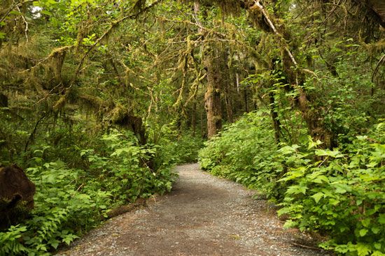
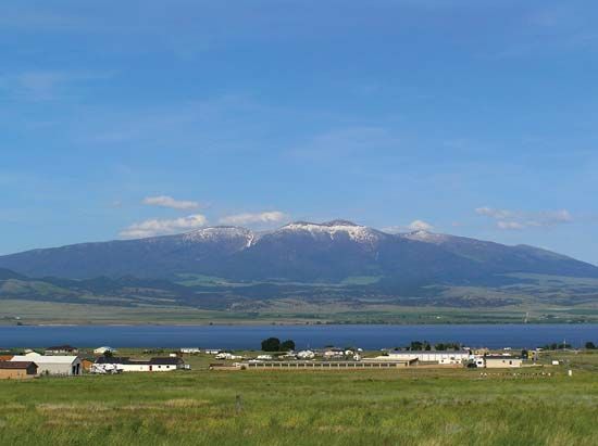
The Big Belt Mountains are a segment of the northern Rocky Mountains located in west-central Montana, U.S. Stretching approximately 80 miles (129 km) along the eastern bank of the Missouri River, the range is situated about 20 miles (30 km) east of Helena.1
The mountains derive their name from a prominent limestone belt that encircles the range. Their elevation ranges from 3,600 feet (1,100 metres) near the river to 9,504 feet (2,897 metres) at their highest point, Mount Edith. Much of the area lies within the Helena National Forest and has a history of gold prospecting dating back to the late 1860s, with further mineral exploration occurring in the 1990s. The range is located west of the Little Belt Mountains.21
How do the Big Belt Mountains differ from the Little Belt Mountains?
The Big Belt Mountains and the Little Belt Mountains are distinct segments of the northern Rocky Mountains in Montana, differing primarily in their geography, scale, and administrative location.
Feature
Big Belt Mountains
Little Belt Mountains
Location
West-central Montana, east of
Helena
Central Montana, southeast of
Great Falls
Extent
80 miles (129 km) along the
Missouri River
40 miles (64 km) toward the
Musselshell River
Highest Point
Mount Edith (9,504 feet)
Big Baldy Mountain (9,191 feet)
Forest Division
Helena National Forest
Lewis and Clark National Forest
Key Characteristics
Named for a limestone belt; history of gold prospecting
Characterized by timber forests and meadows; formed by
Laramide orogeny
While both ranges are significant mineral-bearing regions, the Big Belts are defined by their proximity to the Missouri River, whereas the Little Belts are situated further east and are noted for their diverse timber and meadow landscapes.12
What is the Laramide orogeny and how did it shape the Rocky Mountains?
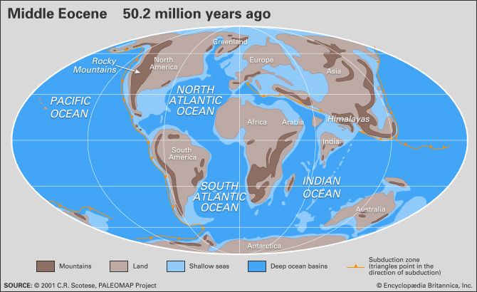
The Laramide orogeny was a series of mountain-building events that occurred in western North America from the Late Cretaceous to the Paleogene period (approximately 80 to 35 million years ago). It was a polyphase process characterized by disparate pulses of deformation that varied in intensity and timing across the region.45
How It Shaped the Rocky Mountains
The orogeny resulted from a broad region of crustal shortening caused by changes in the angle of the subducting oceanic slab beneath the continental margin. As the subducting slab became shallower, it triggered significant tectonic activity far inland.6
- Northern Rockies: In the Canadian and Northern Rockies, the process involved the eastward thrusting of thick Paleozoic limestone sheets over younger Mesozoic rocks, sometimes moving these sheets 20 to 30 miles from their original positions.5
- Middle and Southern Rockies: In these regions, mountain building was primarily driven by compressional folding and high-angle faulting. This forced the granitic cores of mountains upward, arching sedimentary rocks over massive crystalline batholiths.5
- Magmatism and Volcanism: The event was accompanied by acidic plutonic intrusions and a migration of arc magmatism up to 600 miles inland from the coast.46
What role did gold prospecting play in the history of Montana?
Gold prospecting served as a primary catalyst for the rapid settlement and political organization of Montana. Following the discovery of rich placer deposits in the early 1860s, prospectors flocked to the region, prompting the federal government to establish the Montana Territory in 1864 to secure its mineral wealth for the Union.7
Early mining centers became the foundation for the state’s governance and infrastructure. Bannack served as the first territorial capital, followed by Virginia City, both of which emerged directly from gold-seeking activities. Similarly, Butte originated as a gold camp before transitioning to large-scale hard-rock mining in the 1880s, when the discovery of vast copper deposits transformed it into a global industrial powerhouse.78
This influx of settlers driven by mineral wealth significantly altered the region’s demographics and increased tensions with Native American populations, who fought to protect their lands from encroachment. Ultimately, the transition from early gold prospecting to industrial-scale extraction defined Montana’s economic trajectory for nearly a century.78
Sources
- Big Belt Mountains — Encyclopædia Britannica
- Little Belt Mountains — Encyclopædia Britannica
- Beltian Geosyncline — Encyclopædia Britannica
- Laramide orogeny — Encyclopædia Britannica
- North America - 120 to 30 million years ago — Encyclopædia Britannica
- Rocky Mountains - Physiography — Encyclopædia Britannica
- Montana - Statehood and beyond — Encyclopædia Britannica
- Montana - U.S. exploration and settlement — Encyclopædia Britannica
Published on · 3 min read