Lop Nur
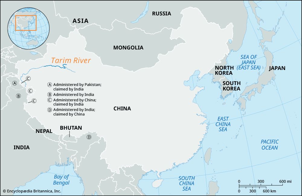
Before it dried up around 1970, Lop Nur served as a critical terminal lake for the Tarim River within the Tarim Basin. For approximately 20,000 years, this…
What role did Lop Nur play in the ecosystem of the Tarim Basin before it dried up?
Before it dried up around 1970, Lop Nur served as a critical terminal lake for the Tarim River within the Tarim Basin. For approximately 20,000 years, this saline lake acted as a vital hydrological anchor in an otherwise extremely arid environment, providing a destination for the river’s flow and supporting a distinct, albeit harsh, ecosystem.
The lake and its surrounding wetlands functioned as a habitat for various forms of life, including native animals such as wild Bactrian camels. Furthermore, the broader Tarim River valley and its associated lakes served as essential stopovers for migratory birds, highlighting the area’s importance as a biological refuge within the Takla Makan Desert.
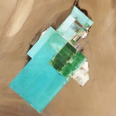
The diversion of water for irrigation and the construction of reservoirs along the Tarim River ultimately severed this connection, transforming the lake into a vast, salt-encrusted basin. This shift has led to increased wind erosion and the formation of extensive salt ridges known as yardangs, fundamentally altering the region’s ecological character.
How has China’s nuclear testing program affected the Lop Nur region?
The Lop Nur region in northwestern China served as a primary testing site for the country’s nuclear weapons program between 1964 and 1996. During this period, the area was used intermittently for a total of 45 nuclear explosions, which included both atmospheric and underground tests.351
The first Chinese nuclear detonation occurred at this site on October 16, 1964, utilizing a 20-kiloton uranium-235 device. Following this, the site hosted a variety of tests that facilitated the development of both fission and fusion warhead technologies, including a three-megaton multistage fusion device detonated in 1967. While the region was already a barren, salt-encrusted lake bed following the diversion of the Tarim River around 1970, the use of the site for nuclear testing marked a significant chapter in the area’s modern history.135
How has the disappearance of Lop Nur affected the local climate and environment?
The disappearance of Lop Nur by approximately 1970, caused by the diversion of the Tarim River for irrigation and reservoir projects, has fundamentally altered the environment of the Tarim Basin.
Before its desiccation, the lake had existed for roughly 20,000 years, providing a stable, albeit arid, hydrological feature in the eastern Takla Makan Desert. Since the water vanished, the region has experienced significant ecological degradation:
- Increased Erosion: The loss of the lake has led to intensified wind erosion across the basin.1
- Salt Encrustation: The area is now covered by an expansive salt crust spanning 8,000 square miles (21,000 square km).1
- Geomorphological Changes: The landscape is now characterized by yardangs—irregularly shaped salt ridges—which occupy nearly 1,200 square miles (3,100 square km) of the former lake bed.1
These changes have solidified the region’s status as one of the most barren areas in China, with the local climate remaining extremely dry, receiving less than 4 inches (100 mm) of annual rainfall.14
How has the Lop Nur region been depicted in Chinese literature and folklore?
Sorry, the Britannica knowledge base does not contain information regarding how the Lop Nur region has been depicted in Chinese literature and folklore.
Sources
- Lop Nur — Encyclopædia Britannica
- Tarim River — Encyclopædia Britannica
- Lop Nur — Merriam-Webster
- Tarim Basin — Encyclopædia Britannica
- nuclear weapon - China — Encyclopædia Britannica
Published on · 2 min read