Tarim River
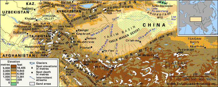
The Tarim River is the primary river of the Xinjiang region in northwestern China. Determining its exact length is complex because the river frequently…
How long is the Tarim River, and what are its main tributaries?
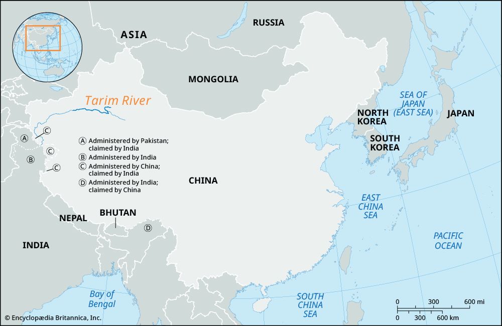
The Tarim River is the primary river of the Xinjiang region in northwestern China. Determining its exact length is complex because the river frequently shifts its bed and banks, and much of its course is unformed. Prior to the 1970s, the total length of the Yarkand-Tarim river system was estimated at approximately 1,260 miles (2,030 km).1
The river is formed by the confluence of the Kaxgar (Kashgar) and Yarkand rivers. Further downstream, it is joined by two other major tributaries:
- Aksu River: The most significant tributary, providing 70–80 percent of the Tarim’s total water volume and flowing year-round.1
- Hotan River: Joins the system downstream from the confluence of the Kaxgar and Yarkand rivers.1
Due to extensive irrigation projects and water diversion, the lower course of the river has been significantly altered, and its flow has historically been interrupted.1
What is the climate like in the Tarim Basin, and how does it affect the river’s flow?
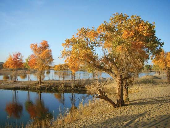
The Tarim Basin features an extremely arid climate, as surrounding mountain ranges block moist sea air. Annual precipitation is minimal, often less than 4 inches (100 mm), and can be nonexistent in some areas, while temperatures can reach 104 °F (40 °C).21
This climate profoundly impacts the Tarim River in several ways:
- Flow Dynamics: Intense evaporation and low precipitation contribute to the river’s tendency to shift its bed and banks. The river experiences high water from May through September due to snowmelt from the Tien Shan and Kunlun Mountains, followed by a low-water period from October to April.1
- Water Loss: The combination of the region’s dry climate and mid-20th-century irrigation projects led to the drying of the river’s lower course and the disappearance of Lop Nur as a lake.1
- Seasonal Freezing: The harsh winter temperatures cause the river to freeze annually from December through March.1
How has the Tarim River influenced the cultural diversity of the Xinjiang region?
The Tarim River has been a vital lifeline for the Tarim Basin, facilitating the development of oasis settlements that have long served as hubs of cultural exchange and diversity in the Xinjiang region.13
The river’s presence allowed for the growth of sedentary Uyghur farming communities, which contrast with the pastoral traditions of groups like the Kazakhs and Mongolians who inhabit the surrounding grasslands. Historically, the oasis cities along the basin acted as critical nodes on the Silk Road, connecting diverse civilizations and enabling the flow of goods, religions, and artistic traditions.432
These oases fostered a unique cultural landscape where:
- Religious and Artistic Exchange: The region became a crossroads for Buddhism, Islam, and other faiths, evidenced by ancient sites like the Kizil caves and the Bezeklik Thousand Buddha caves.42
- Economic Specialization: The river supported agriculture and the production of goods such as jade, carpets, and textiles, which remain significant cultural and economic markers.13
How does the Tarim River contribute to the local economy and agriculture in modern times?
The Tarim River is a critical component of the economy in the Tarim Basin, primarily by enabling irrigation-based agriculture in an otherwise arid environment. Since the mid-20th century, the Chinese government has promoted large-scale water conservation projects, including canals and reservoirs, to expand arable land and support agricultural production.162
Modern agricultural contributions include:
- Crop Production: The region produces significant quantities of rice, wheat, corn, and other grains.12
- Cash Crops: Long-staple cotton has become a vital cash crop for the region.2
- Exports: The basin is a major producer of high-quality fruits, including grapes and watermelons, as well as wool and silk, which are exported to national and international markets.12
- Traditional Industry: Alongside modern farming, the region continues to support traditional oasis agriculture and the production of goods like Khotan jade and carpets.1
Additionally, the Tarim Basin has seen significant economic growth through the exploitation of petroleum and natural gas deposits, with infrastructure like pipelines connecting these resources to eastern China.7
Sources
- Tarim River — Encyclopædia Britannica
- Tarim Basin — Encyclopædia Britannica
- Xinjiang - Cultural life — Encyclopædia Britannica
- Xinjiang - Settlement patterns — Encyclopædia Britannica
- the Steppe - Developments on the steppe proper — Encyclopædia Britannica
- Xinjiang - Resources and manufacturing — Encyclopædia Britannica
- Xinjiang - Agriculture — Encyclopædia Britannica
- Tien Shan - Drainage — Encyclopædia Britannica
Published on · 3 min read