Mendenhall Glacier
The Mendenhall Glacier is located in southeastern Alaska, approximately 13 miles northwest of Juneau. It is a prominent feature of the Tongass National…
Where is Mendenhall Glacier located, and what are its key geographical features?
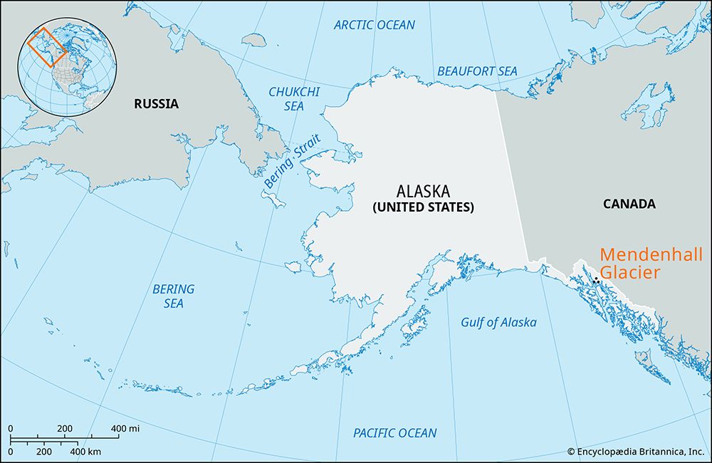
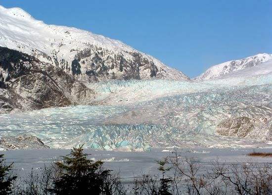
The Mendenhall Glacier is located in southeastern Alaska, approximately 13 miles northwest of Juneau. It is a prominent feature of the Tongass National Forest and is notable for being the only glacier in the region accessible by highway year-round.1
Key geographical features include:
- Dimensions: The glacier spans 12 miles in length and 1.5 miles in width, with a terminus height exceeding 100 feet.1
- Origin: It flows from the southern portion of the Juneau Icefield, which originates in the Boundary Ranges along the Alaska-Canada border.1
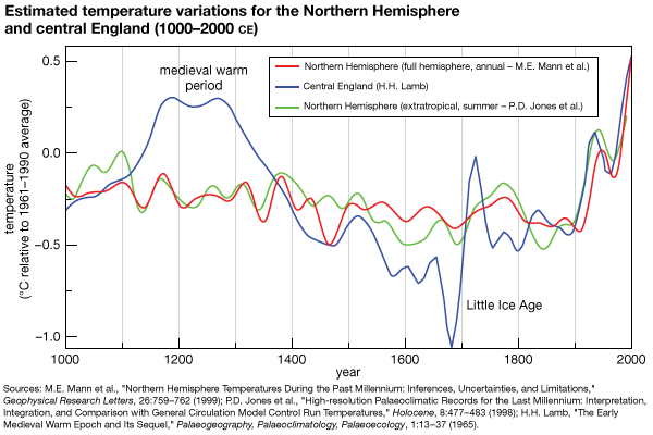
- Recession: As a relic of the Little Ice Age, the glacier is currently receding at a rate of 100 to 150 feet per year, revealing raw glacier moraine and ancient forest remnants.1
- Mendenhall Lake: Situated at the glacier’s face, this lake began forming around 1900 and currently reaches depths of 220 feet.1
How did Mendenhall Glacier get its name, and what is its cultural significance to the local area?
The Mendenhall Glacier was originally named Sitaantaagu (“the Glacier Behind the Town”) or Aak’wtaaksit (“the Glacier Behind the Little Lake”) by the Tlingit people, who have long inhabited the region. Naturalist John Muir later referred to it as Auke (Auk) Glacier, honoring the Auk Kwaan band of the Tlingit. In 1892, the glacier was renamed in honor of Thomas Corwin Mendenhall, a member of the U.S. Coast and Geodetic Survey who played a key role in determining the boundary between Alaska and Canada.1
The glacier holds deep cultural significance as a traditional landmark for the Tlingit, reflecting their historical connection to the landscape. Today, it remains a vital part of the Tongass National Forest and serves as a major focal point for the community of Juneau, acting as a unique, year-round accessible site that connects visitors to the region’s glacial history and the ongoing environmental changes of the Little Ice Age remnants.1
What is the relationship between Mendenhall Glacier and the Juneau Icefield?
The Mendenhall Glacier functions as a primary outlet for the Juneau Icefield, a massive expanse of ice located in the Boundary Ranges along the border of Alaska and Canada. Specifically, the glacier originates from and flows out of the southern portion of this extensive icefield.1
As a relic of the Little Ice Age, the Mendenhall Glacier serves as a visible extension of the larger icefield’s movement and current state of recession. While the icefield remains a vast, high-altitude accumulation zone, the Mendenhall Glacier acts as a dynamic, lower-elevation feature that has become a significant landmark due to its accessibility and the environmental changes it displays, such as the exposure of ancient forest remnants as it retreats.1
How does Mendenhall Glacier compare in size to other glaciers in Alaska?
The Mendenhall Glacier is a significant but relatively modest feature when compared to the vast glacial systems found elsewhere in Alaska. Measuring 12 miles (19 km) in length and approximately 1.5 miles (2.4 km) in width, it serves as an outlet for the larger Juneau Icefield.
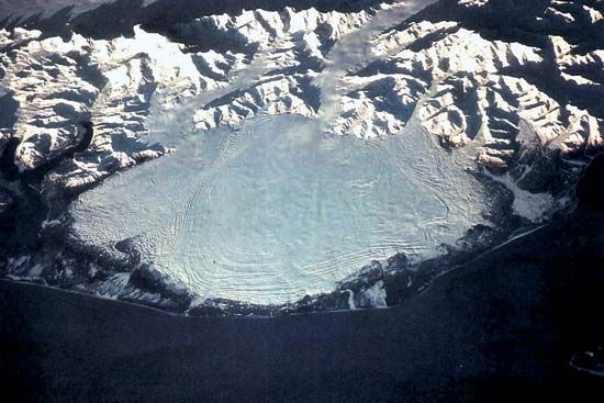
In contrast, Alaska is home to some of the most spectacular and massive mountain glaciers in the world. For example, the Hubbard Glacier in the St. Elias Mountains extends 90 miles in length, far exceeding the reach of the Mendenhall. Additionally, the region features expansive piedmont glaciers like the Malaspina Glacier, which spreads across the lowlands, and massive intermontane systems such as the Seward Glacier. While the Mendenhall is notable for its accessibility and its role as a relic of the Little Ice Age, it is significantly smaller than these major Alaskan ice masses.13
Sources
- Mendenhall Glacier — Encyclopædia Britannica
- Juneau — Encyclopædia Britannica
- Arctic - Other glacier groups — Encyclopædia Britannica
Published on · 3 min read