Mont Sainte-Anne
Mont Sainte-Anne is a provincial park located in Quebec, Canada, situated approximately 25 miles (40 km) east of Quebec City along the northern shore of the…
What is Mont Sainte-Anne?
Mont Sainte-Anne is a provincial park located in Quebec, Canada, situated approximately 25 miles (40 km) east of Quebec City along the northern shore of the St. Lawrence River.1
Geologically, the mountain is part of the Laurentian Mountains, which are a segment of the Canadian Shield—one of the oldest mountain regions on Earth. The peak features a flattened summit that reaches an elevation of 2,675 feet (815 m). The area is widely recognized for its extensive skiing facilities and has served as a venue for World Cup ski events since 1971.1
What is the Canadian Shield?
The Canadian Shield, also known as the Precambrian Shield, is the largest physiographic region in Canada, covering approximately half of the country’s total area. Centered on Hudson Bay, it extends across eastern, central, and northwestern Canada, reaching into the Arctic, Greenland, and parts of the northern United States.23
Geology and Landscape
The region constitutes the largest mass of exposed Precambrian rock on Earth. It is composed of ancient crystalline rocks that have undergone a complex history of mountain building, uplift, and erosion.34
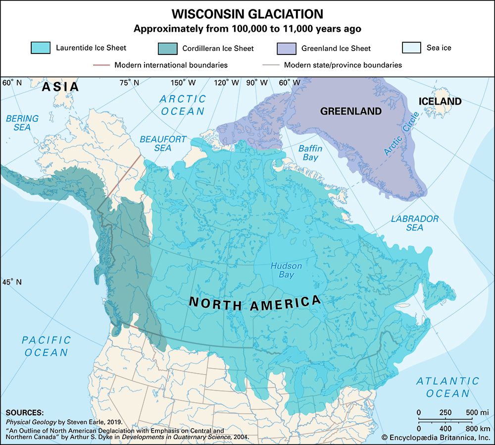
While the shield was once mountainous, it was worn down almost to a plain over millions of years. Its current surface was significantly shaped by Pleistocene glaciers, which scraped away weathered rock and created a landscape characterized by rocky hills, basins, and an enormous number of lakes and swamps.23
Economic and Human Significance
The shield is rich in mineral resources, including gold, silver, copper, nickel, and uranium, which have been vital to Canada’s economic development. However, the region’s thin, acidic soil has historically made agriculture and permanent settlement challenging, resulting in a low population density.253
What are the characteristics of the Laurentian Mountains?
The Laurentian Mountains represent the portion of the Canadian Shield located within the province of Quebec. They are recognized as one of the oldest mountain regions in the world, composed of Precambrian rocks that are more than 540 million years old.7
Geological Characteristics
- Formation and Erosion: Once a much higher range, the mountains have been gradually scoured and worn down over millions of years. They now form a rocky peneplain—a vast erosional plain—characterized by relatively uniform crests.7
- Elevation: The range features crests typically reaching 3,000 feet (900 metres), with a maximum elevation of 3,905 feet (1,190 metres).7
- Geography: The area is defined by a heavily forested landscape containing innumerable lakes and swift rivers.7
Economic and Recreational Significance
The region supports diverse economic activities, including large-scale lumbering, pulp and paper-milling, mining, and hydroelectric power generation. Additionally, the mountains are a significant tourist destination, home to popular provincial parks such as Laurentides and Mont Tremblant, which are easily accessible from major urban centers like Montreal and Quebec City.7
How does the St. Lawrence River impact the region’s climate?
The St. Lawrence River system influences the climate of its surrounding regions through its vast hydrological reach, which spans from subarctic to temperate zones. In the Montreal region, the river’s presence contributes to a climate that is notably less severe and extreme than in surrounding areas, supporting lush vegetation.109
The river’s impact is also observed through its seasonal interaction with ice. During winter, the river develops a thick crust of ice, and while historically prone to ice jams, modern engineering and icebreakers now maintain shipping channels year-round. In the maritime estuary, the salinity of the water and the influence of currents from the Gulf of St. Lawrence discourage ice formation, which helps keep northern ports like Sept-Îles accessible to navigation despite their high latitude. Furthermore, the river’s temperature and flow are heavily influenced by seasonal variations, including summer evaporation in the Great Lakes and significant snowfall in the river’s eastern tributaries.1110
Sources
- Mont Sainte-Anne — Encyclopædia Britannica
- Canada - The Canadian Shield — Encyclopædia Britannica
- Canadian Shield — Encyclopædia Britannica
- Canada - Minerals — Encyclopædia Britannica
- Canadian Shield: Top Questions — Encyclopædia Britannica
- North America - The Canadian Shield — Encyclopædia Britannica
- Laurentian Mountains — Encyclopædia Britannica
- North America - 600 to 250 million years ago — Encyclopædia Britannica
- Quebec - Climate of Quebec — Encyclopædia Britannica
- St. Lawrence River - Climate and hydrology — Encyclopædia Britannica
- St. Lawrence River - Physiography — Encyclopædia Britannica
Published on · 3 min read