Mu Gia Pass
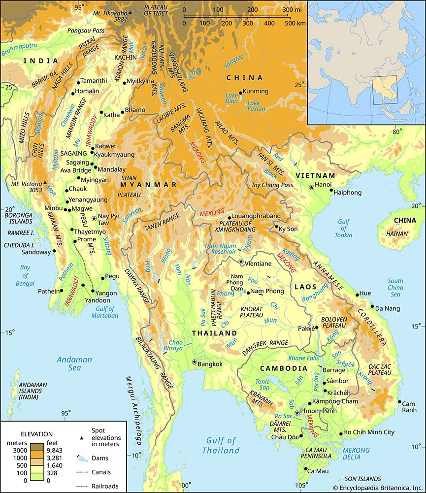
The Mu Gia Pass is a mountain pass located in the Annamese Cordillera along the border between northern Vietnam and Laos. Situated 1,371 feet (418 meters)…
What is Mu Gia Pass?
The Mu Gia Pass is a mountain pass located in the Annamese Cordillera along the border between northern Vietnam and Laos. Situated 1,371 feet (418 meters) above sea level, it is located approximately 55 miles (90 km) northwest of Dong Hoi, Vietnam.1
The pass serves as a vital transportation link, carrying a road that connects Tan Ap in Vietnam to Muang Khammouan (formerly Thakhek) in Laos, which sits on the Mekong River. Historically, the pass held significant military importance as the primary entry point for the Ho Chi Minh Trail access system into Laos. Due to this strategic role, it was a frequent target for heavy bombing during the Vietnam War1.1
What was the strategic purpose of the Ho Chi Minh Trail?
The strategic purpose of the Ho Chi Minh Trail was to serve as a vital logistics network for North Vietnam to infiltrate troops and supplies into South Vietnam, Laos, and Cambodia during the Vietnam War.
Beginning in 1959, the trail was developed to support the North Vietnamese leadership’s goal of using revolutionary warfare to reunify the country. By bypassing the demilitarized zone between North and South Vietnam, the network allowed Hanoi to sustain hundreds of thousands of regular troops operating in the south. Over time, the system evolved from a series of jungle paths into a sophisticated infrastructure of roads, underground support facilities, hospitals, and storage caches. Ultimately, this supply route was instrumental in the North Vietnamese forces’ successful invasion and takeover of South Vietnam in 1975.23
How did the geography of the Annamese Cordillera affect military movement?
The geography of the Annamese Cordillera significantly shaped military movement during the Vietnam War by acting as both a natural barrier and a strategic corridor.
- Limited Access: The range is a fairly continuous 700-mile barrier with few substantial passes, which funneled military traffic toward specific, predictable entry points like the Mu Gia Pass and the Keo Nua Pass.41
- Strategic Infiltration: Because the range forms the boundary between Vietnam and Laos, it allowed North Vietnamese forces to bypass the heavily defended demilitarized zone. By utilizing the upper slopes of the mountains, they established the Ho Chi Minh Trail, a complex network of paths and roads that facilitated the movement of troops and supplies into the south.2
- Defensive Terrain: The rugged, mountainous landscape, characterized by dense tropical rainforests, provided natural cover for underground support facilities, hospitals, and supply caches, making the network difficult to disrupt despite heavy aerial bombardment.42
What other mountain passes were important during the Vietnam War?
While the Mu Gia Pass is the most prominent mountain pass documented in the Annamese Cordillera as a primary entry point for the Ho Chi Minh Trail, the provided records do not detail other specific mountain passes by name that held similar strategic importance during the Vietnam War.
The trail network functioned as an elaborate system of jungle paths and roads that connected the panhandle of North Vietnam southward along the upper slopes of the mountains into Laos and Cambodia. While the Mu Gia Pass served as a critical gateway for this infiltration, the broader infrastructure relied on a series of interconnected routes rather than a single mountain crossing.12
Sources
- Mu Gia Pass — Encyclopædia Britannica
- Ho Chi Minh Trail — Encyclopædia Britannica
- 20th-century international relations - Decolonization and development — Encyclopædia Britannica
- Annamese Cordillera — Encyclopædia Britannica
- Vietnam: Top Questions — Encyclopædia Britannica
Published on · 2 min read