Point Ke Ga
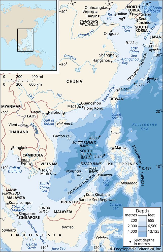
Point Ke Ga is a geographical feature in Vietnam located along the South China Sea. It serves as the country's easternmost point, featuring a promontory that…
What is Point Ke Ga?
Point Ke Ga is a geographical feature in Vietnam located along the South China Sea. It serves as the country’s easternmost point, featuring a promontory that rises 2,316 feet (706 m) above sea level. This landmark is a continuation of a granite spur belonging to the Annamese Cordillera and is situated southeast of Tuy Hoa.1
It is important to note that the name “Ke Ga” also refers to a separate cape located approximately 180 miles (290 km) to the south-southwest along the same coastline.1
What is the Annamese Cordillera?
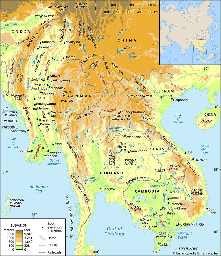
The Annamese Cordillera is the principal mountain range of Southeast Asia and serves as the vital watershed between the Mekong River and the South China Sea. Extending approximately 700 miles (1,100 km) in a northwest-southeast curve, the range forms the natural boundary between Laos and Vietnam.2
Geologically complex, the range consists primarily of limestones, sandstones, granites, and gneisses in the north, while the southern sections feature exposed crystalline basements and basaltic lava flows. These flows have created significant plateaus, such as the Bolovens Plateau in Laos and the Kontum and Dac Lac plateaus in Vietnam. Although the range is fairly continuous, it has few substantial passes, with the Mu Gia Pass being among the most notable.2
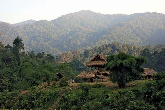
The region experiences a tropical monsoon climate, which historically supported dense tropical mountain rainforests. However, the area has suffered from significant deforestation due to military operations and commercial timber extraction.2
Why are lighthouses important for coastal navigation?
Lighthouses are essential structures designed to assist in maritime navigation by warning mariners of hazards, helping them establish their position, and guiding them safely to their destinations.4
These structures function through several key methods:
- Visual Identification: Mariners identify lighthouses by their distinctive shapes, colors, or specific light patterns, such as flashing, occulting, or fixed lights.45
- Directional Guidance: In ports and harbors, fixed directional lights—often using red and green sectors—or range lights (two lights aligned vertically) provide precise steering information.5
- Daymarks: Lighthouse structures are painted to remain conspicuous against their backgrounds, ensuring they are visible during daylight hours.5
While modern electronic systems have evolved, lighthouses remain vital for their simplicity, reliability, and low cost. They serve as a crucial backup for vessels lacking sophisticated equipment and provide necessary guidance through busy or complex coastal waters where visual reassurance is preferred by mariners. Together with buoys and other markers, they form a global network that significantly reduces the risk of vessels running aground.46
What are some other geographical features of Vietnam?
Vietnam’s geography is defined by a diverse range of landforms beyond the Annamese Cordillera. The country’s relief is primarily characterized by two massive alluvial deltas and a narrow coastal plain that stretches between them.89
Major Geographical Features
- River Deltas: The Red River delta in the north is a flat, triangular region covering approximately 2,700 square miles, known for its intensive cultivation and dense population. In the south, the Mekong River delta is significantly larger, spanning 15,400 square miles of alluvial plains.102
- Northern Uplands: North of the Red River, the terrain features moderate elevations, limestone terraces, and low hills. The region also includes Fan Si Peak, which is the highest point in Vietnam at 10,312 feet (3,143 meters).8
- Plateaus: Southern Vietnam contains several significant plateaus formed by basaltic lava flows, including the Kontum, Dac Lac, and Di Linh plateaus, which vary in elevation and levels of erosion.811
- Coastal Features: A long, narrow coastal plain runs along the eastern seaboard. The northeast coast is notable for being dotted with hundreds of limestone islands, while the south-central coast features smaller deltaic plains.82
Sources
- Point Ke Ga — Encyclopædia Britannica
- Annamese Cordillera — Encyclopædia Britannica
- Andes Mountains - Plant and animal life — Encyclopædia Britannica
- lighthouse — Encyclopædia Britannica
- lighthouse - Identification — Encyclopædia Britannica
- lighthouse - Medieval lighthouses — Encyclopædia Britannica
- navigation - Other aids to navigation — Encyclopædia Britannica
- Vietnam - Relief — Encyclopædia Britannica
- Red River — Encyclopædia Britannica
- Vietnam - Drainage — Encyclopædia Britannica
- Vietnam: Top Questions — Encyclopædia Britannica
- Vietnam - Land — Encyclopædia Britannica
Published on · 3 min read