Mount Bia
Mount Bia is the highest peak in Laos, reaching an elevation of 9,245 feet (2,818 metres). It is situated within the western spurs of the Annamese…
What is Mount Bia?
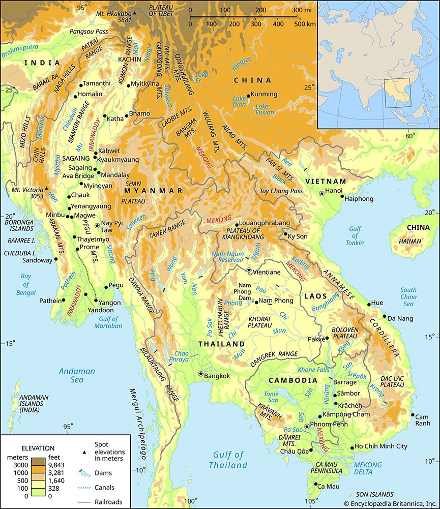
Mount Bia is the highest peak in Laos, reaching an elevation of 9,245 feet (2,818 metres). It is situated within the western spurs of the Annamese Cordillera, located just south of the Xiangkhoang Plateau.1
The massif follows a northwest-southeast trend and remains geographically isolated from neighboring peaks by the Ngum River to the west and the Ngiap River to the east.1
What is the Annamese Cordillera?
The Annamese Cordillera is the principal mountain range of Southeast Asia, serving as the vital watershed between the Mekong River and the South China Sea. Stretching approximately 700 miles (1,100 km) in a northwest-southeast direction, the range forms the natural boundary between Laos and Vietnam.2
Geologically complex, the range consists primarily of limestones, sandstones, granites, and gneisses in the north, while the south features an exposed, folded crystalline basement with basaltic lava flows. These flows have created significant plateaus, such as the Bolovens Plateau in southern Laos. Although the range is characterized by precipitous eastern slopes and few substantial passes—most notably the Mu Gia Pass—it supports a tropical mountain rainforest climate. Unfortunately, the region has experienced widespread deforestation due to past military operations and timber extraction.2
What is the geography of Laos like?
The geography of Laos is defined by its rugged, forest-covered mountains and a general eastward-to-westward slope toward the Mekong River.45
Relief and Landscape
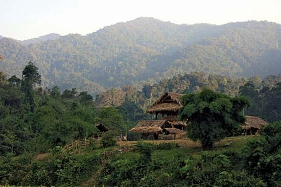
The northern landscape is dominated by mountains, reaching a peak of 9,245 feet (2,818 metres) at Mount Bia. The Annamese Cordillera forms the principal mountain range along a northwest-southeast axis. Notable features include:4
- Xiangkhoang Plateau: Home to the Plain of Jars, characterized by rolling grasslands.4
- Karst Landscapes: Central provinces feature eroded limestone pinnacles and caverns.4
- Bolovens Plateau: A fertile, woodland-covered plateau in the south at about 3,600 feet (1,100 metres).4
- Lowlands: The only extensive flat areas are found along the eastern bank of the Mekong.4
Drainage and Climate
Most rivers in Laos are tributaries of the Mekong, which flows through the west. A few eastern rivers flow toward the Gulf of Tonkin. The country experiences a tropical monsoon climate, with a wet season from May to October and a dry season from November to April.56
How do rivers shape mountain landscapes?
Rivers are the primary agents in molding Earth’s landscapes, acting as more than simple conduits for water and sediment. They shape mountain environments primarily through the processes of erosion and deposition, which transform geologic settings into distinct topographic forms.9
Vertical Entrenchment and Valley Formation
In mountainous regions, rivers often expend significant energy in vertical entrenchment, especially when tectonic activity causes regional uplift. This process creates narrow, deep valleys, canyons, and gorges. As rivers cut downward, they may create features like waterfalls and knickpoints, which are eventually smoothed out as the river approaches its baselevel.1011
Structural Interaction
Rivers interact with the underlying geology in several ways:
- Transverse Canyons: Rivers can cut across resistant ridges. This occurs if a river existed before tectonic uplift (antecedent) or if it was “let down” onto resistant structures from a layer of younger sediment (superimposed).10
- Structural Control: In many mountain belts, the orientation and form of valleys are heavily influenced by existing folds and faults in the bedrock.1112
Ultimately, the size and shape of these mountain features depend on the balance between the rate of river downcutting, the resistance of the bedrock, and the magnitude of tectonic uplift.1011
Sources
- Mount Bia — Encyclopædia Britannica
- Annamese Cordillera — Encyclopædia Britannica
- Andes Mountains - Plant and animal life — Encyclopædia Britannica
- Laos - Relief — Encyclopædia Britannica
- Laos - Drainage — Encyclopædia Britannica
- Laos - Climate — Encyclopædia Britannica
- Laos - Settlement patterns — Encyclopædia Britannica
- Laos - Agriculture, forestry, and fishing — Encyclopædia Britannica
- river - Rivers as agents of landscape evolution — Encyclopædia Britannica
- river - Formation of canyons and gorges — Encyclopædia Britannica
- river - Valley evolution — Encyclopædia Britannica
- valley - Geomorphic characteristics — Encyclopædia Britannica
- soil - Topography — Encyclopædia Britannica
- river - Valleys and canyons — Encyclopædia Britannica
Published on · 3 min read