Plynlimon
Plynlimon is not a mountain range itself but a ridge located on the gritstone plateau of the Cambrian Mountains in central Wales. While it reaches an…
How does Plynlimon compare to other significant mountain ranges in Wales?
Plynlimon is not a mountain range itself but a ridge located on the gritstone plateau of the Cambrian Mountains in central Wales. While it reaches an elevation of 2,468 feet (752 metres) at Plynlimon Fawr, it is significantly lower than the two primary mountain areas of Wales.12
In comparison:
- Snowdonia: Located in the northwest, this region features rugged, volcanic rock formations and contains Snowdon, the highest peak in Wales at 3,560 feet (1,085 metres).2
- Brecon Beacons: Situated in the south, these mountains have softer outlines than Snowdonia and reach 2,906 feet (886 metres) at Pen y Fan.2
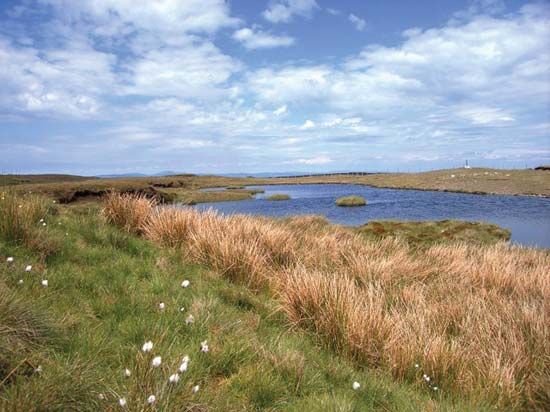
Unlike the dramatic peaks of Snowdonia or the Beacons, Plynlimon is characterized by a boggy, mist-covered landscape of limited agricultural value, primarily used for sheep grazing and water catchment for English industrial cities.1
What is the geographical location and significance of Plynlimon in Wales?
Plynlimon is a ridge situated on the gritstone plateau of central Wales, specifically forming part of the administrative boundary between the counties of Ceredigion and Powys. Its highest point, Plynlimon Fawr, reaches an elevation of 2,468 feet (752 metres).1
The significance of Plynlimon lies in its role as a major watershed. It separates drainage flowing westward into Cardigan Bay from drainage flowing eastward toward the Bristol Channel via the Rivers Severn and Wye.1
Environmentally and economically, the area is characterized by high rainfall and boggy terrain, which limits agricultural use primarily to sheep grazing. However, this heavy precipitation is vital for sustaining reservoirs that supply water to industrial cities in England. Historically, the region was active in lead mining during the 19th century, though today it is marked by abandoned mines and faces challenges related to rural depopulation, despite efforts by the British Forestry Commission to plant conifers.1
What is the history of human settlement and land use in the Plynlimon region?
Human settlement and land use in the Plynlimon region have been shaped by the area’s challenging geography and industrial history. While Wales as a whole has been inhabited since the Paleolithic Period, the high, boggy, and mist-covered terrain of the Plynlimon ridge has historically limited intensive human activity.13
Land use in the region has primarily been restricted to sheep grazing due to the poor agricultural quality of the soil. In the 19th century, the area experienced a period of industrial activity and an extension of settlement driven by lead mining. Today, the remnants of this era are visible in the abandoned mines that dot the slopes.1
In more recent times, the landscape has been altered by the British Forestry Commission, which has carried out extensive planting of conifers. Additionally, the region serves as a critical water catchment area, with its heavy rainfall feeding reservoirs that supply industrial cities in England. Despite these efforts, the region currently faces significant challenges related to severe rural depopulation.1
What is the highest peak in the Plynlimon range, and how tall is it?
The highest peak in the Plynlimon range is Plynlimon Fawr, which reaches an elevation of 2,468 feet (752 metres).1
Sources
- Plynlimon — Encyclopædia Britannica
- Wales - Relief — Encyclopædia Britannica
- Wales - Ethnic groups and languages — Encyclopædia Britannica
Published on · 2 min read