Port Phillip Bay
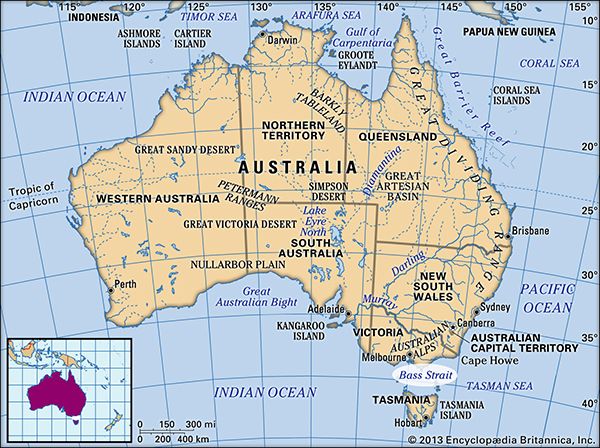
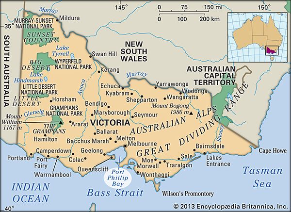
Port Phillip Bay is an inlet of Bass Strait situated on the south-central coast of Victoria, Australia.
Where is Port Phillip Bay located, and what are its main geographical features?
Port Phillip Bay is an inlet of Bass Strait situated on the south-central coast of Victoria, Australia.1
Geographical Features
The bay spans approximately 30 miles (50 km) north-to-south and 25 miles (40 km) east-to-west. Key features include:1
- The Entrance: Known as “the Rip,” this 1.75-mile (2.8 km) wide opening lies between Point Lonsdale to the west and Point Nepean to the east.1
- Navigation: It features a navigation channel that is 3,600 feet (1,100 metres) wide and 45 feet (14 metres) deep, providing access to Hobsons Bay in the north and Corio Bay—the harbour of Geelong—in the west.1
- Hydrology: Several rivers empty into the bay, most notably the Yarra River, as well as the Little and Werribee rivers.1
- Urban Context: The metropolitan area of Melbourne is located at the head of the bay.1
What is the historical significance of Port Phillip Bay in the development of Melbourne and Victoria?
Port Phillip Bay has been central to the development of Melbourne and the state of Victoria since the early 19th century. Its historical significance is defined by its role as a gateway for exploration, settlement, and economic expansion.
Exploration and Early Settlement
Following European discovery in 1802, the bay became the focal point for establishing a permanent presence in the region. While initial attempts at convict settlements near Sorrento in 1803 were unsuccessful, the area flourished after 1835 when pioneers John Batman and John Pascoe Fawkner established colonies at the head of the bay and along the Yarra River, respectively. This unofficial settlement eventually grew into Melbourne, the capital of Victoria.123
Economic Growth and Trade
The bay’s geography provided the natural harbor necessary for Melbourne to dominate the region’s trade. By capitalizing on its port facilities, the city became the hub of Victoria’s communications and economic network. The development of the port at the mouth of the Yarra River—including the cutting of the Coode Canal in 1877—facilitated massive growth, particularly during the gold rushes of the 1850s and the subsequent industrialization of the 20th century. Today, it remains one of Australia’s largest shipping areas, serving as a vital link for international and domestic trade.145
How deep is Port Phillip Bay, and how does this affect shipping and marine life?
Port Phillip Bay is a relatively shallow body of water, with the exception of its primary navigation channel. While the bay itself is expansive, the main shipping channel is maintained at a depth of 45 feet (14 metres) to allow for the passage of large vessels into the ports of Melbourne and Geelong.1
Impact on Shipping
The depth of the navigation channel is critical for the bay’s status as one of Australia’s largest shipping areas. Because the natural entrance to the bay, known as “the Rip,” and the surrounding waters are generally shallow, this dredged channel serves as the essential artery for international and domestic maritime trade. It ensures that deep-draft commercial ships can safely navigate from Bass Strait into the northern reaches of the bay.1
Impact on Marine Life
The provided information does not contain specific details regarding how the depth of Port Phillip Bay affects its marine life.
What major rivers flow into Port Phillip Bay, and how do they impact its ecology?
The major rivers that flow into Port Phillip Bay include the Yarra River, the Werribee River, and the Little River.7
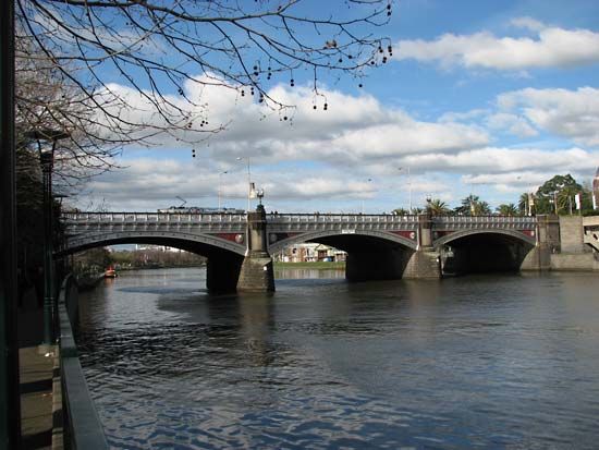
The Yarra River is the most prominent of these, rising in the Eastern Highlands and flowing 153 miles (246 km) to its mouth at Hobsons Bay, located at the head of Port Phillip Bay. Historically, the mouth of the Yarra was a swampy area that was significantly altered through dredging to establish the port of Melbourne.1
Regarding the impact of these rivers on the bay’s ecology, the provided search results do not contain specific information. While the rivers are identified as key geographic features that empty into the inlet, the available data does not detail their ecological influence on the bay’s marine environment.
Sources
- Port Phillip Bay — Encyclopædia Britannica
- Victoria - European exploration and settlement — Encyclopædia Britannica
- Melbourne - Early settlement — Encyclopædia Britannica
- Melbourne - Industry and trade — Encyclopædia Britannica
- Melbourne - Growth of the city — Encyclopædia Britannica
- Port Phillip Bay — Merriam-Webster
- Yarra River — Encyclopædia Britannica
- Western Port — Encyclopædia Britannica
Published on · 3 min read