Prut River
The Prut River is a significant waterway in Eastern Europe and a tributary of the Danube River. Rising on the northeastern slopes of the Eastern Carpathians…
What is Prut River?
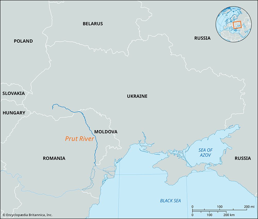
The Prut River is a significant waterway in Eastern Europe and a tributary of the Danube River. Rising on the northeastern slopes of the Eastern Carpathians in southwestern Ukraine, the river flows for approximately 530 to 565 miles before emptying into the Danube east of Galați, Romania.12
Historically, the river was situated almost entirely within Romania until 1940, when the Soviet Union annexed Bessarabia. Today, the Prut serves as a vital international boundary, separating Romania from Moldova and parts of Ukraine. Along its course, it passes through cities such as Kolomyya and receives water from various tributaries originating in the Eastern Carpathians and the Moldavian Basin.12
What is the significance of the Danube River?
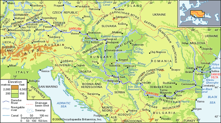
The Danube River is the second-longest river in Europe and serves as a vital artery for the continent. Its significance spans history, commerce, and energy production across the 10 countries it traverses: Germany, Austria, Slovakia, Hungary, Croatia, Serbia, Bulgaria, Romania, Moldova, and Ukraine.3
Historical and Cultural Importance
The Danube has played a central role in the political evolution and settlement of central and southeastern Europe. Historically, its banks served as boundaries between great empires, marked by numerous castles and fortresses. The river has also deeply influenced European culture, famously inspiring Johann Strauss the Younger to compose the waltz The Blue Danube, which became a symbol of imperial Vienna.3
Economic and Industrial Role
The river is a critical commercial highway. Major cities, including Vienna, Budapest, and Belgrade, rely on it for economic growth. Key economic functions include:
- Freight Transport: The river is a major trade artery, supported by infrastructure like the Danube–Black Sea Canal and the Main–Danube Canal, which connects it to the North Sea.4
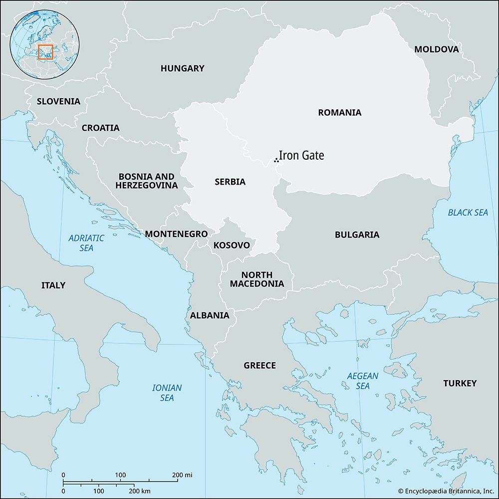
- Energy: It is a significant source of hydroelectric power, notably through the Iron Gate project through the Iron Gate project.34
- Resources: The river provides water for industry, residential supply, and irrigation, though it faces ongoing challenges from pollution.45
What are the Carpathian Mountains like?
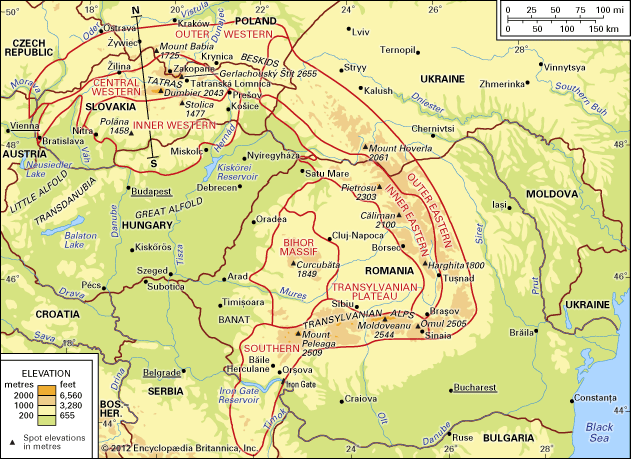
The Carpathian Mountains are a geologically young, arcuate mountain chain in Central and Eastern Europe, stretching approximately 900 miles in a wide crescent from the Danube near Bratislava to the Iron Gate in Romania. While often compared to the Alps, the Carpathians are less compact, lower in average elevation, and characterized by mountain blocks separated by basins rather than continuous ranges.6
Physical Features and Geology
The range is divided into the Western and Southeastern (Eastern) Carpathians, featuring a complex structure of flysch (sandstone-shale), crystalline, metamorphic, and volcanic rocks. Unlike the Alps, which were heavily shaped by widespread glaciation, the relief of the Carpathians was primarily formed by the action of running water, with glaciers affecting only the highest peaks. Notable features include:678
- High Peaks: The Tatras contain the highest elevations, such as Gerlachovský Štít (8,711 feet).67
- Diverse Landscapes: The range encompasses everything from rugged volcanic chains and high-mountain glacial relief to hilly plateaus and deep-cut gap valleys.67
- Climate: The region experiences a continental climate, with significant temperature inversions in intermontane depressions during winter.9
Ecology and Tourism
The mountains host distinct vegetation zones, ranging from oak and elm forests in the foreland to spruce and alpine pastures at higher altitudes. The eastern sections are particularly noted for well-preserved forests and wildlife, including bears, wolves, and lynx. Today, the region is a popular destination for sports and recreation, featuring numerous health spas and winter sports centers like Zakopane in Poland and Sinaia in Romania.1011
How do rivers serve as international borders?
Rivers frequently serve as international borders because they provide clear, visible, and relatively stable physical markers across a landscape. By utilizing the natural path of a river, nations can establish a definitive frontier that is easily recognized by both parties.
For example, the Danube River acts as a southern frontier for Romania, delineating the boundary between it and neighboring territories along a significant portion of its course. While rivers are convenient for demarcation, they can present challenges; because river channels may shift over time due to erosion or sedimentation, international agreements often specify whether the border follows the “thalweg” (the deepest part of the channel) or the center of the river’s surface.13
Sources
- Prut River — Encyclopædia Britannica
- Prut — Merriam-Webster
- Danube River — Encyclopædia Britannica
- Danube River - The economy — Encyclopædia Britannica
- Danube River - Hydrology of Danube River — Encyclopædia Britannica
- Carpathian Mountains — Encyclopædia Britannica
- Carpathian Mountains - Geology — Encyclopædia Britannica
- Carpathian Mountains - Physiography of the Carpathian Mountains — Encyclopædia Britannica
- Carpathian Mountains - Climate — Encyclopædia Britannica
- Carpathian Mountains - Transportation — Encyclopædia Britannica
- Carpathian Mountains - Tourism — Encyclopædia Britannica
- Carpathian Mountains - Plant and animal life — Encyclopædia Britannica
- Romania - Drainage of Romania — Encyclopædia Britannica
Published on · 3 min read