Ribbon Fall
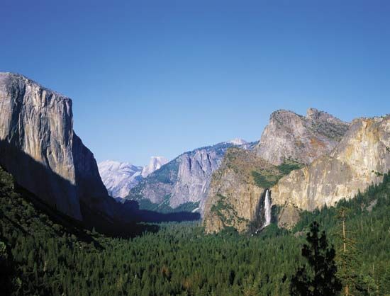
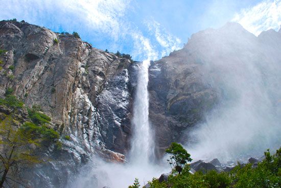
Ribbon Fall is a prominent cataract located on the west slope of the Sierra Nevada within Yosemite National Park in California, U.S.
What is Ribbon Fall?
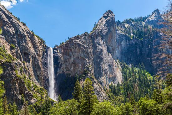
Ribbon Fall is a prominent cataract located on the west slope of the Sierra Nevada within Yosemite National Park in California, U.S.1
With a vertical drop of 1,612 feet (491 meters), it is recognized as one of the highest waterfalls in the world and is frequently cited as the highest single-drop waterfall in the United States. The waterfall is primarily fed by snowmelt, causing it to reach peak volume during May and June; because of this seasonal reliance, the fall can occasionally run dry during the midsummer months.1
How does snowmelt affect waterfall flow?
Snowmelt plays a critical role in regulating the flow of many waterfalls, acting as a primary water source that dictates their seasonal volume. Because waterfalls fed by snowmelt rely on the transition of solid precipitation into liquid water, their discharge is highly dependent on temperature and timing.1
- Seasonal Peak: Waterfalls that depend on snowmelt typically reach their peak volume during late spring and early summer, when rising temperatures accelerate the melting process.1
- Variability: Because this water source is finite and seasonal, these waterfalls can experience significant fluctuations in flow. For example, some may become reduced to a trickle or run completely dry during midsummer once the primary snowpack has melted.1
- Glacial Regulation: In regions with glaciers, the process is more complex. Glaciers act as reservoirs that store precipitation and release it over time. The runoff from these glaciers is influenced by the glacier’s albedo—its surface reflectivity. As snow melts and exposes darker ice, more solar radiation is absorbed, which can increase melt rates even as summer progresses.2
What are some other famous waterfalls in Yosemite?
Yosemite National Park is home to numerous iconic waterfalls, many of which are fed by the region’s seasonal snowmelt. Beyond Ribbon Fall, some of the most famous include:
- Yosemite Falls: One of the world’s highest cataracts, this feature consists of three distinct sections—Upper Yosemite Fall, a middle series of cascades, and Lower Yosemite Fall—with a combined total drop of 2,425 feet (740 meters).56
- Bridalveil Fall: Known for its mist that is often blown sideways by the wind, this 620-foot (189-meter) waterfall is one of the most recognizable features in the valley.76
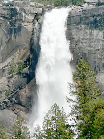
- Nevada Fall: A powerful, large-volume waterfall located on the Merced River, known for its distinctive appearance as the water descends over a massive granite cliff.6
- Vernal Fall: Situated downstream from Nevada Fall, this waterfall is famous for its wide, curtain-like flow and is a popular destination for hikers within the park.6
How do glaciers shape mountain landscapes?
Glaciers are powerful agents of landscape transformation, reshaping mountain environments through both erosion and deposition. Their movement drastically alters the topography, turning narrow, V-shaped stream valleys into broad, parabolic U-shaped valleys by scouring away loose debris and eroding bedrock along the valley floor and sidewalls.910
Key erosional features include:
- Cirques and Tarns: Glaciers often originate in cirques—amphitheatre-shaped hollows carved into mountainsides. When these basins are over-deepened and later fill with water, they form tarns.9
- Arêtes and Horns: As multiple cirques erode a mountain from different sides, they leave behind sharp, knife-edge ridges known as arêtes. When three or more cirques converge, they create a jagged, pyramid-shaped peak called a horn, such as the Matterhorn.9
- Hanging Valleys: Because smaller tributary glaciers erode their beds less rapidly than the main glacier, their valleys are left “hanging” high above the main valley floor, often resulting in waterfalls after the ice retreats.10
Additionally, glaciers deposit till and other debris, forming features like moraines and drumlins, which further define the post-glacial landscape.11
Sources
- Ribbon Fall — Encyclopædia Britannica
- river - Falls attributable to constructional processes — Encyclopædia Britannica
- waterfall — Encyclopædia Britannica
- glacier - Glacier hydrology — Encyclopædia Britannica
- Yosemite Falls — Encyclopædia Britannica
- Bridalveil Fall — Encyclopædia Britannica
- Yosemite National Park — Encyclopædia Britannica
- Upper Yosemite Fall — Encyclopædia Britannica
- glacial landform - Cirques , tarns, U-shaped valleys, arêtes, and horns — Encyclopædia Britannica
- glacial valley — Encyclopædia Britannica
- Quaternary - Landforms — Encyclopædia Britannica
Published on · 3 min read