Río De La Plata
The Río de la Plata serves as a vital commercial artery for South America, functioning as the primary estuary for the Paraná and Uruguay river systems. Its…
How does the Río de la Plata impact the economy and trade of the surrounding regions?
The Río de la Plata serves as a vital commercial artery for South America, functioning as the primary estuary for the Paraná and Uruguay river systems. Its economic significance is defined by its role as a gateway for international trade and a hub for regional industrial activity.12
Trade and Transportation
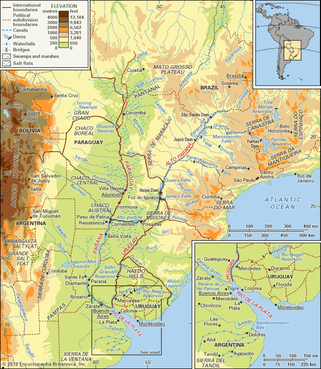
The estuary is essential for the export of agricultural products from the hinterland, particularly meat and grain. Major ports, most notably Buenos Aires and Montevideo, facilitate this global trade. While large oceangoing vessels can navigate the lower reaches of the river system, the upper basin faces significant challenges, including shallow drafts and the need for constant dredging to maintain navigable channels. Consequently, the commercial value of the system is concentrated in its lower reaches, where infrastructure such as shipyards, flour mills, and petroleum refineries supports the export economy.213
Regional Impact
Historically, the river system has been a focal point for both cooperation and conflict among riparian states, including Argentina, Uruguay, Brazil, and Paraguay. Today, these nations share responsibility for navigation aids and maintenance to ensure the continued flow of goods.4
What role did the Río de la Plata play in European exploration and colonization of South America?
The Río de la Plata played a pivotal role in the European exploration and colonization of South America, serving as both a gateway for discovery and a strategic focal point for imperial control.
Exploration
European interest began in 1516 when Juan Díaz de Solís entered the estuary, which he named Mar Dulce (Fresh Sea), while searching for a route to the Pacific. Following his death, subsequent explorers like Ferdinand Magellan and Sebastian Cabot further mapped the region. Cabot’s 1526 expedition up the Paraná and Uruguay rivers led to the name Río de la Plata (River of Silver) after he bartered for silver trinkets with the Guaraní people, fueling hopes of finding precious metals.67
Colonization and Administration
Early settlement attempts were difficult; Buenos Aires was not permanently established until 1580, and the region remained a colonial backwash for much of the Spanish era. By the 17th century, Jesuit missionaries established a network of settlements that became a significant cultural and economic force.
In 1776, Spain established the Viceroyalty of the Río de la Plata to defend against Portuguese and British encroachment and to manage trade. This administrative shift transformed Buenos Aires into a flourishing hub for exporting silver from Potosí and cattle products from the Pampas, eventually setting the stage for the region’s independence movements.68
What is the meaning of ‘Río de la Plata’ in English, and why was it given this name?
The name Río de la Plata translates to “River of Silver” in English.
This name was given to the estuary by the Italian explorer Sebastian Cabot following his expedition between 1526 and 1529. While exploring the Paraná and Uruguay rivers, Cabot reached Asunción, where he bartered with the Guaraní people and obtained silver trinkets. His discovery of these items led him to name the waterway in the hope that it would prove to be a river of silver, reflecting the persistent European desire to find precious metals in the region.6
Where is the Río de la Plata located, and which countries share its coastline?
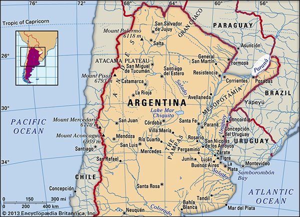
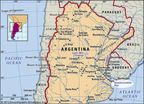
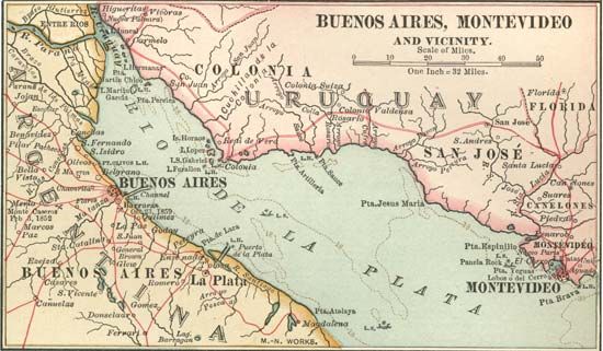
The Río de la Plata is a tapering intrusion of the Atlantic Ocean located on the east coast of South America. While its classification is debated—with some geographers identifying it as a gulf, a marginal sea, or the world’s widest river—it is most commonly defined as the estuary formed by the confluence of the Paraná and Uruguay rivers.1
The coastline of the estuary is shared by two countries:
- Uruguay to the north, where the capital city of Montevideo is located.1
- Argentina to the south, where the capital city of Buenos Aires is situated on the southwestern shore.1
The estuary spans approximately 180 miles (290 kilometers) from its head to the Atlantic, widening significantly as it reaches the ocean.1
Sources
- Río de la Plata — Encyclopædia Britannica
- Río de la Plata - The region since 1800 — Encyclopædia Britannica
- Río de la Plata - Transportation — Encyclopædia Britannica
- Río de la Plata - Physiography of the Río de la Plata — Encyclopædia Britannica
- Argentina - Agriculture, forestry, and fishing — Encyclopædia Britannica
- Río de la Plata - Early European exploration and settlement — Encyclopædia Britannica
- Juan Díaz de Solís — Encyclopædia Britannica
- Viceroyalty of the Río de la Plata — Encyclopædia Britannica
- Río de la Plata - Mapping of the basin — Encyclopædia Britannica
- Uruguay River — Encyclopædia Britannica
Published on · 3 min read