Pelotas River
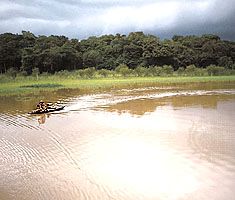
The Pelotas River is a waterway located in southern Brazil. It originates on the western slope of the Serra Geral at Alto do Bispo, situated in the state of…
What is Pelotas River?
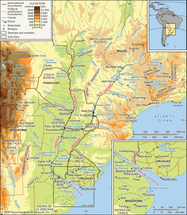
The Pelotas River is a waterway located in southern Brazil. It originates on the western slope of the Serra Geral at Alto do Bispo, situated in the state of Santa Catarina.1
The river flows northwestward across the uplands for about 280 miles (450 km). Throughout much of its course, it serves as the boundary between the states of Santa Catarina and Rio Grande do Sul. Near the town of Marcelino Ramos, the Pelotas River joins the Canoas River to form the Uruguay River. The river is utilized for navigation.1
What is the significance of the Uruguay River?
The Uruguay River is a vital waterway in southern South America, serving as a significant geographic and economic feature for Brazil, Argentina, and Uruguay. Its importance is defined by several key roles:23
- Political Boundaries: The river acts as a crucial international border, separating Brazil from Argentina and later forming the boundary between Argentina and Uruguay.23
- Navigation and Trade: While its upper reaches are limited by rapids, the lower course serves as a commercial artery. Oceangoing vessels can travel as far as Paysandú, Uruguay, and smaller ships can reach Salto. It facilitates trade for regional centers like Concepción del Uruguay.245
- Energy Production: The river is a key source of hydroelectric power. Along with the Negro River, it provides a significant portion of Uruguay’s electric power, including through the Salto Grande Reservoir.36
- Hydrological System: It is one of the two major systems that flow into the Río de la Plata estuary, which is essential for the export of meat and grain from the region’s hinterland.235
How do mountain ranges like the Serra Geral affect river paths?
Mountain ranges significantly influence the paths of rivers, acting as both barriers and guides for drainage systems. Their impact generally manifests in two ways:
- Geographic Barriers and Divides: Ranges like the Serra do Mar in Brazil serve as critical watersheds. Rivers such as the Uruguay River originate on the western slopes of these coastal ranges, forcing the water to flow inland away from the Atlantic coast. Similarly, ranges like the Karakoram and Kailas act as great water divides, separating distinct river systems and preventing them from draining specific regions.893
- Antecedent Drainage: In some cases, such as the Himalayas, rivers are older than the mountains themselves. Because the mountains were uplifted slowly, these rivers maintained their original courses, cutting deep transverse gorges through the rising terrain. This allows rivers like the Indus and Brahmaputra to drain areas on both sides of the mountain crests.3
What are the major industries in the Santa Catarina and Rio Grande do Sul states?
The states of Santa Catarina and Rio Grande do Sul possess diverse industrial sectors, ranging from robust agricultural processing to specialized manufacturing.
Santa Catarina
Industry in Santa Catarina is characterized by a strong focus on natural resources and food production:10
- Wood and Furniture: The manufacture of wood products, including processed timber, furniture, and charcoal, is a major industrial pillar.10
- Food Processing: The state is a leading national producer of pork and poultry. It also processes significant quantities of wheat, tobacco, and apples.10
- Manufacturing: Key sectors include the production of ceramic tiles, textiles, and mechanical equipment.10
- Mining: High-quality coal is mined near Criciúma.10
- Fishing: The state maintains a significant fishing and fish-processing industry.10
Rio Grande do Sul
Industrial activity in Rio Grande do Sul is concentrated primarily in cities such as Porto Alegre, Rio Grande, and Pelotas:11
- Footwear and Textiles: The state is a major center for the footwear industry, which originated from the processing of leather hides. It also hosts wool, cotton, and jute textile mills.1213
- Food and Agriculture: As a major agricultural region, the state supports extensive meat-processing plants, vegetable canneries, and facilities for processing rice, wheat, and tobacco.1113
- Energy and Mining: Coal is mined at São Jerônimo, and the state includes petroleum refining infrastructure.1113
- Manufacturing: The state contributes to Brazil’s broader industrial output, with manufacturing sectors that are increasingly significant to the national economy.12
Sources
- Pelotas River — Encyclopædia Britannica
- Uruguay River — Encyclopædia Britannica
- Río de la Plata - Physiography of the Uruguay basin — Encyclopædia Britannica
- Río de la Plata - Transportation — Encyclopædia Britannica
- Uruguay - Drainage — Encyclopædia Britannica
- Uruguay - Resources and power — Encyclopædia Britannica
- Negro River — Encyclopædia Britannica
- Serra do Mar — Encyclopædia Britannica
- Himalayas - Drainage of the Himalayas — Encyclopædia Britannica
- Santa Catarina — Encyclopædia Britannica
- Rio Grande do Sul — Encyclopædia Britannica
- Brazil - Manufacturing of Brazil — Encyclopædia Britannica
- Brazil - Industry — Encyclopædia Britannica
- Rio Grande — Encyclopædia Britannica
Published on · 3 min read