Tummel
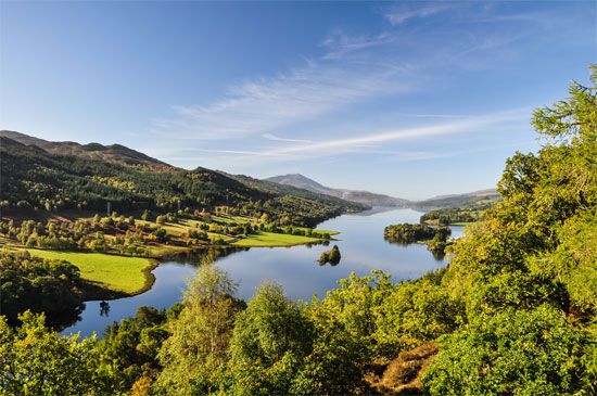
The Tummel refers to both a river and a loch (lake) located in Scotland. The River Tummel originates on Rannoch Moor and flows through a glaciated valley…
What is Tummel?
The Tummel refers to both a river and a loch (lake) located in Scotland. The River Tummel originates on Rannoch Moor and flows through a glaciated valley, passing through Loch Rannoch and Loch Tummel before joining the River Tay near Pitlochry.1
The river basin is notable for the Tummel-Garry Hydro-Electric Scheme, which includes 10 main power stations. Additionally, the area is well-known for its natural beauty, particularly at Loch Tummel and the Falls of Tummel, which are situated near the confluence of the Tummel and Garry rivers.1
How do hydroelectric power stations work?
Hydroelectric power stations generate electricity by converting the potential energy of water into mechanical energy and finally into electrical energy.2
The process typically functions as follows:
- Collection: Water is stored at a higher elevation, often behind a dam, creating a difference in elevation known as the head.2
- Flow: Water is directed downward through large pipes or tunnels called penstocks toward a powerhouse.2
- Generation: The force of the falling water rotates turbines, which drive generators to produce electricity.2
- Transmission: Transformers increase the voltage of the generated electricity to make it suitable for long-distance transmission.2
To manage varying energy demands, some facilities use pumped-storage systems, which pump water to an elevated reservoir during off-peak hours to be released later when demand is high. While hydroelectric power is a clean, renewable resource, it is important to acknowledge that the construction of dams can significantly disrupt natural systems, including fish migration and local ecosystems.23
What are the characteristics of a ribbon lake?
A ribbon lake, often referred to as a long, narrow lake of substantial depth, is a feature formed by glacial action in long mountain valleys. These basins are created when large ice sheets or glaciers move through and deepen existing valleys, scouring the landscape as they retreat.4
Key characteristics of these lakes include:
- Shape: They are characteristically long and narrow, reflecting the morphology of the glaciated valleys they occupy.4
- Depth: They are typically of substantial depth, a result of the intense erosional power of the ice that carved the basin.4
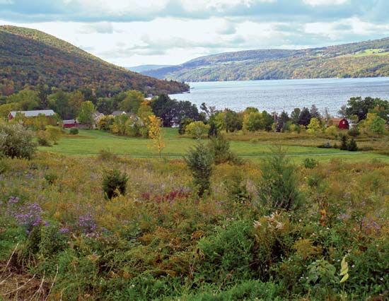
- Formation: Many are formed through the scouring of preexisting valleys. In some instances, such as the Finger Lakes in New York, the basins are further defined by being blocked at their ends by glacial moraine deposits.4
- Distribution: Excellent examples are found in regions shaped by past glaciation, including the Lake District in England, the Alps, the Andes, and parts of British Columbia.4
What is the significance of Rannoch Moor?
Rannoch Moor is a significant geographic region located within the Grampian Mountains of Scotland. Spanning 20 square miles (52 square km), this windswept landscape is characterized by its vast stretches of heather and peat bog.5
The area holds ecological and historical importance for several reasons:
- Remnant Ecosystem: The moor contains surviving pine trees that serve as rare relics of the original Caledonian Forest, which once covered much of Scotland.5
- Conservation: Recognizing its unique environmental value, the northeast section of the moor has been designated as a nature reserve.5
- Hydroelectric Integration: The broader Rannoch region is integral to regional infrastructure, as it includes Loch Rannoch, which serves as a component of the Tummel-Ericht hydroelectric scheme.5
Sources
- Tummel — Encyclopædia Britannica
- Did you know? — Merriam-Webster
- hydroelectric power — Encyclopædia Britannica
- lake - Basins formed by glaciation — Encyclopædia Britannica
- Rannoch — Encyclopædia Britannica
Published on · 2 min read