Finger Lakes
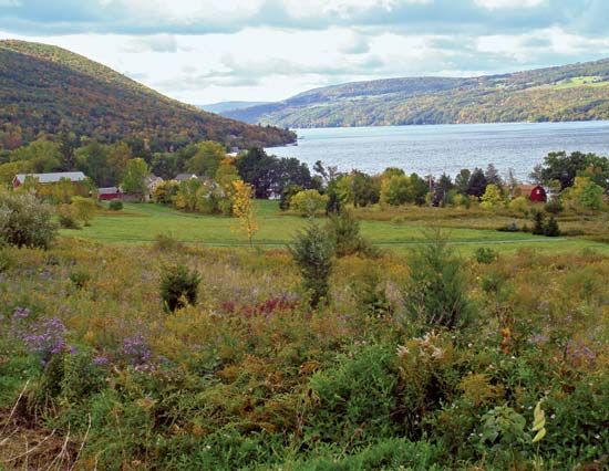
The Finger Lakes are a group of narrow, glacial lakes located in west-central New York state, U.S. They are situated in north-south valleys spanning the…
What are the Finger Lakes and where are they located in New York State?
The Finger Lakes are a group of narrow, glacial lakes located in west-central New York state, U.S. They are situated in north-south valleys spanning the region between Syracuse to the east and Geneseo to the west.1
These lakes were created through the glacial scouring of existing valleys, which were subsequently dammed at their northern and southern ends by glacial moraine—heterogeneous sedimentary deposits left by retreating ice sheets.2
The primary lakes, listed from west to east, include:
- Canandaigua
- Keuka
- Seneca (the largest and deepest)
- Cayuga
- Owasco
- Skaneateles
- Otisco
Four additional lakes to the west—Conesus, Hemlock, Canadice, and Honeoye—are also sometimes included in the group. The region is well-known for its scenic beauty, numerous resorts, and agricultural production, particularly grapes and vegetables.1
How were the Finger Lakes formed and what is their geological significance?
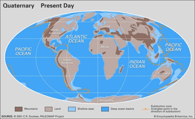
The Finger Lakes were formed through the process of glacial erosion during the Quaternary period. As massive continental ice sheets advanced across west-central New York, they scoured out pre-existing valleys, deepening them into the long, narrow, rock-floored basins seen today.13
The geological significance of these lakes lies in their role as prime examples of large-scale glacial sculpting. They are aligned parallel to the direction of regional ice flow, and their formation illustrates how glaciers can effectively reshape a landscape by stripping away soil and debris to abrade the underlying bedrock. While some lake basins are influenced by preglacial drainage systems or the structure of the bedrock—specifically areas with softer or more fractured rock—the Finger Lakes are primarily recognized as a result of the intense erosional capacity of the great ice sheets.13
Beyond their formation, these lakes serve as a distinctive imprint of the Quaternary environment, marking the extensive impact that glacial activity has had on modern surface landscapes.1
What are some of the major lakes in the Finger Lakes region and their characteristics?
The Finger Lakes region in west-central New York is characterized by a series of long, narrow, glacial lakes that occupy north-south valleys. These lakes vary significantly in size, ranging from 6 miles (10 km) to 40 miles (64 km) in length and reaching widths of up to 3.5 miles (5.6 km).1
Primary Lakes and Characteristics
The region’s lakes are generally categorized by their glacial origin, having been formed by the scouring of existing valleys and subsequently dammed by glacial moraine at their northern and southern ends.12
- Seneca Lake: The largest and deepest of the group, covering approximately 67 square miles (174 square km).1
- Cayuga Lake: A prominent lake in the region, serving as a key feature of the surrounding Cayuga county landscape.16
- Other Major Lakes: The primary list from west to east includes Canandaigua, Keuka, Owasco, Skaneateles, and Otisco. Additionally, four lakes located to the west—Conesus, Hemlock, Canadice, and Honeoye—are often included in the Finger Lakes group.1
The region is widely noted for its scenic beauty, numerous state parks, and agricultural output, particularly the production of grapes and vegetables.1
How did glaciers specifically shape the landscape of the Finger Lakes?
The Finger Lakes of New York were shaped primarily through the mechanical action of glaciers during the Pleistocene epoch. The landscape was transformed through two key processes:
- Glacial Scouring: Massive ice sheets moved across the region, deepening and widening pre-existing valleys. This intense erosional activity carved out the long, narrow, rock-floored basins that define the lakes today.23
- Morainic Damming: As the glaciers retreated, they left behind glacial moraine—heterogeneous sedimentary deposits—at the northern and southern ends of these valleys. These deposits acted as natural dams, confining the water and creating the lake basins we see in the modern landscape.24
This combination of glacial erosion and subsequent deposition significantly altered the region’s drainage patterns, resulting in the characteristic parallel alignment of the lakes in the direction of regional ice flow.34
Sources
- Finger Lakes — Encyclopædia Britannica
- lake - Basins formed by glaciation — Encyclopædia Britannica
- glacial landform - Erosional landforms of continental glaciers — Encyclopædia Britannica
- Quaternary - Landforms — Encyclopædia Britannica
- Finger Lakes — Merriam-Webster
- Cayuga — Encyclopædia Britannica
- Pleistocene Epoch - Fluvial environments — Encyclopædia Britannica
Published on · 3 min read