Sint Anna Bay
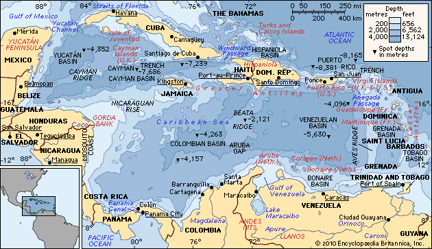
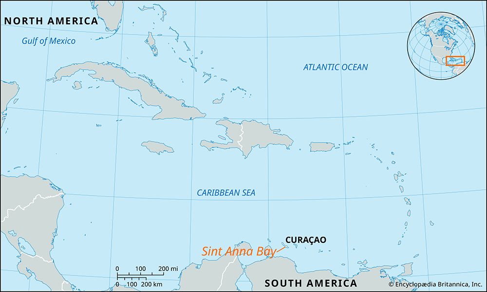
Sint Anna Bay is a narrow, deep channel that separates the two districts of Willemstad, the capital of Curaçao.
What is Sint Anna Bay?
Sint Anna Bay is a narrow, deep channel that separates the two districts of Willemstad, the capital of Curaçao.1
Measuring approximately 1 mile (1.6 km) in length and between 300 and 1,000 feet (90 to 300 metres) in width, the bay serves as a vital waterway connecting the Caribbean Sea to the south with the Schottegat, a large, deep lagoon used as a harbour and seaplane anchorage, to the north.1
The bay is crossed by two notable structures:
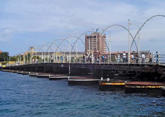
- Koningin Emma Bridge: A historic pontoon bridge that links the two sides of the city.1
- Queen Juliana Bridge: A modern, fixed bridge that stands 160 feet (50 metres) above the water and carries a four-lane highway.1
What is the history of the Schottegat lagoon?
The Schottegat is a large, deep, and virtually enclosed lagoon located at the northern end of Sint Anna Bay on the island of Curaçao.11
Historically, the lagoon has been recognized as one of the finest natural harbours in the West Indies. Its development into a major maritime hub was central to the growth of Willemstad, the island’s capital, which sits along its shores. In the early 20th century, the discovery of oil in Venezuela’s Maracaibo Basin transformed the Schottegat into a critical site for petroleum refining and transshipment. The lagoon’s capacity to accommodate large tankers, combined with its strategic location, facilitated the construction of extensive dry-docking, bunkering, and storage facilities, establishing Willemstad as one of the Caribbean’s principal ports. While the petroleum sector has declined following the closure of the Isla refinery in 2019, the Schottegat continues to serve as a vital harbour and seaplane anchorage.12
How does a pontoon bridge like the Queen Emma Bridge function?
A pontoon bridge, such as the Koningin Emma (“Queen Emma”) Bridge in Willemstad, functions as a floating bridge supported by buoyant structures rather than fixed piers. These bridges rely on the displacement of water to remain afloat, with the roadway resting on a series of pontoons or flat-bottomed boats.13
Because these structures sit directly on the water, they can obstruct navigation. To allow ships to pass through Sint Anna Bay, the Queen Emma Bridge is designed to be moved; it can be retracted or swung aside to clear the channel for maritime traffic. While pontoon bridges have historically been used by military engineers for rapid, temporary crossings, they also serve as permanent or semi-permanent infrastructure in specific civilian contexts where fixed bridges are impractical.435
What is the significance of Willemstad as a capital city?
Willemstad, the capital of Curaçao, holds significant historical and economic importance in the Caribbean. Its prominence is largely due to its location on Sint Anna Bay, which provides access to one of the finest natural harbours in the West Indies. This strategic geography transformed the city into a vital hub for maritime commerce, petroleum refining, and international trade.72
The city’s significance is further defined by its rich cultural and political heritage:
- Political Center: Willemstad serves as the seat of government, housed in the historic Fort Amsterdam. It previously functioned as the capital of the Netherlands Antilles until the territory’s dissolution in 2010.7
- Cultural Heritage: In 1997, the city’s inner harbour and historic districts were designated a UNESCO World Heritage site. It features iconic Dutch-style gabled houses and the Mikvé Israel-Emanuel Synagogue, the oldest synagogue in continuous use in the Western Hemisphere.7
- Economic Hub: Beyond its history, the city remains a regional center for banking, tourism, and financial services.72
Sources
- Sint Anna Bay — Encyclopædia Britannica
- Curaçao — Encyclopædia Britannica
- military bridge — Encyclopædia Britannica
- floating bridge — Merriam-Webster
- bridge - Cantilever bridges — Encyclopædia Britannica
- pontoon bridge — Encyclopædia Britannica
- Willemstad — Encyclopædia Britannica
Published on · 3 min read