Tasermiut
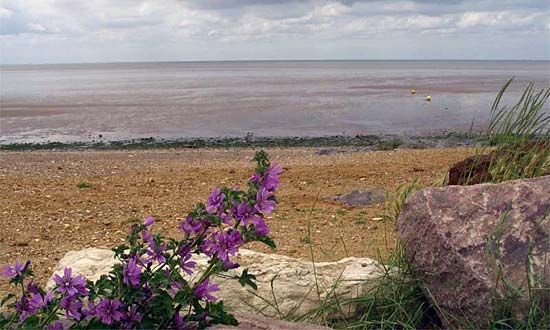
Tasermiut is a fjord located in southern Greenland that stretches 45 miles (70 km) from the Atlantic Ocean, near the town of Nanortalik, toward the inland…
What is Tasermiut?
Tasermiut is a fjord located in southern Greenland that stretches 45 miles (70 km) from the Atlantic Ocean, near the town of Nanortalik, toward the inland ice cap.1
Historically, the area was known as Ketilsfjord and served as a site for Norse settlements during the 10th century. These settlements included Vatsdalr and Vík, the latter of which was home to an Augustinian monastery.1
What were the Norse settlements in Greenland like?
Norse settlements in Greenland were established in 985 by Erik the Red following his banishment from Iceland2. These colonies consisted of two main areas: the East Settlement near present-day Qaqortoq and the West Settlement near modern Nuuk.23
At their peak, these settlements supported an estimated 3,000 to 6,000 people across approximately 280 farms. The settlers engaged in cattle breeding, fishing, and sealing, with walrus tusks serving as their primary export. Because the region lacked sufficient wood and iron for shipbuilding, the settlers struggled to maintain consistent communication with Europe, eventually submitting to the Norwegian king in 1261 in exchange for promised annual supply voyages.32
The society was Christianized in the 11th century, eventually establishing a bishopric and two cloisters. However, the colonies faced significant challenges, including a cooling climate, plagues, and interactions with the expanding Inuit Thule culture. By the 15th century, the Norse presence in Greenland had ceased.32
How do fjords form in cold climates?
Fjords are long, narrow arms of the sea formed through the marine inundation of glaciated valleys. Their creation is a two-stage process driven by glacial erosion and subsequent changes in sea level.56
During periods of glaciation, massive, thick glaciers descend from coastal mountains. Due to their immense weight and movement, these glaciers carve deep, U-shaped valleys into the landscape, often eroding the valley floor far below sea level. Because erosive power is greatest near the glacier’s source, these valleys are typically deeper in their middle and upper reaches than at the seaward end.56
As the climate warms and the glaciers melt, the sea level rises, causing the ocean to flood these deep, steep-sided depressions. The resulting fjords often feature a submerged ridge or sill near their mouth, composed of glacial deposits, which can restrict water circulation and create deep basins of stagnant water.657
What is the history of the Augustinian monastery in Ketilsfjord?
The Augustinian monastery in Ketilsfjord—known today as Tasermiut—was located at the site of Vík, also referred to as Ároskirkja. This monastery was one of two cloisters established in Greenland during the period of Norse settlement, which began in 985 under the leadership of Erik the Red.112
While historical records confirm the existence of these religious institutions as part of the broader Christianization of the Norse colonies in the 11th and 12th centuries, specific details regarding the daily operations or the eventual fate of the Ketilsfjord monastery are limited. The Norse settlements in the region, including those in the East Settlement near present-day Qaqortoq, faced significant challenges in the 14th and 15th centuries, including a cooling climate, economic isolation, and potential conflict with the expanding Inuit Thule culture. By the early 15th century, the Norse presence in Greenland had largely ceased, and the settlements were abandoned.32
Sources
- Tasermiut — Encyclopædia Britannica
- Greenland - Erik the Red and Norse settlements — Encyclopædia Britannica
- Norway - Greenland — Encyclopædia Britannica
- Greenland - People of Greenland — Encyclopædia Britannica
- fjord — Encyclopædia Britannica
- coast — Encyclopædia Britannica
- estuary - Fjords — Encyclopædia Britannica
Published on · 2 min read