Vulcano Island
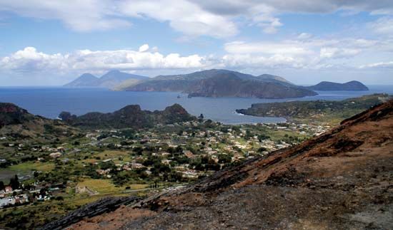
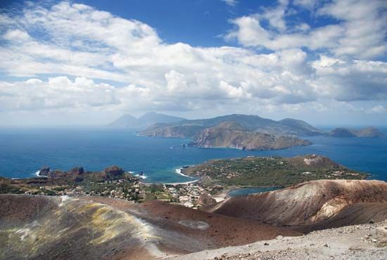
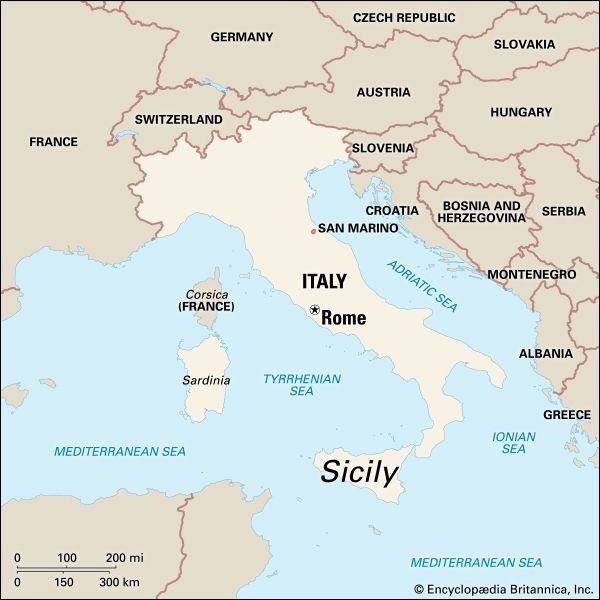
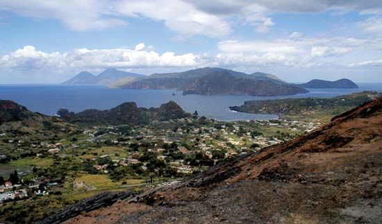
Vulcano Island is the southernmost island of the Eolie Islands, a volcanic group located in the Tyrrhenian Sea off the northeastern coast of Sicily, Italy.…
What is Vulcano Island?
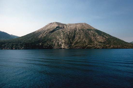
Vulcano Island is the southernmost island of the Eolie Islands, a volcanic group located in the Tyrrhenian Sea off the northeastern coast of Sicily, Italy. Covering an area of approximately 8 square miles (21 square km), the island is administratively part of northern Sicily.12
Although the island has not experienced a major eruption since 1888–90, it remains geologically active. Its Gran Cratere is still considered active, and the presence of fumaroles—vents that release sulfurous vapor—serves as evidence of ongoing volcanic processes. Historically, the island has been a site for resource extraction, specifically featuring alum quarries.12
The Eolie Islands, which include Vulcano, have a rich history of human habitation dating back to the Neolithic Period, and they have served various roles over the centuries, including as a place of banishment for political prisoners during the Roman era and the 20th-century Fascist period.2
What are fumaroles and how do they form?
A fumarole is a vent in the Earth’s surface that emits steam and volcanic gases. These features are commonly found on active volcanoes during periods of relative quiet between eruptions.5
Fumaroles form primarily through the interaction of groundwater and magma. As groundwater is heated by magma bodies located relatively close to the surface, it turns into water vapor. This steam, along with gases such as carbon dioxide, sulfur dioxide, and hydrogen sulfide that are released directly from the magma, escapes through surface vents.56
The specific composition of these emissions depends on the temperature, pressure, and chemical makeup of the magma. For instance, a fumarole rich in sulfur is known as a solfatara, while one rich in carbon dioxide is called a mofette. Fumaroles are closely related to hot springs and geysers; if the water table rises near the surface, a fumarole may transition into a hot spring.57
Who was Aeolus and why are the islands named after him?
In Greek mythology, Aeolus was the divine controller of the winds and the ruler of the floating island of Aeolia. Often depicted as a human in Homer’s Odyssey, he possessed the power to calm the ocean or raise storms, and he famously provided Odysseus with a bag containing the winds to aid his journey.8
The Eolie Islands—a volcanic group located in the Tyrrhenian Sea—derive their name from this mythological figure. Ancient Greeks believed these islands were the home of Aeolus, specifically identifying the island of Lipari as his residence. The name serves as a testament to the cultural significance the islands held in antiquity, rooted in the belief that the winds were governed from this volcanic archipelago.98
How do scientists monitor active volcanoes like the one on Vulcano?
Scientists monitor active volcanoes using a variety of sophisticated instruments designed to detect precursors to eruptions. Because volcanoes often pose significant hazards, permanent volcano observatories are established at high-risk sites to provide early warnings.10
Key monitoring techniques include:
- Seismology: Seismographs detect swarms of earthquake tremors caused by the upward movement of magma. An increase in the frequency and intensity of these quakes is a primary indicator of an impending eruption.10
- Deformation Tracking: As magma fills subsurface chambers, the volcano may inflate. Scientists use tiltmeters to measure changes in slope angles and laser beams to detect surface deformation.10
- Geophysical and Geochemical Analysis: Researchers utilize gas detectors to monitor volcanic emissions, as well as instruments sensitive to variations in magnetic and gravity fields. Additionally, analyzing gases and hot springs provides insight into the late stages of volcanic activity.10
- Subsurface Mapping: Methods such as resistivity or seismic surveys help map magma chambers and identify faults that control the flow of subsurface fluids.11
Sources
- Vulcano Island — Encyclopædia Britannica
- Eolie Islands — Encyclopædia Britannica
- volcanology — Encyclopædia Britannica
- Aeolis — Encyclopædia Britannica
- fumarole — Encyclopædia Britannica
- mofette — Encyclopædia Britannica
- volcano - Gas clouds — Encyclopædia Britannica
- Aeolus — Encyclopædia Britannica
- Aeolus — Encyclopædia Britannica
- geology - Volcanology — Encyclopædia Britannica
- Earth exploration - Geothermal methods — Encyclopædia Britannica
- volcano - Submarine volcanoes — Encyclopædia Britannica
Published on · 3 min read