Yuna River
The Yuna River is a significant waterway located in the central and northeastern Dominican Republic. It ranks as one of the nation's three most vital river…
What is Yuna River?
The Yuna River is a significant waterway located in the central and northeastern Dominican Republic. It ranks as one of the nation’s three most vital river systems, alongside the Yaque del Norte and Yaque del Sur rivers.1
Originating from various headstreams near Bonao in the Cordillera Central mountains, the river flows northeast into the fertile Cibao Valley. After receiving its major tributary, the Camú, it continues eastward through marshy lowlands before emptying into Samaná Bay near the port of Sánchez.1
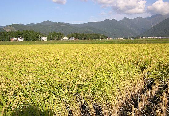
Spanning approximately 100 miles (160 km) in length, the Yuna is primarily utilized for rice irrigation, with navigation limited to its lower course. Please note that the Yuna River is distinct from the Red (Yuan) River found in the Yunnan province of China.12
What is the importance of the Cibao Valley for agriculture?
The Cibao Valley is the most densely settled and agriculturally significant region in the Dominican Republic. Its importance stems from its exceptionally fertile alluvial soils, which are nourished by two major river systems: the Yaque del Norte River in the west and the Yuna River in the east.31
The valley’s agricultural output is divided by its distinct climatic zones:
- Western Section: This drier area relies on modern irrigation to support the cultivation of rice, bananas, and wheat.3
- La Vega Real (Eastern Section): This humid, fertile region is highly productive, yielding coffee, tobacco, cacao, corn (maize), and rice.3
The combination of favorable topography, consistent water supply from the river systems, and nutrient-rich soil makes the Cibao Valley the backbone of the nation’s agricultural economy.31
What are the other major river systems in the Dominican Republic?
The Dominican Republic’s hydrology is dominated by three primary river systems, which are essential for the nation’s agriculture and economic development. In addition to the Yuna River, the other two major systems are:
- Yaque del Norte River: As the largest river in the country, it spans 240 miles (386 km). It flows from the northern slopes of the Cordillera Central through the Cibao Valley before emptying into the Atlantic Ocean. It is vital for irrigating crops such as rice, tobacco, and sugarcane, and it supports hydroelectric power generation at the Tavera dam.67
- Yaque del Sur River: Located in the southwest, this 80-mile (130 km) river originates on the southern slopes of the Cordillera Central. It flows through the San Juan and Neiba valleys before reaching the Caribbean Sea. Its waters are extensively used for irrigating a variety of crops, including plantains, beans, and peanuts.47
Beyond these three, other notable rivers include the Ozama River, which flows to the Caribbean at Santo Domingo, and various smaller rivers in the southeast like the Macorís, Soco, and Chavón.7
How does the Yuna River impact the ecosystem of Samaná Bay?
The Yuna River plays a significant role in the geography of the northeastern Dominican Republic by emptying into Samaná Bay. As it flows eastward through marshy lowlands, the river deposits freshwater and sediment into the bay near the port of Sánchez.18
While the Yuna River is essential for regional irrigation, particularly for rice cultivation, the provided information does not detail the specific biological or ecological impacts of its discharge on the bay’s marine life or water quality. The bay itself is recognized as a vital site for fishing and tourism, benefiting from its status as a well-protected natural harbor.18
We could dive deeper into the broader environmental characteristics of Samaná Bay or explore the biodiversity found in the coastal regions of the Dominican Republic.
Sources
- Yuna River — Encyclopædia Britannica
- Yunnan - Relief and drainage — Encyclopædia Britannica
- Cibao Valley — Encyclopædia Britannica
- Dominican Republic - Relief, drainage, and soils — Encyclopædia Britannica
- Cobán: Top Questions — Encyclopædia Britannica
- Yaque del Sur River — Encyclopædia Britannica
- Yaque del Norte River — Encyclopædia Britannica
- Samaná Bay — Encyclopædia Britannica
Published on · 3 min read